Grafenau elevation
Grafenau (Bavaria, Lower Bavaria), Germany elevation is 604 meters and Grafenau elevation in feet is 1982 ft above sea level [src 1]. Grafenau is a populated place (feature code) with elevation that is 346 meters (1135 ft) bigger than average city elevation in Germany.
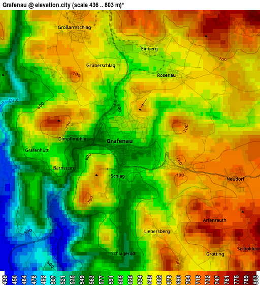
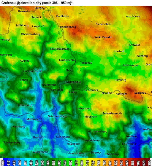
Below is the Elevation map of Grafenau, which displays elevation range with different colors. Scale of the first map is from 436 to 803 m (1430 to 2635 ft) with average elevation of 636 meters (=2087 ft) [note 1]
These maps also provides idea of topography and contour of this city, they are displayed at different zoom levels. More info about maps, scale and edge coordinates you can find below images.
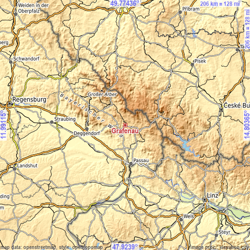
| \ | Map #1 | Map #2 | Topo.Map |
| Scale [m] | 436..803 m | 396..950 m | × |
| Scale [ft] | 1430..2635 ft | 1299..3117 ft | × |
| Average | 636 m = 2087 ft | 639.4 m = 2098 ft | × |
| Width | 6.43 km = 4 mi | 12.86 km = 8 mi | 205.8 km = 127.9 mi |
| Height | 6.43 km = 4 mi | 12.86 km = 8 mi | 205.7 km = 127.8 mi |
| ↑Max Latitude | 48.886585° | 48.915473° | 49.77436° |
| Latitude at center | 48.85768° | 48.85768° | 48.85768° |
| ↓Min Latitude | 48.828759° | 48.799821° | 47.9239° |
| ← Min Longitude | 13.353455° | 13.309509° | 11.99115° |
| Longitude center | 13.3974° | 13.3974° | 13.3974° |
| →Max Longitude | 13.441345° | 13.485291° | 14.80365° |
Nearby cities:
Cities around Grafenau sort by population:
• Freyung elevation 653 m
12.2 km,  115°
115°
• Spiegelau 729 m
6.9 km,  338°
338°
• Hohenau 808 m
6.7 km,  97°
97°
• Perlesreut 562 m
9 km,  160°
160°
• Thurmansbang 499 m
11.8 km,  210°
210°
• Neuschönau 748 m
6.4 km,  62°
62°
• Kirchdorf im Wald 695 m
11.3 km,  301°
301°
• Ringelai 422 m
7.3 km,  132°
132°
• Saldenburg 536 m
9.9 km,  197°
197°
• Innernzell 637 m
9 km,  265°
265°
• Schöfweg 774 m
12.5 km,  260°
260°
• Zenting 447 m
12.5 km,  233°
233°
Multilingual:
 En español:
Grafenau elevación 604 m.
 En France:
Grafenau élévation 604 m.
 Auf Deutsch:
Grafenau höhe über dem Meeresspiegel ist 604 m.

Sources and notes:
- [note 1] Map square and city borders are not equal. Map elevation data is calculated only from area inside that square.
- [src 1] Elevation data from geonames database provided with same terms of usage.
- [src 2] The elevation map of Grafenau is generated using elevation data from NASA's 3 arcsec (90m) resolution SRTM data.
- [src 3] Base (background) map © OpenStreetMap contributors tiles are generated by Geofabrik and OpenTopoMap.
Copyright & License:
This Grafenau Elevation Map is licensed under CC BY-SA. You may reuse any part from this page, if you give a proper credit by linking to this URL:
 More info on terms of use page.