Gräfenhainichen elevation
Gräfenhainichen (Saxony-Anhalt), Germany elevation is 92 meters and Gräfenhainichen elevation in feet is 302 ft above sea level [src 1]. Gräfenhainichen is a populated place (feature code) with elevation that is 166 meters (545 ft) smaller than average city elevation in Germany.
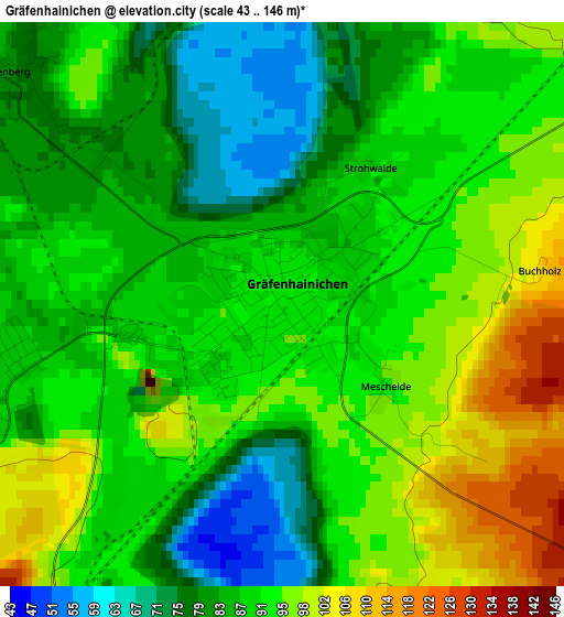
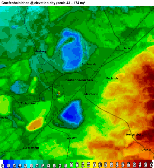
Below is the Elevation map of Gräfenhainichen, which displays elevation range with different colors. Scale of the first map is from 43 to 146 m (141 to 479 ft) with average elevation of 89.5 meters (=294 ft) [note 1]
These maps also provides idea of topography and contour of this city, they are displayed at different zoom levels. More info about maps, scale and edge coordinates you can find below images.
| \ | Map #1 | Map #2 | Topo.Map |
| Scale [m] | 43..146 m | 43..174 m | × |
| Scale [ft] | 141..479 ft | 141..571 ft | × |
| Average | 89.5 m = 294 ft | 100.7 m = 330 ft | × |
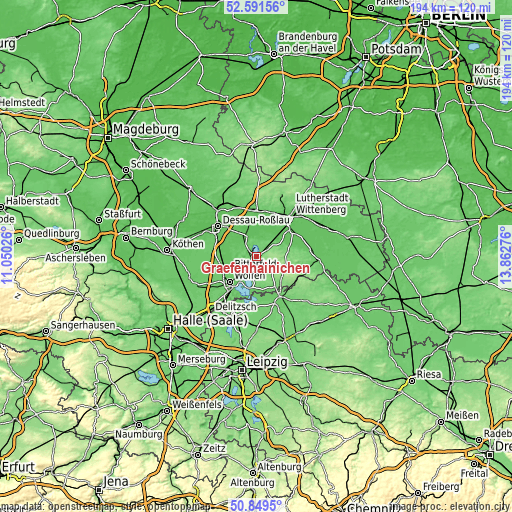
| Width | 6.05 km = 3.8 mi | 12.11 km = 7.5 mi | 193.7 km = 120.4 mi |
| Height | 6.05 km = 3.8 mi | 12.11 km = 7.5 mi | 193.7 km = 120.4 mi |
| ↑Max Latitude | 51.756131° | 51.783325° | 52.59156° |
| Latitude at center | 51.72892° | 51.72892° | 51.72892° |
| ↓Min Latitude | 51.701693° | 51.674449° | 50.8495° |
| ← Min Longitude | 12.412565° | 12.368619° | 11.05026° |
| Longitude center | 12.45651° | 12.45651° | 12.45651° |
| →Max Longitude | 12.500455° | 12.544401° | 13.86276° |
Nearby cities:
Cities around Gräfenhainichen sort by population:
• Raguhn elevation 73 m
12.6 km,  261°
261°
• Jeßnitz 75 m
11.9 km,  244°
244°
• Oranienbaum 66 m
8.5 km,  335°
335°
• Zschornewitz 90 m
4.2 km,  249°
249°
• Möhlau 76 m
7.1 km,  272°
272°
• Muldenstein 89 m
9.9 km,  230°
230°
• Friedersdorf 81 m
11 km,  214°
214°
• Wörlitz 63 m
12.8 km,  349°
349°
• Bergwitz 69 m
11.7 km,  51°
51°
• Pouch 93 m
12.4 km,  197°
197°
• Radis 99 m
4.8 km,  56°
56°
• Schlaitz 99 m
8 km,  193°
193°
Multilingual:
 En español:
Gräfenhainichen elevación 92 m.
 En France:
Gräfenhainichen élévation 92 m.
 Auf Deutsch:
Gräfenhainichen höhe über dem Meeresspiegel ist 92 m.

Sources and notes:
- [note 1] Map square and city borders are not equal. Map elevation data is calculated only from area inside that square.
- [src 1] Elevation data from geonames database provided with same terms of usage.
- [src 2] The elevation map of Gräfenhainichen is generated using elevation data from NASA's 3 arcsec (90m) resolution SRTM data.
- [src 3] Base (background) map © OpenStreetMap contributors tiles are generated by Geofabrik and OpenTopoMap.
Copyright & License:
This Gräfenhainichen Elevation Map is licensed under CC BY-SA. You may reuse any part from this page, if you give a proper credit by linking to this URL:
 More info on terms of use page.