Güsten elevation
Güsten (Saxony-Anhalt), Germany elevation is 78 meters and Güsten elevation in feet is 256 ft above sea level [src 1]. Güsten is a populated place (feature code) with elevation that is 180 meters (591 ft) smaller than average city elevation in Germany.
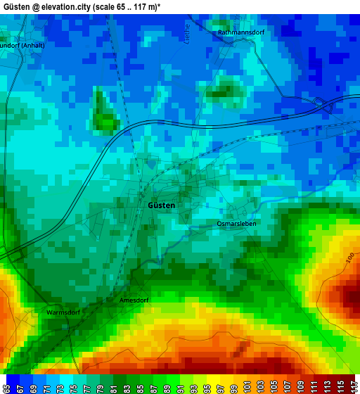
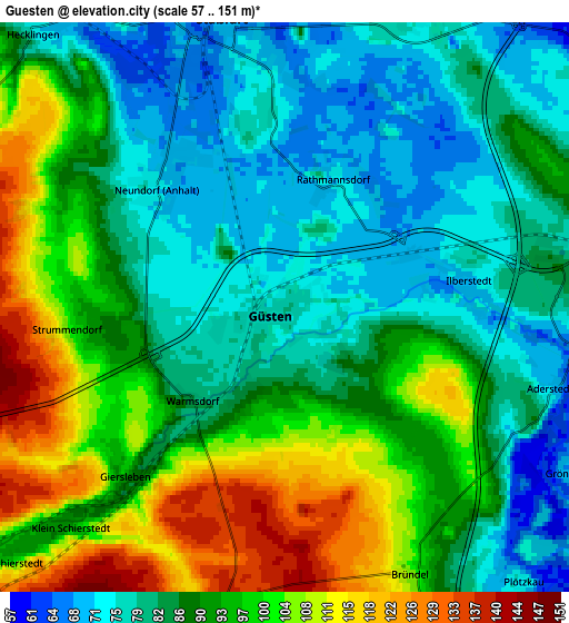
Below is the Elevation map of Güsten, which displays elevation range with different colors. Scale of the first map is from 65 to 117 m (213 to 384 ft) with average elevation of 79.5 meters (=261 ft) [note 1]
These maps also provides idea of topography and contour of this city, they are displayed at different zoom levels. More info about maps, scale and edge coordinates you can find below images.
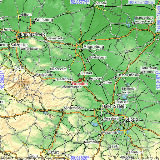
| \ | Map #1 | Map #2 | Topo.Map |
| Scale [m] | 65..117 m | 57..151 m | × |
| Scale [ft] | 213..384 ft | 187..495 ft | × |
| Average | 79.5 m = 261 ft | 89.7 m = 294 ft | × |
| Width | 6.04 km = 3.8 mi | 12.09 km = 7.5 mi | 193.4 km = 120.2 mi |
| Height | 6.04 km = 3.8 mi | 12.09 km = 7.5 mi | 193.4 km = 120.2 mi |
| ↑Max Latitude | 51.82354° | 51.850694° | 52.65771° |
| Latitude at center | 51.79637° | 51.79637° | 51.79637° |
| ↓Min Latitude | 51.769183° | 51.741981° | 50.91826° |
| ← Min Longitude | 11.568515° | 11.524569° | 10.20621° |
| Longitude center | 11.61246° | 11.61246° | 11.61246° |
| →Max Longitude | 11.656405° | 11.700351° | 13.01871° |
Nearby cities:
Cities around Güsten sort by population:
• Bernburg elevation 86 m
8.8 km,  91°
91°
• Aschersleben 115 m
11.3 km,  247°
247°
• Staßfurt 67 m
6.5 km,  343°
343°
• Hecklingen 81 m
7.8 km,  316°
316°
• Alsleben 80 m
11.4 km,  157°
157°
• Neundorf 71 m
3.8 km, 316°
• Förderstedt 77 m
11.3 km,  7°
7°
• Beesenlaublingen 71 m
11 km,  147°
147°
• Plötzkau 68 m
7.1 km,  136°
136°
• Ilberstedt 71 m
3.7 km,  83°
83°
• Mehringen 108 m
10.4 km,  221°
221°
• Giersleben 86 m
4.6 km, 223°
Multilingual:
 En español:
Güsten elevación 78 m.
 En France:
Güsten élévation 78 m.


Sources and notes:
- [note 1] Map square and city borders are not equal. Map elevation data is calculated only from area inside that square.
- [src 1] Elevation data from geonames database provided with same terms of usage.
- [src 2] The elevation map of Güsten is generated using elevation data from NASA's 3 arcsec (90m) resolution SRTM data.
- [src 3] Base (background) map © OpenStreetMap contributors tiles are generated by Geofabrik and OpenTopoMap.
Copyright & License:
This Güsten Elevation Map is licensed under CC BY-SA. You may reuse any part from this page, if you give a proper credit by linking to this URL:
 More info on terms of use page.