Harrislee elevation
Harrislee (Schleswig-Holstein), Germany elevation is 48 meters and Harrislee elevation in feet is 157 ft above sea level [src 1]. Harrislee is a seat of a fourth-order administrative division (feature code) with elevation that is 210 meters (689 ft) smaller than average city elevation in Germany.
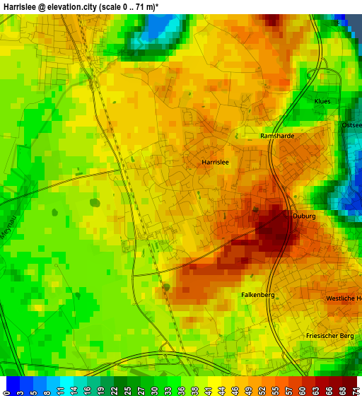
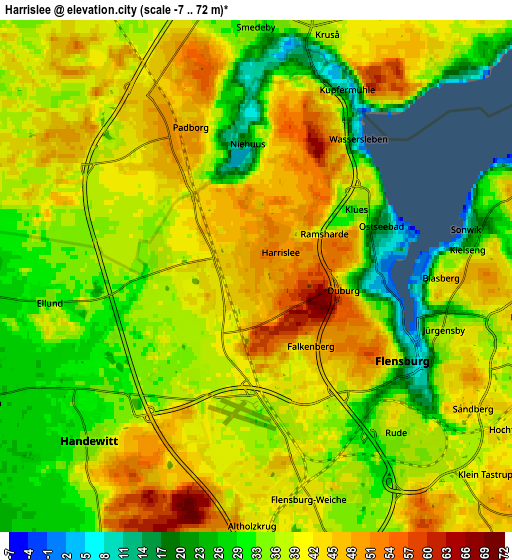
Below is the Elevation map of Harrislee, which displays elevation range with different colors. Scale of the first map is from 0 to 71 m (0 to 233 ft) with average elevation of 41.9 meters (=137 ft) [note 1]
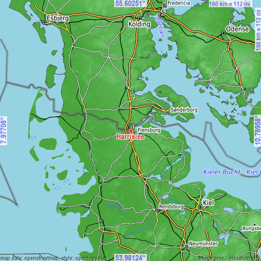
These maps also provides idea of topography and contour of this city, they are displayed at different zoom levels. More info about maps, scale and edge coordinates you can find below images.
| \ | Map #1 | Map #2 | Topo.Map |
| Scale [m] | 0..71 m | -7..72 m | × |
| Scale [ft] | 0..233 ft | -23..236 ft | × |
| Average | 41.9 m = 137 ft | 37.8 m = 124 ft | × |
| Width | 5.63 km = 3.5 mi | 11.27 km = 7 mi | 180.3 km = 112 mi |
| Height | 5.63 km = 3.5 mi | 11.27 km = 7 mi | 180.3 km = 112 mi |
| ↑Max Latitude | 54.825324° | 54.850631° | 55.60251° |
| Latitude at center | 54.8° | 54.8° | 54.8° |
| ↓Min Latitude | 54.774661° | 54.749305° | 53.98124° |
| ← Min Longitude | 9.339385° | 9.295439° | 7.97708° |
| Longitude center | 9.38333° | 9.38333° | 9.38333° |
| →Max Longitude | 9.427275° | 9.471221° | 10.78958° |
Nearby cities:
Cities around Harrislee sort by population:
• Flensburg elevation 7 m
4 km,  115°
115°
• Handewitt 40 m
4.9 km,  220°
220°
• Glücksburg 19 m
11.3 km,  69°
69°
• Jarplund-Weding 39 m
7.3 km,  162°
162°
• Schafflund 16 m
13.6 km,  250°
250°
• Wanderup 23 m
13.4 km,  193°
193°
• Wees 47 m
8.6 km,  85°
85°
• Oeversee 29 m
11.6 km, 163°
• Freienwill 42 m
10.7 km,  138°
138°
• Sankelmark 36 m
9.5 km, 164°
• Hürup 44 m
11.1 km, 120°
• Munkbrarup 48 m
11.8 km, 90°
Multilingual:
 En español:
Harrislee elevación 48 m.
 En France:
Harrislee élévation 48 m.
 Auf Deutsch:
Harrislee höhe über dem Meeresspiegel ist 48 m.

Sources and notes:
- [note 1] Map square and city borders are not equal. Map elevation data is calculated only from area inside that square.
- [src 1] Elevation data from geonames database provided with same terms of usage.
- [src 2] The elevation map of Harrislee is generated using elevation data from NASA's 3 arcsec (90m) resolution SRTM data.
- [src 3] Base (background) map © OpenStreetMap contributors tiles are generated by Geofabrik and OpenTopoMap.
Copyright & License:
This Harrislee Elevation Map is licensed under CC BY-SA. You may reuse any part from this page, if you give a proper credit by linking to this URL:
 More info on terms of use page.