Haselhorst elevation
Haselhorst (Berlin), Germany elevation is 34 meters and Haselhorst elevation in feet is 112 ft above sea level [src 1]. Haselhorst is a section of populated place (feature code) with elevation that is 224 meters (735 ft) smaller than average city elevation in Germany.
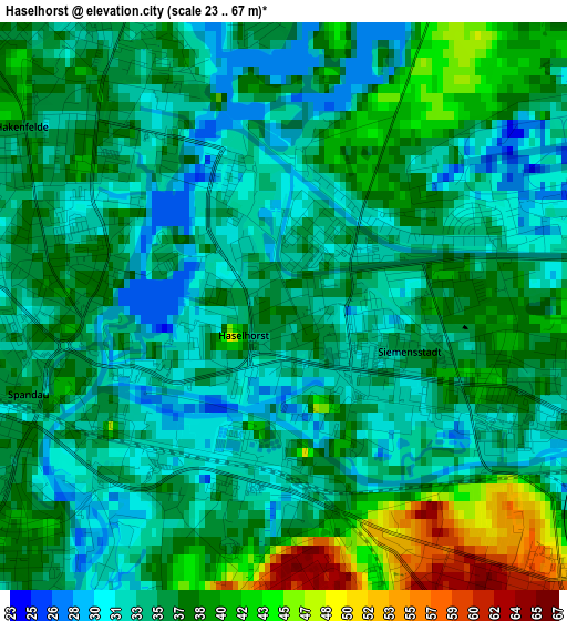
Below is the Elevation map of Haselhorst, which displays elevation range with different colors. Scale of the first map is from 23 to 67 m (75 to 220 ft) with average elevation of 36 meters (=118 ft) [note 1]
These maps also provides idea of topography and contour of this city, they are displayed at different zoom levels. More info about maps, scale and edge coordinates you can find below images.
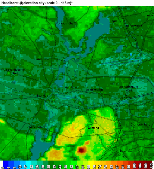
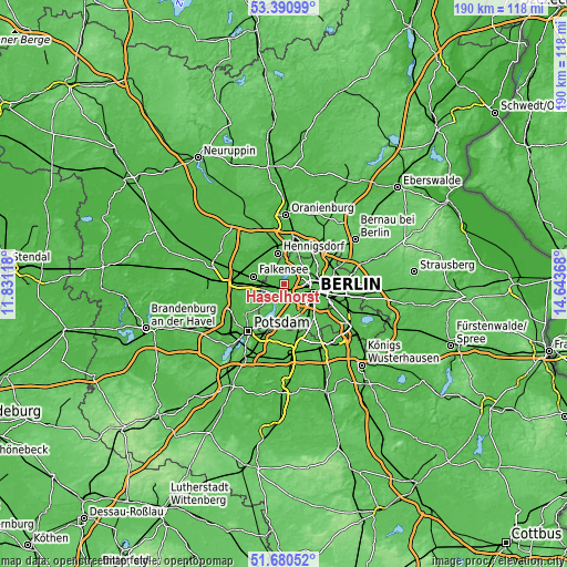
| \ | Map #1 | Map #2 | Topo.Map |
| Scale [m] | 23..67 m | 0..113 m | × |
| Scale [ft] | 75..220 ft | 0..371 ft | × |
| Average | 36 m = 118 ft | 39.6 m = 130 ft | × |
| Width | 5.94 km = 3.7 mi | 11.89 km = 7.4 mi | 190.2 km = 118.2 mi |
| Height | 5.94 km = 3.7 mi | 11.89 km = 7.4 mi | 190.2 km = 118.2 mi |
| ↑Max Latitude | 52.570807° | 52.597508° | 53.39099° |
| Latitude at center | 52.54409° | 52.54409° | 52.54409° |
| ↓Min Latitude | 52.517356° | 52.490607° | 51.68052° |
| ← Min Longitude | 13.193485° | 13.149539° | 11.83118° |
| Longitude center | 13.23743° | 13.23743° | 13.23743° |
| →Max Longitude | 13.281375° | 13.325321° | 14.64368° |
Nearby cities:
Cities around Haselhorst sort by population:
• Charlottenburg elevation 46 m
4.4 km,  134°
134°
• Reinickendorf 42 m
7 km,  68°
68°
• Staaken 31 m
5.9 km,  261°
261°
• Westend 60 m
4 km,  138°
138°
• Wilhelmstadt 33 m
4.6 km,  242°
242°
• Falkenhagener Feld 33 m
4.8 km,  280°
280°
• Spandau 35 m
2.7 km,  286°
286°
• Tegel 36 m
5.2 km,  47°
47°
• Hakenfelde 37 m
2.6 km,  309°
309°
• Charlottenburg-Nord 28 m
4.1 km,  111°
111°
• Siemensstadt 34 m
1.8 km,  102°
102°
• Konradshöhe 39 m
4.6 km,  351°
351°
Multilingual:
 En español:
Haselhorst elevación 34 m.
 En France:
Berlin-Haselhorst élévation 34 m.
 Auf Deutsch:
Berlin-Haselhorst höhe über dem Meeresspiegel ist 34 m.

Sources and notes:
- [note 1] Map square and city borders are not equal. Map elevation data is calculated only from area inside that square.
- [src 1] Elevation data from geonames database provided with same terms of usage.
- [src 2] The elevation map of Haselhorst is generated using elevation data from NASA's 3 arcsec (90m) resolution SRTM data.
- [src 3] Base (background) map © OpenStreetMap contributors tiles are generated by Geofabrik and OpenTopoMap.
Copyright & License:
This Haselhorst Elevation Map is licensed under CC BY-SA. You may reuse any part from this page, if you give a proper credit by linking to this URL:
 More info on terms of use page.