Heitersheim elevation
Heitersheim (Baden-Württemberg, Freiburg Region), Germany elevation is 236 meters and Heitersheim elevation in feet is 774 ft above sea level [src 1]. Heitersheim is a populated place (feature code) with elevation that is 22 meters (72 ft) smaller than average city elevation in Germany.
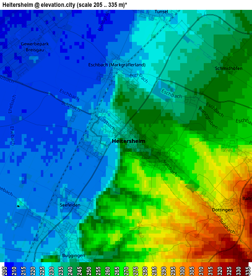
Below is the Elevation map of Heitersheim, which displays elevation range with different colors. Scale of the first map is from 205 to 335 m (673 to 1099 ft) with average elevation of 240.5 meters (=789 ft) [note 1]
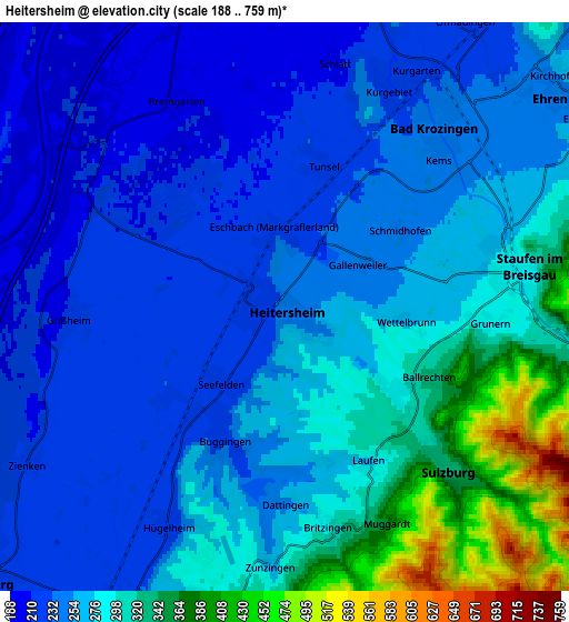
These maps also provides idea of topography and contour of this city, they are displayed at different zoom levels. More info about maps, scale and edge coordinates you can find below images.
| \ | Map #1 | Map #2 | Topo.Map |
| Scale [m] | 205..335 m | 188..759 m | × |
| Scale [ft] | 673..1099 ft | 617..2490 ft | × |
| Average | 240.5 m = 789 ft | 269.7 m = 885 ft | × |
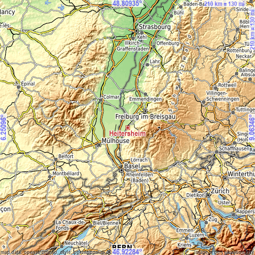
| Width | 6.55 km = 4.1 mi | 13.11 km = 8.1 mi | 209.8 km = 130.4 mi |
| Height | 6.55 km = 4.1 mi | 13.11 km = 8.1 mi | 209.7 km = 130.3 mi |
| ↑Max Latitude | 47.904148° | 47.933599° | 48.80935° |
| Latitude at center | 47.87468° | 47.87468° | 47.87468° |
| ↓Min Latitude | 47.845195° | 47.815693° | 46.92284° |
| ← Min Longitude | 7.613265° | 7.569319° | 6.25096° |
| Longitude center | 7.65721° | 7.65721° | 7.65721° |
| →Max Longitude | 7.701155° | 7.745101° | 9.06346° |
Nearby cities:
Cities around Heitersheim sort by population:
• Müllheim elevation 268 m
7.7 km,  195°
195°
• Unterkrozingen 224 m
5.5 km,  26°
26°
• Neuenburg am Rhein 228 m
9.9 km,  227°
227°
• Münstertal/Schwarzwald 381 m
9.7 km,  103°
103°
• Hartheim 201 m
6.8 km,  344°
344°
• Badenweiler 415 m
8.1 km,  172°
172°
• Buggingen 225 m
3.3 km,  205°
205°
• Sulzburg 338 m
5.3 km,  134°
134°
• Pfaffenweiler 260 m
9.5 km,  46°
46°
• Auggen 283 m
11 km, 202°
• Bollschweil 327 m
11.2 km,  62°
62°
• Feldberg 381 m
11.2 km,  186°
186°
Multilingual:
 En español:
Heitersheim elevación 236 m.
 En France:
Heitersheim élévation 236 m.
 Auf Deutsch:
Heitersheim höhe über dem Meeresspiegel ist 236 m.

Sources and notes:
- [note 1] Map square and city borders are not equal. Map elevation data is calculated only from area inside that square.
- [src 1] Elevation data from geonames database provided with same terms of usage.
- [src 2] The elevation map of Heitersheim is generated using elevation data from NASA's 3 arcsec (90m) resolution SRTM data.
- [src 3] Base (background) map © OpenStreetMap contributors tiles are generated by Geofabrik and OpenTopoMap.
Copyright & License:
This Heitersheim Elevation Map is licensed under CC BY-SA. You may reuse any part from this page, if you give a proper credit by linking to this URL:
 More info on terms of use page.