Hellenthal elevation
Hellenthal (North Rhine-Westphalia, Regierungsbezirk Köln), Germany elevation is 416 meters and Hellenthal elevation in feet is 1365 ft above sea level [src 1]. Hellenthal is a seat of a fourth-order administrative division (feature code) with elevation that is 158 meters (518 ft) bigger than average city elevation in Germany.
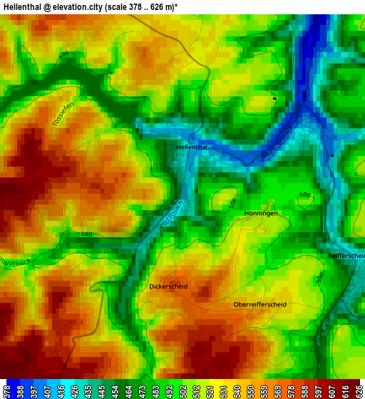
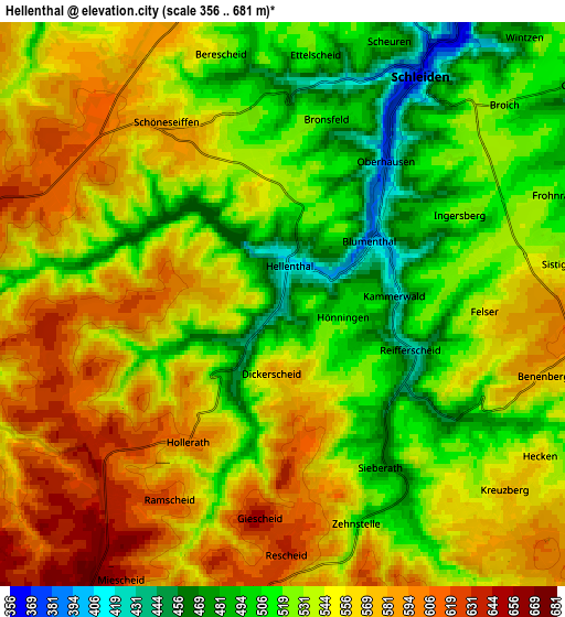
Below is the Elevation map of Hellenthal, which displays elevation range with different colors. Scale of the first map is from 378 to 626 m (1240 to 2054 ft) with average elevation of 511.6 meters (=1678 ft) [note 1]
These maps also provides idea of topography and contour of this city, they are displayed at different zoom levels. More info about maps, scale and edge coordinates you can find below images.
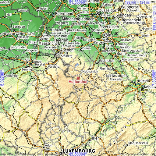
| \ | Map #1 | Map #2 | Topo.Map |
| Scale [m] | 378..626 m | 356..681 m | × |
| Scale [ft] | 1240..2054 ft | 1168..2234 ft | × |
| Average | 511.6 m = 1678 ft | 542.5 m = 1780 ft | × |
| Width | 6.22 km = 3.9 mi | 12.44 km = 7.7 mi | 199 km = 123.7 mi |
| Height | 6.22 km = 3.9 mi | 12.44 km = 7.7 mi | 199 km = 123.7 mi |
| ↑Max Latitude | 50.511284° | 50.539222° | 51.36968° |
| Latitude at center | 50.48333° | 50.48333° | 50.48333° |
| ↓Min Latitude | 50.455359° | 50.427372° | 49.58004° |
| ← Min Longitude | 6.389385° | 6.345439° | 5.02708° |
| Longitude center | 6.43333° | 6.43333° | 6.43333° |
| →Max Longitude | 6.477275° | 6.521221° | 7.83958° |
Nearby cities:
Cities around Hellenthal sort by population:
• Mechernich elevation 301 m
19.7 km,  51°
51°
• Simmerath 536 m
16 km,  324°
324°
• Schleiden 367 m
5.9 km,  31°
31°
• Monschau 418 m
15.8 km,  300°
300°
• Kall 384 m
11.3 km, 54°
• Blankenheim 518 m
16.3 km,  109°
109°
• Nettersheim 452 m
13.9 km,  85°
85°
• Heimbach 224 m
17.3 km,  8°
8°
• Dahlem 493 m
13.5 km,  143°
143°
• Jünkerath 430 m
18.7 km,  145°
145°
• Stadtkyll 459 m
16.4 km, 154°
• Lissendorf 472 m
22 km, 147°
Multilingual:
 En español:
Hellenthal elevación 416 m.
 En France:
Hellenthal élévation 416 m.
 Auf Deutsch:
Hellenthal höhe über dem Meeresspiegel ist 416 m.

Sources and notes:
- [note 1] Map square and city borders are not equal. Map elevation data is calculated only from area inside that square.
- [src 1] Elevation data from geonames database provided with same terms of usage.
- [src 2] The elevation map of Hellenthal is generated using elevation data from NASA's 3 arcsec (90m) resolution SRTM data.
- [src 3] Base (background) map © OpenStreetMap contributors tiles are generated by Geofabrik and OpenTopoMap.
Copyright & License:
This Hellenthal Elevation Map is licensed under CC BY-SA. You may reuse any part from this page, if you give a proper credit by linking to this URL:
 More info on terms of use page.