Höchstadt an der Aisch elevation
Höchstadt an der Aisch (Bavaria, Regierungsbezirk Mittelfranken), Germany elevation is 274 meters and Höchstadt an der Aisch elevation in feet is 899 ft above sea level [src 1]. Höchstadt an der Aisch is a populated place (feature code) with elevation that is 16 meters (52 ft) bigger than average city elevation in Germany.
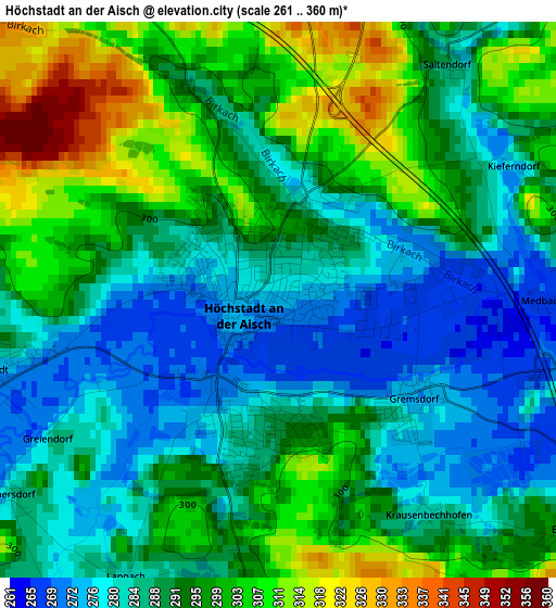
Below is the Elevation map of Höchstadt an der Aisch, which displays elevation range with different colors. Scale of the first map is from 261 to 360 m (856 to 1181 ft) with average elevation of 291.9 meters (=958 ft) [note 1]
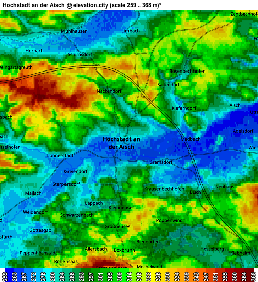
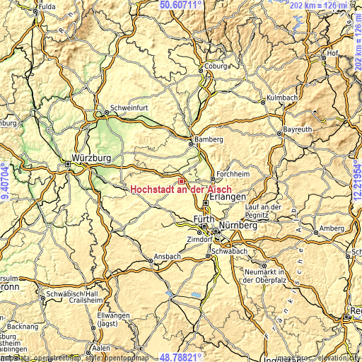
These maps also provides idea of topography and contour of this city, they are displayed at different zoom levels. More info about maps, scale and edge coordinates you can find below images.
| \ | Map #1 | Map #2 | Topo.Map |
| Scale [m] | 261..360 m | 259..368 m | × |
| Scale [ft] | 856..1181 ft | 850..1207 ft | × |
| Average | 291.9 m = 958 ft | 297.7 m = 977 ft | × |
| Width | 6.32 km = 3.9 mi | 12.64 km = 7.9 mi | 202.2 km = 125.6 mi |
| Height | 6.32 km = 3.9 mi | 12.64 km = 7.9 mi | 202.2 km = 125.6 mi |
| ↑Max Latitude | 49.734581° | 49.762976° | 50.60711° |
| Latitude at center | 49.70617° | 49.70617° | 49.70617° |
| ↓Min Latitude | 49.677742° | 49.649297° | 48.78821° |
| ← Min Longitude | 10.769345° | 10.725399° | 9.40704° |
| Longitude center | 10.81329° | 10.81329° | 10.81329° |
| →Max Longitude | 10.857235° | 10.901181° | 12.21954° |
Nearby cities:
Cities around Höchstadt an der Aisch sort by population:
• Weisendorf elevation 308 m
9.3 km,  174°
174°
• Hemhofen 317 m
9 km,  106°
106°
• Röttenbach 311 m
9.4 km,  119°
119°
• Heßdorf 290 m
11.2 km,  141°
141°
• Uehlfeld 282 m
7.8 km,  239°
239°
• Pommersfelden 268 m
6.7 km,  2°
2°
• Großenseebach 294 m
9.3 km,  151°
151°
• Wachenroth 294 m
8.8 km,  305°
305°
• Lonnerstadt 282 m
3.4 km,  256°
256°
• Mühlhausen 277 m
6 km,  333°
333°
• Vestenbergsgreuth 305 m
11.8 km, 259°
• Gremsdorf 275 m
1.8 km,  132°
132°
Multilingual:
 En español:
Höchstadt an der Aisch elevación 274 m.
 En France:
Höchstadt an der Aisch élévation 274 m.
 Auf Deutsch:
Höchstadt höhe über dem Meeresspiegel ist 274 m.

Sources and notes:
- [note 1] Map square and city borders are not equal. Map elevation data is calculated only from area inside that square.
- [src 1] Elevation data from geonames database provided with same terms of usage.
- [src 2] The elevation map of Höchstadt an der Aisch is generated using elevation data from NASA's 3 arcsec (90m) resolution SRTM data.
- [src 3] Base (background) map © OpenStreetMap contributors tiles are generated by Geofabrik and OpenTopoMap.
Copyright & License:
This Höchstadt an der Aisch Elevation Map is licensed under CC BY-SA. You may reuse any part from this page, if you give a proper credit by linking to this URL:
 More info on terms of use page.