Hohenmölsen elevation
Hohenmölsen (Saxony-Anhalt), Germany elevation is 184 meters and Hohenmölsen elevation in feet is 604 ft above sea level [src 1]. Hohenmölsen is a populated place (feature code) with elevation that is 74 meters (243 ft) smaller than average city elevation in Germany.
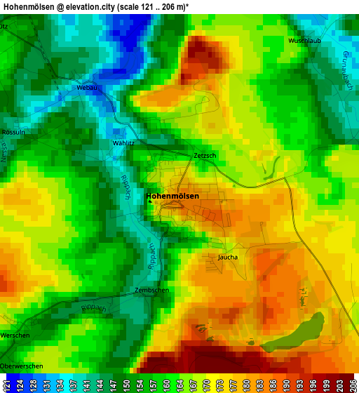
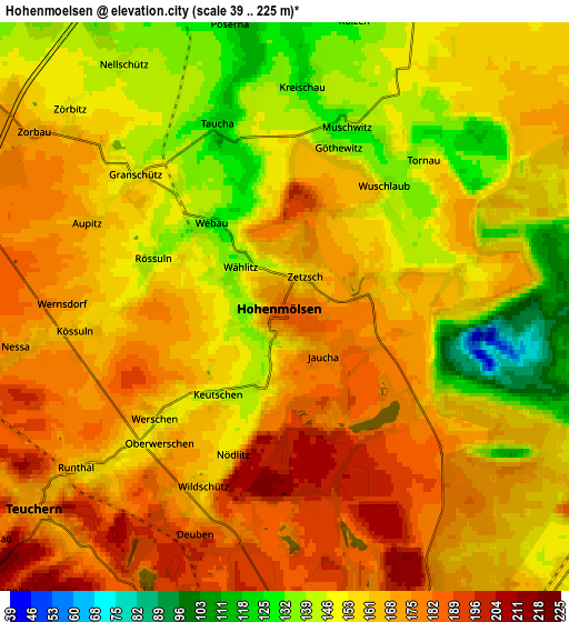
Below is the Elevation map of Hohenmölsen, which displays elevation range with different colors. Scale of the first map is from 121 to 206 m (397 to 676 ft) with average elevation of 162.8 meters (=534 ft) [note 1]
These maps also provides idea of topography and contour of this city, they are displayed at different zoom levels. More info about maps, scale and edge coordinates you can find below images.
| \ | Map #1 | Map #2 | Topo.Map |
| Scale [m] | 121..206 m | 39..225 m | × |
| Scale [ft] | 397..676 ft | 128..738 ft | × |
| Average | 162.8 m = 534 ft | 161.1 m = 529 ft | × |
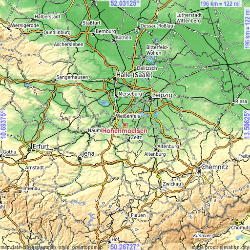
| Width | 6.13 km = 3.8 mi | 12.26 km = 7.6 mi | 196.1 km = 121.9 mi |
| Height | 6.13 km = 3.8 mi | 12.26 km = 7.6 mi | 196.1 km = 121.9 mi |
| ↑Max Latitude | 51.185243° | 51.21278° | 52.03125° |
| Latitude at center | 51.15769° | 51.15769° | 51.15769° |
| ↓Min Latitude | 51.13012° | 51.102534° | 50.26727° |
| ← Min Longitude | 12.056055° | 12.012109° | 10.69375° |
| Longitude center | 12.1° | 12.1° | 12.1° |
| →Max Longitude | 12.143945° | 12.187891° | 13.50625° |
Nearby cities:
Cities around Hohenmölsen sort by population:
• Weißenfels elevation 102 m
10.4 km,  297°
297°
• Pegau 136 m
10.6 km,  84°
84°
• Teuchern 170 m
6.7 km,  232°
232°
• Langendorf 143 m
10 km,  284°
284°
• Kitzen 143 m
11.2 km,  50°
50°
• Theißen 173 m
7.8 km,  176°
176°
• Elstertrebnitz 132 m
9.3 km,  95°
95°
• Deuben 197 m
5.7 km,  199°
199°
• Granschütz 149 m
4.5 km,  311°
311°
• Muschwitz 140 m
4.2 km,  20°
20°
• Burgwerben 113 m
10.8 km, 311°
• Nessa 180 m
6.5 km,  258°
258°
Multilingual:
 En español:
Hohenmölsen elevación 184 m.
 En France:
Hohenmölsen élévation 184 m.
 Auf Deutsch:
Hohenmölsen höhe über dem Meeresspiegel ist 184 m.

Sources and notes:
- [note 1] Map square and city borders are not equal. Map elevation data is calculated only from area inside that square.
- [src 1] Elevation data from geonames database provided with same terms of usage.
- [src 2] The elevation map of Hohenmölsen is generated using elevation data from NASA's 3 arcsec (90m) resolution SRTM data.
- [src 3] Base (background) map © OpenStreetMap contributors tiles are generated by Geofabrik and OpenTopoMap.
Copyright & License:
This Hohenmölsen Elevation Map is licensed under CC BY-SA. You may reuse any part from this page, if you give a proper credit by linking to this URL:
 More info on terms of use page.