Hohndorf elevation
Hohndorf (Saxony), Germany elevation is 377 meters and Hohndorf elevation in feet is 1237 ft above sea level [src 1]. Hohndorf is a seat of a fourth-order administrative division (feature code) with elevation that is 119 meters (390 ft) bigger than average city elevation in Germany.
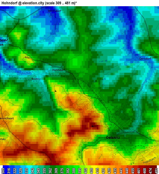
Below is the Elevation map of Hohndorf, which displays elevation range with different colors. Scale of the first map is from 309 to 481 m (1014 to 1578 ft) with average elevation of 377.1 meters (=1237 ft) [note 1]
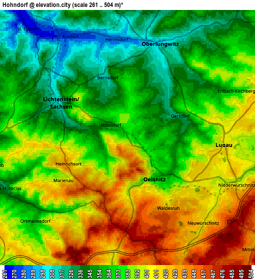
These maps also provides idea of topography and contour of this city, they are displayed at different zoom levels. More info about maps, scale and edge coordinates you can find below images.
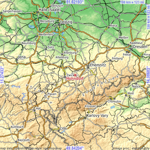
| \ | Map #1 | Map #2 | Topo.Map |
| Scale [m] | 309..481 m | 261..504 m | × |
| Scale [ft] | 1014..1578 ft | 856..1654 ft | × |
| Average | 377.1 m = 1237 ft | 379.6 m = 1245 ft | × |
| Width | 6.18 km = 3.8 mi | 12.37 km = 7.7 mi | 197.9 km = 123 mi |
| Height | 6.18 km = 3.8 mi | 12.37 km = 7.7 mi | 197.9 km = 123 mi |
| ↑Max Latitude | 50.768242° | 50.796027° | 51.62193° |
| Latitude at center | 50.74044° | 50.74044° | 50.74044° |
| ↓Min Latitude | 50.712622° | 50.684787° | 49.84204° |
| ← Min Longitude | 12.636635° | 12.592689° | 11.27433° |
| Longitude center | 12.68058° | 12.68058° | 12.68058° |
| →Max Longitude | 12.724525° | 12.768471° | 14.08683° |
Nearby cities:
Cities around Hohndorf sort by population:
• Hohenstein-Ernstthal elevation 361 m
7.1 km,  18°
18°
• Lichtenstein 308 m
4 km,  296°
296°
• Stollberg 417 m
7.8 km,  115°
115°
• Mülsen 318 m
8.1 km,  277°
277°
• Oelsnitz 379 m
2.2 km,  138°
138°
• Lugau 407 m
4.8 km,  92°
92°
• Oberlungwitz 300 m
5 km, 22°
• Gersdorf 329 m
2.8 km,  67°
67°
• Sankt Egidien 269 m
6.5 km,  321°
321°
• Bernsdorf 318 m
3.1 km,  341°
341°
• Kirchberg 388 m
6.4 km, 68°
• Niederdorf 403 m
7.6 km,  102°
102°
Multilingual:
 En español:
Hohndorf elevación 377 m.
 En France:
Hohndorf élévation 377 m.
 Auf Deutsch:
Hohndorf höhe über dem Meeresspiegel ist 377 m.

Sources and notes:
- [note 1] Map square and city borders are not equal. Map elevation data is calculated only from area inside that square.
- [src 1] Elevation data from geonames database provided with same terms of usage.
- [src 2] The elevation map of Hohndorf is generated using elevation data from NASA's 3 arcsec (90m) resolution SRTM data.
- [src 3] Base (background) map © OpenStreetMap contributors tiles are generated by Geofabrik and OpenTopoMap.
Copyright & License:
This Hohndorf Elevation Map is licensed under CC BY-SA. You may reuse any part from this page, if you give a proper credit by linking to this URL:
 More info on terms of use page.