Hunderdorf elevation
Hunderdorf (Bavaria, Lower Bavaria), Germany elevation is 318 meters and Hunderdorf elevation in feet is 1043 ft above sea level [src 1]. Hunderdorf is a populated locality (feature code) with elevation that is 60 meters (197 ft) bigger than average city elevation in Germany.
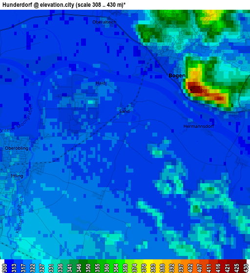
Below is the Elevation map of Hunderdorf, which displays elevation range with different colors. Scale of the first map is from 308 to 430 m (1010 to 1411 ft) with average elevation of 321.1 meters (=1053 ft) [note 1]
These maps also provides idea of topography and contour of this city, they are displayed at different zoom levels. More info about maps, scale and edge coordinates you can find below images.
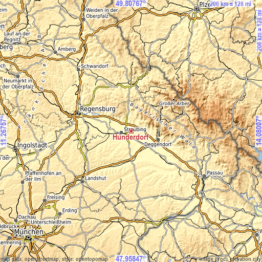
| \ | Map #1 | Topo.Map |
| Scale [m] | 308..430 m | × |
| Scale [ft] | 1010..1411 ft | × |
| Average | 321.1 m = 1053 ft | × |
| Width | 6.43 km = 4 mi | 205.6 km = 127.8 mi |
| Height | 6.43 km = 4 mi | 205.6 km = 127.8 mi |
| ↑Max Latitude | 48.920505° | 49.80767° |
| Latitude at center | 48.89162° | 48.89162° |
| ↓Min Latitude | 48.862718° | 47.95847° |
| ← Min Longitude | 12.629875° | 11.26757° |
| Longitude center | 12.67382° | 12.67382° |
| →Max Longitude | 12.717765° | 14.08007° |
Nearby cities:
Cities around Hunderdorf sort by population:
• Straubing elevation 333 m
7.4 km,  261°
261°
• Bogen 320 m
2.5 km,  27°
27°
• Alterhofen 331 m
6.4 km,  218°
218°
• Straßkirchen 323 m
7.6 km,  152°
152°
• Parkstetten 320 m
6.1 km,  297°
297°
• Steinach 334 m
8.5 km,  324°
324°
• Schwarzach 366 m
10.4 km,  75°
75°
• Oberschneiding 359 m
10.9 km,  192°
192°
• Mitterfels 426 m
9.4 km,  2°
2°
• Niederwinkling 319 m
9.3 km,  95°
95°
• Irlbach 317 m
8 km,  134°
134°
• Windberg 430 m
7.8 km,  42°
42°
Multilingual:
 En español:
Hunderdorf elevación 318 m.
 En France:
Hunderdorf élévation 318 m.
 Auf Deutsch:
Hunderdorf höhe über dem Meeresspiegel ist 318 m.

Sources and notes:
- [note 1] Map square and city borders are not equal. Map elevation data is calculated only from area inside that square.
- [src 1] Elevation data from geonames database provided with same terms of usage.
- [src 2] The elevation map of Hunderdorf is generated using elevation data from NASA's 3 arcsec (90m) resolution SRTM data.
- [src 3] Base (background) map © OpenStreetMap contributors tiles are generated by Geofabrik and OpenTopoMap.
Copyright & License:
This Hunderdorf Elevation Map is licensed under CC BY-SA. You may reuse any part from this page, if you give a proper credit by linking to this URL:
 More info on terms of use page.