Igensdorf elevation
Igensdorf (Bavaria, Upper Franconia), Germany elevation is 341 meters and Igensdorf elevation in feet is 1119 ft above sea level [src 1]. Igensdorf is a populated place (feature code) with elevation that is 83 meters (272 ft) bigger than average city elevation in Germany.
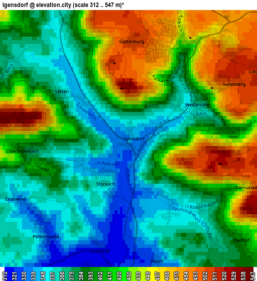
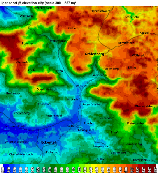
Below is the Elevation map of Igensdorf, which displays elevation range with different colors. Scale of the first map is from 312 to 547 m (1024 to 1795 ft) with average elevation of 403 meters (=1322 ft) [note 1]
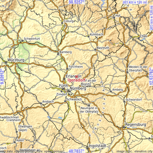
These maps also provides idea of topography and contour of this city, they are displayed at different zoom levels. More info about maps, scale and edge coordinates you can find below images.
| \ | Map #1 | Map #2 | Topo.Map |
| Scale [m] | 312..547 m | 300..557 m | × |
| Scale [ft] | 1024..1795 ft | 984..1827 ft | × |
| Average | 403 m = 1322 ft | 420.1 m = 1378 ft | × |
| Width | 6.33 km = 3.9 mi | 12.66 km = 7.9 mi | 202.6 km = 125.9 mi |
| Height | 6.33 km = 3.9 mi | 12.66 km = 7.9 mi | 202.6 km = 125.9 mi |
| ↑Max Latitude | 49.65168° | 49.680123° | 50.5257° |
| Latitude at center | 49.62322° | 49.62322° | 49.62322° |
| ↓Min Latitude | 49.594743° | 49.56625° | 48.7037° |
| ← Min Longitude | 11.187425° | 11.143479° | 9.82512° |
| Longitude center | 11.23137° | 11.23137° | 11.23137° |
| →Max Longitude | 11.275315° | 11.319261° | 12.63762° |
Nearby cities:
Cities around Igensdorf sort by population:
• Neunkirchen am Brand elevation 316 m
7.4 km,  260°
260°
• Schnaittach 349 m
10.7 km,  131°
131°
• Gräfenberg 435 m
2.7 km,  29°
29°
• Simmelsdorf 378 m
8.3 km,  110°
110°
• Kalchreuth 414 m
10.1 km,  224°
224°
• Egloffstein 417 m
8.9 km,  12°
12°
• Dormitz 308 m
8.7 km,  251°
251°
• Leutenbach 339 m
10.5 km,  336°
336°
• Hiltpoltstein 519 m
7.8 km,  57°
57°
• Kleinsendelbach 312 m
6.1 km,  239°
239°
• Hetzles 346 m
7.1 km,  279°
279°
• Weißenohe 367 m
1.8 km, 62°
Multilingual:
 En español:
Igensdorf elevación 341 m.
 En France:
Igensdorf élévation 341 m.
 Auf Deutsch:
Igensdorf höhe über dem Meeresspiegel ist 341 m.

Sources and notes:
- [note 1] Map square and city borders are not equal. Map elevation data is calculated only from area inside that square.
- [src 1] Elevation data from geonames database provided with same terms of usage.
- [src 2] The elevation map of Igensdorf is generated using elevation data from NASA's 3 arcsec (90m) resolution SRTM data.
- [src 3] Base (background) map © OpenStreetMap contributors tiles are generated by Geofabrik and OpenTopoMap.
Copyright & License:
This Igensdorf Elevation Map is licensed under CC BY-SA. You may reuse any part from this page, if you give a proper credit by linking to this URL:
 More info on terms of use page.