Kirchberg elevation
Kirchberg (Bavaria, Lower Bavaria), Germany elevation is 670 meters and Kirchberg elevation in feet is 2198 ft above sea level [src 1]. Kirchberg is a populated place (feature code) with elevation that is 412 meters (1352 ft) bigger than average city elevation in Germany.
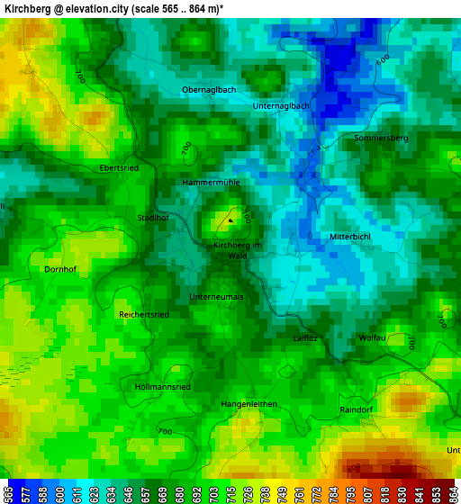
Below is the Elevation map of Kirchberg, which displays elevation range with different colors. Scale of the first map is from 565 to 864 m (1854 to 2835 ft) with average elevation of 677 meters (=2221 ft) [note 1]
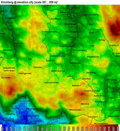
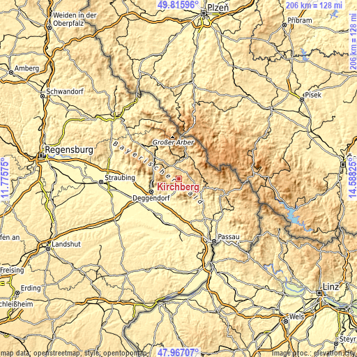
These maps also provides idea of topography and contour of this city, they are displayed at different zoom levels. More info about maps, scale and edge coordinates you can find below images.
| \ | Map #1 | Map #2 | Topo.Map |
| Scale [m] | 565..864 m | 381..959 m | × |
| Scale [ft] | 1854..2835 ft | 1250..3146 ft | × |
| Average | 677 m = 2221 ft | 661.6 m = 2171 ft | × |
| Width | 6.42 km = 4 mi | 12.85 km = 8 mi | 205.6 km = 127.8 mi |
| Height | 6.42 km = 4 mi | 12.85 km = 8 mi | 205.6 km = 127.8 mi |
| ↑Max Latitude | 48.92894° | 48.957804° | 49.81596° |
| Latitude at center | 48.90006° | 48.90006° | 48.90006° |
| ↓Min Latitude | 48.871163° | 48.84225° | 47.96707° |
| ← Min Longitude | 13.138055° | 13.094109° | 11.77575° |
| Longitude center | 13.182° | 13.182° | 13.182° |
| →Max Longitude | 13.225945° | 13.269891° | 14.58825° |
Nearby cities:
Cities around Kirchberg sort by population:
• Regen elevation 544 m
8.9 km,  333°
333°
• Rinchnach 566 m
5.7 km,  14°
14°
• Bischofsmais 680 m
7.6 km,  285°
285°
• Frauenau 621 m
13.1 km,  41°
41°
• Auerbach 328 m
12.3 km,  209°
209°
• Kirchdorf im Wald 695 m
6.3 km,  79°
79°
• Innernzell 637 m
8.7 km,  128°
128°
• Lalling 432 m
6.8 km, 206°
• Schaufling 495 m
10.1 km,  236°
236°
• Grattersdorf 478 m
10.9 km,  190°
190°
• Schöfweg 774 m
7.6 km,  153°
153°
• Hunding 467 m
6.4 km,  183°
183°
Multilingual:
 En español:
Kirchberg elevación 670 m.
 En France:
Kirchberg élévation 670 m.
 Auf Deutsch:
Kirchberg höhe über dem Meeresspiegel ist 670 m.

Sources and notes:
- [note 1] Map square and city borders are not equal. Map elevation data is calculated only from area inside that square.
- [src 1] Elevation data from geonames database provided with same terms of usage.
- [src 2] The elevation map of Kirchberg is generated using elevation data from NASA's 3 arcsec (90m) resolution SRTM data.
- [src 3] Base (background) map © OpenStreetMap contributors tiles are generated by Geofabrik and OpenTopoMap.
Copyright & License:
This Kirchberg Elevation Map is licensed under CC BY-SA. You may reuse any part from this page, if you give a proper credit by linking to this URL:
 More info on terms of use page.