Kirchdorf elevation
Kirchdorf (Baden-Württemberg, Tübingen Region), Germany elevation is 555 meters and Kirchdorf elevation in feet is 1821 ft above sea level [src 1]. Kirchdorf is a populated place (feature code) with elevation that is 297 meters (974 ft) bigger than average city elevation in Germany.
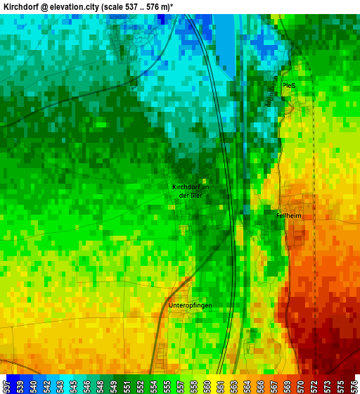
Below is the Elevation map of Kirchdorf, which displays elevation range with different colors. Scale of the first map is from 537 to 576 m (1762 to 1890 ft) with average elevation of 554.7 meters (=1820 ft) [note 1]
These maps also provides idea of topography and contour of this city, they are displayed at different zoom levels. More info about maps, scale and edge coordinates you can find below images.
| \ | Map #1 | Map #2 | Topo.Map |
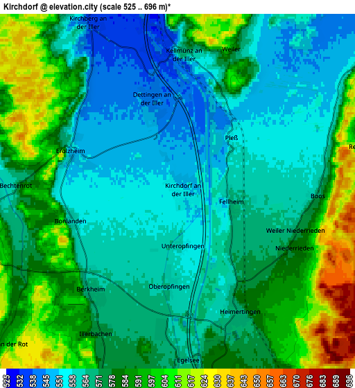
| Scale [m] | 537..576 m | 525..696 m | × |
| Scale [ft] | 1762..1890 ft | 1722..2283 ft | × |
| Average | 554.7 m = 1820 ft | 575.2 m = 1887 ft | × |
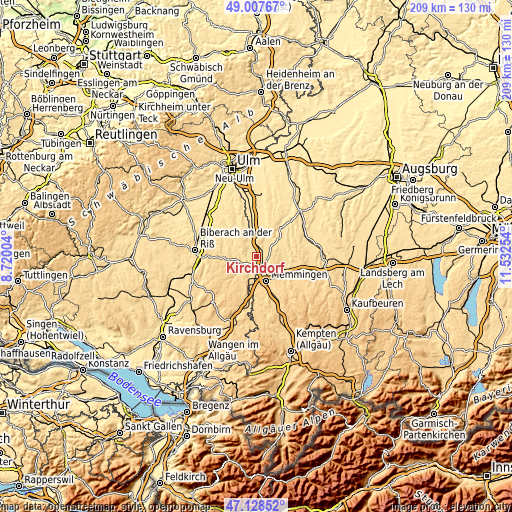
| Width | 6.53 km = 4.1 mi | 13.06 km = 8.1 mi | 208.9 km = 129.8 mi |
| Height | 6.53 km = 4.1 mi | 13.06 km = 8.1 mi | 208.9 km = 129.8 mi |
| ↑Max Latitude | 48.106023° | 48.135359° | 49.00767° |
| Latitude at center | 48.07667° | 48.07667° | 48.07667° |
| ↓Min Latitude | 48.0473° | 48.017914° | 47.12852° |
| ← Min Longitude | 10.082345° | 10.038399° | 8.72004° |
| Longitude center | 10.12629° | 10.12629° | 10.12629° |
| →Max Longitude | 10.170235° | 10.214181° | 11.53254° |
Nearby cities:
Cities around Kirchdorf sort by population:
• Amendingen elevation 593 m
9.1 km,  154°
154°
• Erolzheim 552 m
4.2 km,  290°
290°
• Buxheim 587 m
8.5 km,  176°
176°
• Steinheim 586 m
7.3 km,  159°
159°
• Berkheim 568 m
5 km,  220°
220°
• Tannheim 586 m
9.1 km,  200°
200°
• Boos 570 m
5.1 km,  91°
91°
• Kirchberg an der Iller 537 m
7.1 km,  333°
333°
• Heimertingen 565 m
5.1 km, 159°
• Kellmünz 571 m
5 km,  1°
1°
• Niederrieden 583 m
4.7 km,  116°
116°
• Fellheim 565 m
2 km,  102°
102°
Multilingual:
 En español:
Kirchdorf elevación 555 m.
 En France:
Kirchdorf élévation 555 m.
 Auf Deutsch:
Kirchdorf höhe über dem Meeresspiegel ist 555 m.

Sources and notes:
- [note 1] Map square and city borders are not equal. Map elevation data is calculated only from area inside that square.
- [src 1] Elevation data from geonames database provided with same terms of usage.
- [src 2] The elevation map of Kirchdorf is generated using elevation data from NASA's 3 arcsec (90m) resolution SRTM data.
- [src 3] Base (background) map © OpenStreetMap contributors tiles are generated by Geofabrik and OpenTopoMap.
Copyright & License:
This Kirchdorf Elevation Map is licensed under CC BY-SA. You may reuse any part from this page, if you give a proper credit by linking to this URL:
 More info on terms of use page.