Kölleda elevation
Kölleda (Thuringia), Germany elevation is 146 meters and Kölleda elevation in feet is 479 ft above sea level [src 1]. Kölleda is a populated place (feature code) with elevation that is 112 meters (367 ft) smaller than average city elevation in Germany.
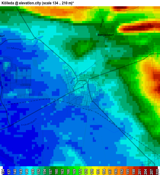
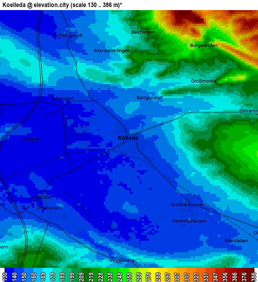
Below is the Elevation map of Kölleda, which displays elevation range with different colors. Scale of the first map is from 134 to 210 m (440 to 689 ft) with average elevation of 151.1 meters (=496 ft) [note 1]
These maps also provides idea of topography and contour of this city, they are displayed at different zoom levels. More info about maps, scale and edge coordinates you can find below images.
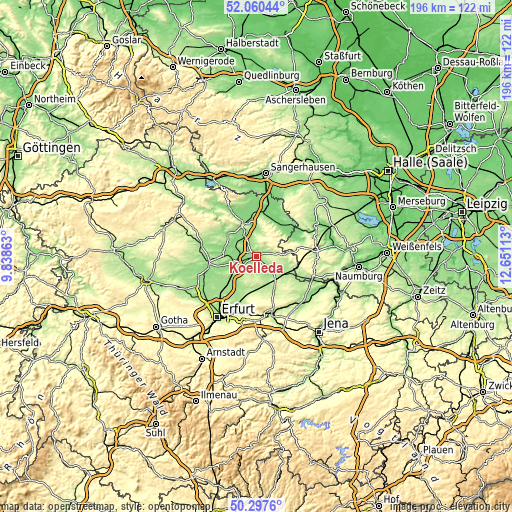
| \ | Map #1 | Map #2 | Topo.Map |
| Scale [m] | 134..210 m | 130..386 m | × |
| Scale [ft] | 440..689 ft | 427..1266 ft | × |
| Average | 151.1 m = 496 ft | 172.1 m = 565 ft | × |
| Width | 6.13 km = 3.8 mi | 12.25 km = 7.6 mi | 196 km = 121.8 mi |
| Height | 6.13 km = 3.8 mi | 12.25 km = 7.6 mi | 196 km = 121.8 mi |
| ↑Max Latitude | 51.214986° | 51.242505° | 52.06044° |
| Latitude at center | 51.18745° | 51.18745° | 51.18745° |
| ↓Min Latitude | 51.159898° | 51.132329° | 50.2976° |
| ← Min Longitude | 11.200935° | 11.156989° | 9.83863° |
| Longitude center | 11.24488° | 11.24488° | 11.24488° |
| →Max Longitude | 11.288825° | 11.332771° | 12.65113° |
Nearby cities:
Cities around Kölleda sort by population:
• Sömmerda elevation 140 m
9.6 km,  250°
250°
• Weißensee 149 m
12.3 km,  276°
276°
• Rastenberg 200 m
12.3 km,  96°
96°
• Buttstädt 192 m
14 km,  121°
121°
• Oldisleben 132 m
14.5 km,  339°
339°
• Heldrungen 129 m
12.9 km,  351°
351°
• Kindelbrück 140 m
13.6 km,  307°
307°
• Berlstedt 226 m
14 km,  180°
180°
• Schloßvippach 176 m
11.5 km,  217°
217°
• Buttelstedt 190 m
14.1 km,  150°
150°
• Großmonra 186 m
4.5 km,  51°
51°
• Kannawurf 130 m
11.7 km,  318°
318°
Multilingual:
 En español:
Kölleda elevación 146 m.
 En France:
Kölleda élévation 146 m.


Sources and notes:
- [note 1] Map square and city borders are not equal. Map elevation data is calculated only from area inside that square.
- [src 1] Elevation data from geonames database provided with same terms of usage.
- [src 2] The elevation map of Kölleda is generated using elevation data from NASA's 3 arcsec (90m) resolution SRTM data.
- [src 3] Base (background) map © OpenStreetMap contributors tiles are generated by Geofabrik and OpenTopoMap.
Copyright & License:
This Kölleda Elevation Map is licensed under CC BY-SA. You may reuse any part from this page, if you give a proper credit by linking to this URL:
 More info on terms of use page.