Kraiburg am Inn elevation
Kraiburg am Inn (Bavaria, Upper Bavaria), Germany elevation is 410 meters and Kraiburg am Inn elevation in feet is 1345 ft above sea level [src 1]. Kraiburg am Inn is a populated place (feature code) with elevation that is 152 meters (499 ft) bigger than average city elevation in Germany.
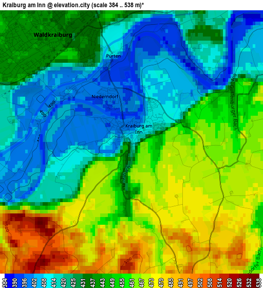
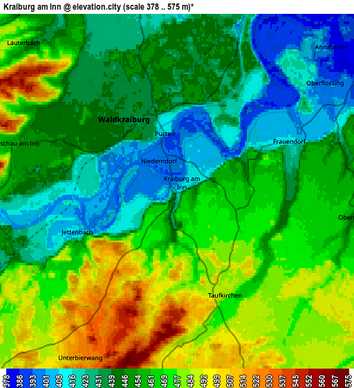
Below is the Elevation map of Kraiburg am Inn, which displays elevation range with different colors. Scale of the first map is from 384 to 538 m (1260 to 1765 ft) with average elevation of 442.1 meters (=1450 ft) [note 1]
These maps also provides idea of topography and contour of this city, they are displayed at different zoom levels. More info about maps, scale and edge coordinates you can find below images.
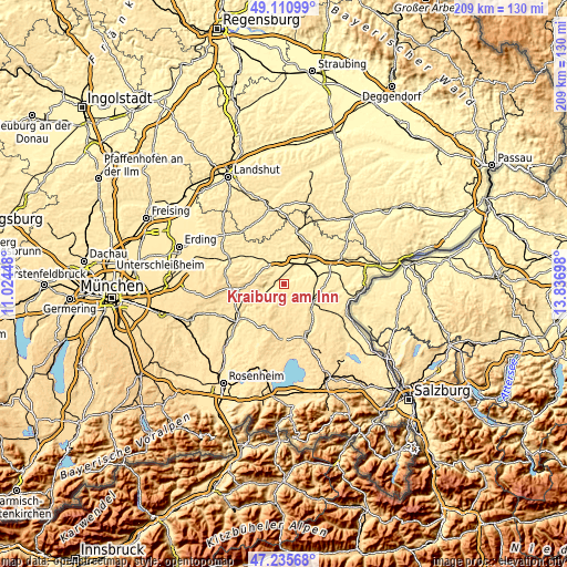
| \ | Map #1 | Map #2 | Topo.Map |
| Scale [m] | 384..538 m | 378..575 m | × |
| Scale [ft] | 1260..1765 ft | 1240..1886 ft | × |
| Average | 442.1 m = 1450 ft | 455.7 m = 1495 ft | × |
| Width | 6.52 km = 4.1 mi | 13.03 km = 8.1 mi | 208.5 km = 129.6 mi |
| Height | 6.52 km = 4.1 mi | 13.03 km = 8.1 mi | 208.5 km = 129.6 mi |
| ↑Max Latitude | 48.211203° | 48.240479° | 49.11099° |
| Latitude at center | 48.18191° | 48.18191° | 48.18191° |
| ↓Min Latitude | 48.1526° | 48.123274° | 47.23568° |
| ← Min Longitude | 12.386785° | 12.342839° | 11.02448° |
| Longitude center | 12.43073° | 12.43073° | 12.43073° |
| →Max Longitude | 12.474675° | 12.518621° | 13.83698° |
Nearby cities:
Cities around Kraiburg am Inn sort by population:
• Waldkraiburg elevation 439 m
3.8 km,  321°
321°
• Mühldorf 415 m
9.9 km,  43°
43°
• Ampfing 418 m
8.1 km,  351°
351°
• Neufahrn 417 m
8.3 km,  5°
5°
• Polling 408 m
10.8 km,  69°
69°
• Mettenheim 411 m
9.8 km,  15°
15°
• Aschau am Inn 457 m
6.3 km,  287°
287°
• Engelsberg 515 m
11.1 km,  131°
131°
• Unterreit 493 m
10.2 km,  224°
224°
• Reichertsheim 526 m
11.1 km,  280°
280°
• Taufkirchen 486 m
3.8 km,  158°
158°
• Zangberg 418 m
10.3 km,  356°
356°
Multilingual:
 En español:
Kraiburg am Inn elevación 410 m.
 En France:
Kraiburg am Inn élévation 410 m.
 Auf Deutsch:
Kraiburg am Inn höhe über dem Meeresspiegel ist 410 m.

Sources and notes:
- [note 1] Map square and city borders are not equal. Map elevation data is calculated only from area inside that square.
- [src 1] Elevation data from geonames database provided with same terms of usage.
- [src 2] The elevation map of Kraiburg am Inn is generated using elevation data from NASA's 3 arcsec (90m) resolution SRTM data.
- [src 3] Base (background) map © OpenStreetMap contributors tiles are generated by Geofabrik and OpenTopoMap.
Copyright & License:
This Kraiburg am Inn Elevation Map is licensed under CC BY-SA. You may reuse any part from this page, if you give a proper credit by linking to this URL:
 More info on terms of use page.