Kreut elevation
Kreut (Bavaria, Upper Bavaria), Germany elevation is 676 meters and Kreut elevation in feet is 2218 ft above sea level [src 1]. Kreut is a populated place (feature code) with elevation that is 418 meters (1371 ft) bigger than average city elevation in Germany.
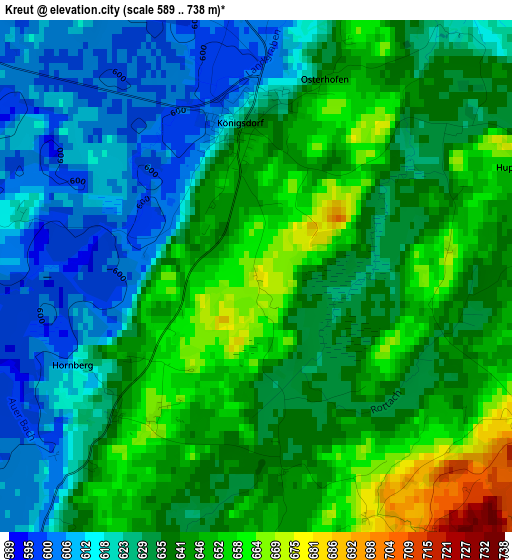
Below is the Elevation map of Kreut, which displays elevation range with different colors. Scale of the first map is from 589 to 738 m (1932 to 2421 ft) with average elevation of 635.1 meters (=2084 ft) [note 1]
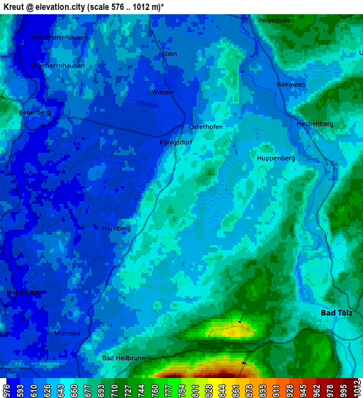
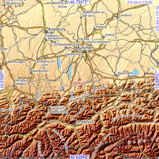
These maps also provides idea of topography and contour of this city, they are displayed at different zoom levels. More info about maps, scale and edge coordinates you can find below images.
| \ | Map #1 | Map #2 | Topo.Map |
| Scale [m] | 589..738 m | 576..1012 m | × |
| Scale [ft] | 1932..2421 ft | 1890..3320 ft | × |
| Average | 635.1 m = 2084 ft | 644.5 m = 2115 ft | × |
| Width | 6.56 km = 4.1 mi | 13.13 km = 8.2 mi | 210.1 km = 130.5 mi |
| Height | 6.56 km = 4.1 mi | 13.13 km = 8.2 mi | 210.1 km = 130.5 mi |
| ↑Max Latitude | 47.828191° | 47.857686° | 48.73473° |
| Latitude at center | 47.79868° | 47.79868° | 47.79868° |
| ↓Min Latitude | 47.769152° | 47.739607° | 46.84545° |
| ← Min Longitude | 11.439175° | 11.395229° | 10.07687° |
| Longitude center | 11.48312° | 11.48312° | 11.48312° |
| →Max Longitude | 11.527065° | 11.571011° | 12.88937° |
Nearby cities:
Cities around Kreut sort by population:
• Geretsried elevation 607 m
6.6 km,  358°
358°
• Bad Tölz 662 m
7 km,  126°
126°
• Penzberg 600 m
9.4 km,  237°
237°
• Dietramszell 688 m
10.1 km,  56°
56°
• Eurasburg 586 m
8.4 km,  316°
316°
• Bad Heilbrunn 681 m
6 km,  197°
197°
• Wackersberg 727 m
8.8 km,  145°
145°
• Benediktbeuern 639 m
11.5 km,  206°
206°
• Gaißach 731 m
9.2 km, 125°
• Königsdorf 638 m
1.9 km,  354°
354°
• Bichl 625 m
10.2 km, 211°
• Greiling 719 m
10.6 km,  109°
109°
Multilingual:
 En español:
Kreut elevación 676 m.
 En France:
Kreut élévation 676 m.


Sources and notes:
- [note 1] Map square and city borders are not equal. Map elevation data is calculated only from area inside that square.
- [src 1] Elevation data from geonames database provided with same terms of usage.
- [src 2] The elevation map of Kreut is generated using elevation data from NASA's 3 arcsec (90m) resolution SRTM data.
- [src 3] Base (background) map © OpenStreetMap contributors tiles are generated by Geofabrik and OpenTopoMap.
Copyright & License:
This Kreut Elevation Map is licensed under CC BY-SA. You may reuse any part from this page, if you give a proper credit by linking to this URL:
 More info on terms of use page.