Künzell elevation
Künzell (Hesse, Regierungsbezirk Kassel), Germany elevation is 307 meters and Künzell elevation in feet is 1007 ft above sea level [src 1]. Künzell is a seat of a fourth-order administrative division (feature code) with elevation that is 49 meters (161 ft) bigger than average city elevation in Germany.
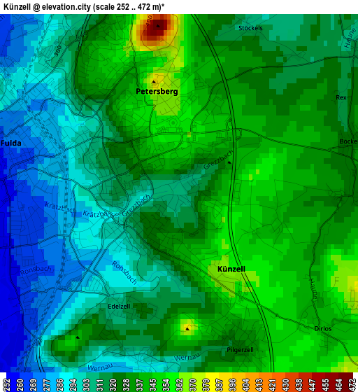
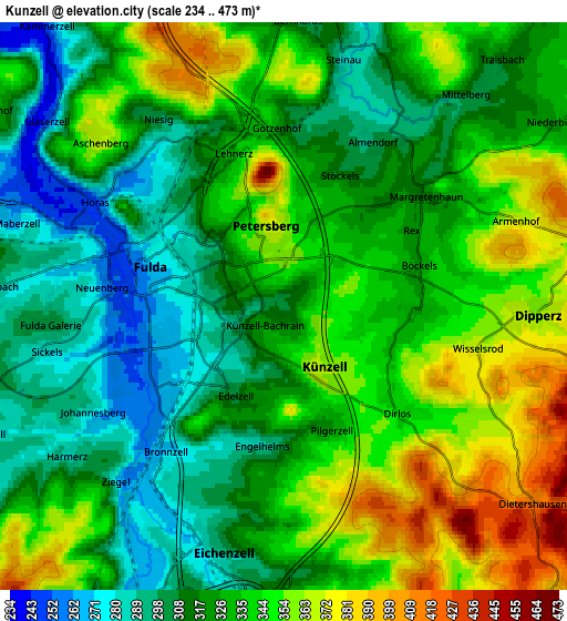
Below is the Elevation map of Künzell, which displays elevation range with different colors. Scale of the first map is from 252 to 472 m (827 to 1549 ft) with average elevation of 320.7 meters (=1052 ft) [note 1]
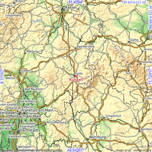
These maps also provides idea of topography and contour of this city, they are displayed at different zoom levels. More info about maps, scale and edge coordinates you can find below images.
| \ | Map #1 | Map #2 | Topo.Map |
| Scale [m] | 252..472 m | 234..473 m | × |
| Scale [ft] | 827..1549 ft | 768..1552 ft | × |
| Average | 320.7 m = 1052 ft | 329.8 m = 1082 ft | × |
| Width | 6.21 km = 3.9 mi | 12.42 km = 7.7 mi | 198.7 km = 123.5 mi |
| Height | 6.21 km = 3.9 mi | 12.42 km = 7.7 mi | 198.7 km = 123.5 mi |
| ↑Max Latitude | 50.572118° | 50.60002° | 51.4294° |
| Latitude at center | 50.5442° | 50.5442° | 50.5442° |
| ↓Min Latitude | 50.516265° | 50.488314° | 49.64207° |
| ← Min Longitude | 9.673975° | 9.630029° | 8.31167° |
| Longitude center | 9.71792° | 9.71792° | 9.71792° |
| →Max Longitude | 9.761865° | 9.805811° | 11.12417° |
Nearby cities:
Cities around Künzell sort by population:
• Fulda elevation 265 m
3.1 km,  285°
285°
• Hünfeld 277 m
15.5 km,  13°
13°
• Neuhof 275 m
12.4 km,  215°
215°
• Eichenzell 290 m
5.6 km,  195°
195°
• Flieden 299 m
17.1 km, 218°
• Großenlüder 257 m
13.5 km, 293°
• Burghaun 252 m
17 km,  1°
1°
• Hofbieber 380 m
9.5 km,  60°
60°
• Gersfeld 486 m
17.3 km,  126°
126°
• Dipperz 360 m
5.5 km,  91°
91°
• Poppenhausen 454 m
12.3 km,  120°
120°
• Motten 413 m
17 km,  166°
166°
Multilingual:
 En español:
Künzell elevación 307 m.
 En France:
Künzell élévation 307 m.


Sources and notes:
- [note 1] Map square and city borders are not equal. Map elevation data is calculated only from area inside that square.
- [src 1] Elevation data from geonames database provided with same terms of usage.
- [src 2] The elevation map of Künzell is generated using elevation data from NASA's 3 arcsec (90m) resolution SRTM data.
- [src 3] Base (background) map © OpenStreetMap contributors tiles are generated by Geofabrik and OpenTopoMap.
Copyright & License:
This Künzell Elevation Map is licensed under CC BY-SA. You may reuse any part from this page, if you give a proper credit by linking to this URL:
 More info on terms of use page.