Kupferzell elevation
Kupferzell (Baden-Württemberg, Regierungsbezirk Stuttgart), Germany elevation is 333 meters and Kupferzell elevation in feet is 1093 ft above sea level [src 1]. Kupferzell is a seat of a fourth-order administrative division (feature code) with elevation that is 75 meters (246 ft) bigger than average city elevation in Germany.
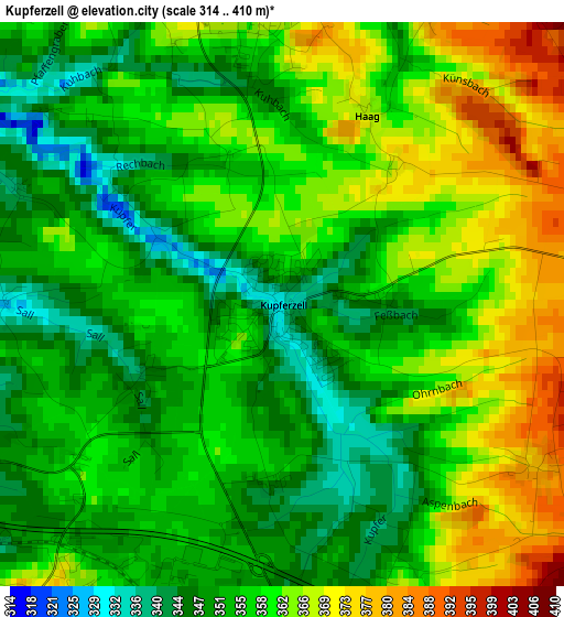
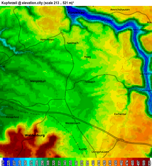
Below is the Elevation map of Kupferzell, which displays elevation range with different colors. Scale of the first map is from 314 to 410 m (1030 to 1345 ft) with average elevation of 357.3 meters (=1172 ft) [note 1]
These maps also provides idea of topography and contour of this city, they are displayed at different zoom levels. More info about maps, scale and edge coordinates you can find below images.
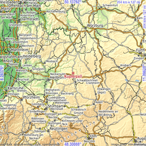
| \ | Map #1 | Map #2 | Topo.Map |
| Scale [m] | 314..410 m | 213..521 m | × |
| Scale [ft] | 1030..1345 ft | 699..1709 ft | × |
| Average | 357.3 m = 1172 ft | 369 m = 1211 ft | × |
| Width | 6.38 km = 4 mi | 12.76 km = 7.9 mi | 204.2 km = 126.9 mi |
| Height | 6.38 km = 4 mi | 12.76 km = 7.9 mi | 204.2 km = 126.9 mi |
| ↑Max Latitude | 49.25647° | 49.285144° | 50.13762° |
| Latitude at center | 49.22778° | 49.22778° | 49.22778° |
| ↓Min Latitude | 49.199073° | 49.170349° | 48.30088° |
| ← Min Longitude | 9.646055° | 9.602109° | 8.28375° |
| Longitude center | 9.69° | 9.69° | 9.69° |
| →Max Longitude | 9.733945° | 9.777891° | 11.09625° |
Nearby cities:
Cities around Kupferzell sort by population:
• Künzelsau elevation 220 m
6 km,  355°
355°
• Neuenstein 286 m
8.4 km,  252°
252°
• Ingelfingen 213 m
8.5 km,  341°
341°
• Forchtenberg 197 m
11.6 km,  305°
305°
• Niedernhall 208 m
9.2 km,  324°
324°
• Waldenburg 503 m
6 km,  217°
217°
• Untermünkheim 265 m
9 km,  159°
159°
• Braunsbach 248 m
8 km,  113°
113°
• Weißbach 205 m
10.3 km, 318°
• Wolpertshausen 443 m
13.1 km,  120°
120°
• Langenburg 464 m
12.4 km,  76°
76°
• Zweiflingen 325 m
12.9 km,  284°
284°
Multilingual:
 En español:
Kupferzell elevación 333 m.
 En France:
Kupferzell élévation 333 m.
 Auf Deutsch:
Kupferzell höhe über dem Meeresspiegel ist 333 m.

Sources and notes:
- [note 1] Map square and city borders are not equal. Map elevation data is calculated only from area inside that square.
- [src 1] Elevation data from geonames database provided with same terms of usage.
- [src 2] The elevation map of Kupferzell is generated using elevation data from NASA's 3 arcsec (90m) resolution SRTM data.
- [src 3] Base (background) map © OpenStreetMap contributors tiles are generated by Geofabrik and OpenTopoMap.
Copyright & License:
This Kupferzell Elevation Map is licensed under CC BY-SA. You may reuse any part from this page, if you give a proper credit by linking to this URL:
 More info on terms of use page.