Lachendorf elevation
Lachendorf (Lower Saxony), Germany elevation is 47 meters and Lachendorf elevation in feet is 154 ft above sea level [src 1]. Lachendorf is a seat of a fourth-order administrative division (feature code) with elevation that is 211 meters (692 ft) smaller than average city elevation in Germany.
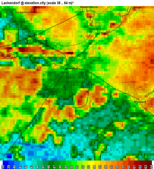
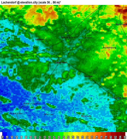
Below is the Elevation map of Lachendorf, which displays elevation range with different colors. Scale of the first map is from 38 to 64 m (125 to 210 ft) with average elevation of 50.3 meters (=165 ft) [note 1]
These maps also provides idea of topography and contour of this city, they are displayed at different zoom levels. More info about maps, scale and edge coordinates you can find below images.
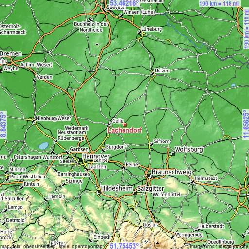
| \ | Map #1 | Map #2 | Topo.Map |
| Scale [m] | 38..64 m | 36..86 m | × |
| Scale [ft] | 125..210 ft | 118..282 ft | × |
| Average | 50.3 m = 165 ft | 51.8 m = 170 ft | × |
| Width | 5.93 km = 3.7 mi | 11.87 km = 7.4 mi | 189.9 km = 118 mi |
| Height | 5.93 km = 3.7 mi | 11.87 km = 7.4 mi | 189.9 km = 118 mi |
| ↑Max Latitude | 52.643343° | 52.67° | 53.46216° |
| Latitude at center | 52.61667° | 52.61667° | 52.61667° |
| ↓Min Latitude | 52.589981° | 52.563275° | 51.75453° |
| ← Min Longitude | 10.206055° | 10.162109° | 8.84375° |
| Longitude center | 10.25° | 10.25° | 10.25° |
| →Max Longitude | 10.293945° | 10.337891° | 11.65625° |
Nearby cities:
Cities around Lachendorf sort by population:
• Celle elevation 45 m
11.5 km,  273°
273°
• Wathlingen 44 m
11.1 km,  217°
217°
• Müden 48 m
12.4 km,  143°
143°
• Wienhausen 44 m
5.8 km,  225°
225°
• Eschede 76 m
13.2 km,  355°
355°
• Eicklingen 43 m
8.6 km,  211°
211°
• Eldingen 65 m
9.3 km,  37°
37°
• Langlingen 47 m
7.1 km,  161°
161°
• Ahnsbeck 54 m
2.5 km,  105°
105°
• Ummern 61 m
12.6 km,  103°
103°
• Steinhorst 76 m
12.5 km,  53°
53°
• Beedenbostel 53 m
3 km,  11°
11°
Multilingual:
 En español:
Lachendorf elevación 47 m.
 En France:
Lachendorf élévation 47 m.
 Auf Deutsch:
Lachendorf höhe über dem Meeresspiegel ist 47 m.

Sources and notes:
- [note 1] Map square and city borders are not equal. Map elevation data is calculated only from area inside that square.
- [src 1] Elevation data from geonames database provided with same terms of usage.
- [src 2] The elevation map of Lachendorf is generated using elevation data from NASA's 3 arcsec (90m) resolution SRTM data.
- [src 3] Base (background) map © OpenStreetMap contributors tiles are generated by Geofabrik and OpenTopoMap.
Copyright & License:
This Lachendorf Elevation Map is licensed under CC BY-SA. You may reuse any part from this page, if you give a proper credit by linking to this URL:
 More info on terms of use page.