Landsberg elevation
Landsberg (Saxony-Anhalt), Germany elevation is 118 meters and Landsberg elevation in feet is 387 ft above sea level [src 1]. Landsberg is a populated place (feature code) with elevation that is 140 meters (459 ft) smaller than average city elevation in Germany.
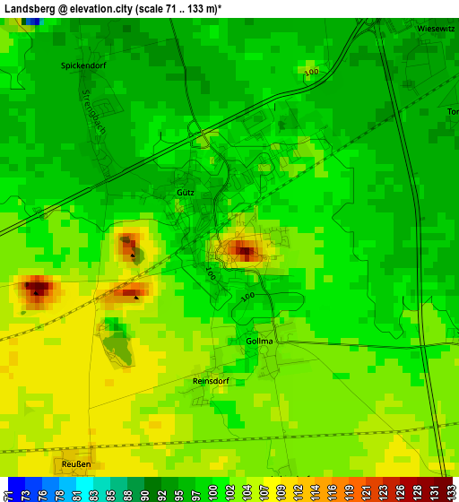
Below is the Elevation map of Landsberg, which displays elevation range with different colors. Scale of the first map is from 71 to 133 m (233 to 436 ft) with average elevation of 101.1 meters (=332 ft) [note 1]
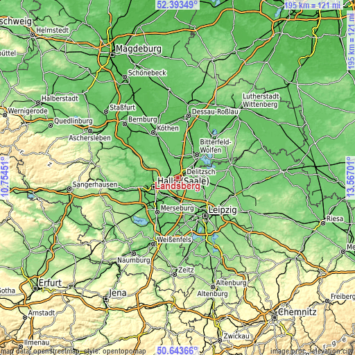
These maps also provides idea of topography and contour of this city, they are displayed at different zoom levels. More info about maps, scale and edge coordinates you can find below images.
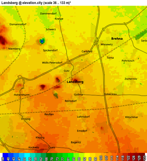
| \ | Map #1 | Map #2 | Topo.Map |
| Scale [m] | 71..133 m | 36..133 m | × |
| Scale [ft] | 233..436 ft | 118..436 ft | × |
| Average | 101.1 m = 332 ft | 99.9 m = 328 ft | × |
| Width | 6.08 km = 3.8 mi | 12.16 km = 7.6 mi | 194.6 km = 120.9 mi |
| Height | 6.08 km = 3.8 mi | 12.16 km = 7.6 mi | 194.5 km = 120.9 mi |
| ↑Max Latitude | 51.554312° | 51.581628° | 52.39349° |
| Latitude at center | 51.52698° | 51.52698° | 51.52698° |
| ↓Min Latitude | 51.499631° | 51.472266° | 50.64366° |
| ← Min Longitude | 12.116815° | 12.072869° | 10.75451° |
| Longitude center | 12.16076° | 12.16076° | 12.16076° |
| →Max Longitude | 12.204705° | 12.248651° | 13.56701° |
Nearby cities:
Cities around Landsberg sort by population:
• Brehna elevation 95 m
5 km,  46°
46°
• Roitzsch 90 m
8.9 km, 52°
• Hohenthurm 104 m
4.5 km,  257°
257°
• Wiedemar 109 m
7.2 km,  157°
157°
• Oppin 117 m
9.3 km,  287°
287°
• Queis 113 m
5.9 km,  197°
197°
• Niemberg 98 m
5.5 km,  298°
298°
• Braschwitz 100 m
7.1 km,  266°
266°
• Dölbau 95 m
9.8 km,  227°
227°
• Zwochau 112 m
10.2 km,  132°
132°
• Peißen 101 m
7.6 km,  249°
249°
• Reußen 110 m
3.6 km,  216°
216°
Multilingual:
 En español:
Landsberg elevación 118 m.
 En France:
Landsberg élévation 118 m.
 Auf Deutsch:
Landsberg höhe über dem Meeresspiegel ist 118 m.

Sources and notes:
- [note 1] Map square and city borders are not equal. Map elevation data is calculated only from area inside that square.
- [src 1] Elevation data from geonames database provided with same terms of usage.
- [src 2] The elevation map of Landsberg is generated using elevation data from NASA's 3 arcsec (90m) resolution SRTM data.
- [src 3] Base (background) map © OpenStreetMap contributors tiles are generated by Geofabrik and OpenTopoMap.
Copyright & License:
This Landsberg Elevation Map is licensed under CC BY-SA. You may reuse any part from this page, if you give a proper credit by linking to this URL:
 More info on terms of use page.