Landshut elevation
Landshut (Bavaria, Lower Bavaria), Germany elevation is 488 meters and Landshut elevation in feet is 1601 ft above sea level [src 1]. Landshut is a seat of a second-order administrative division (feature code) with elevation that is 230 meters (755 ft) bigger than average city elevation in Germany.
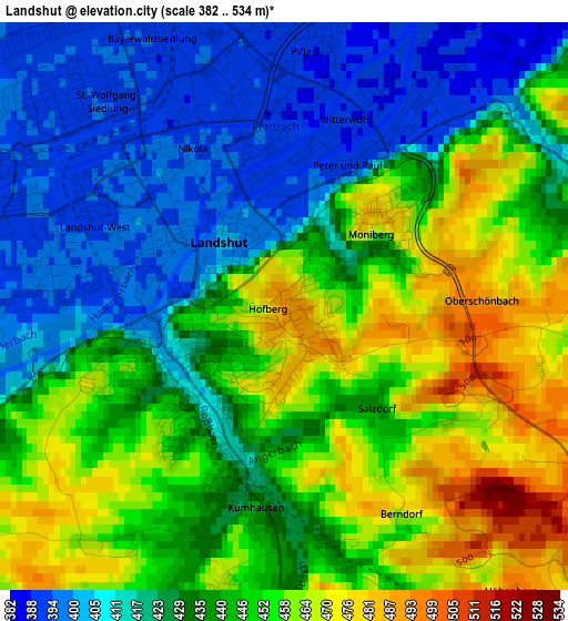
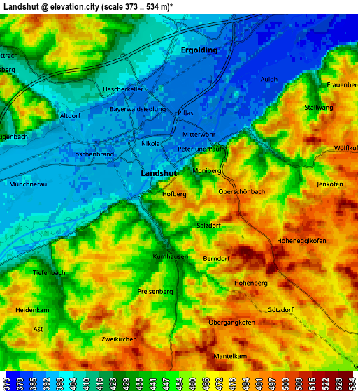
Below is the Elevation map of Landshut, which displays elevation range with different colors. Scale of the first map is from 382 to 534 m (1253 to 1752 ft) with average elevation of 437.2 meters (=1434 ft) [note 1]
These maps also provides idea of topography and contour of this city, they are displayed at different zoom levels. More info about maps, scale and edge coordinates you can find below images.
| \ | Map #1 | Map #2 | Topo.Map |
| Scale [m] | 382..534 m | 373..534 m | × |
| Scale [ft] | 1253..1752 ft | 1224..1752 ft | × |
| Average | 437.2 m = 1434 ft | 443.7 m = 1456 ft | × |
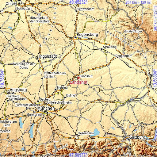
| Width | 6.47 km = 4 mi | 12.94 km = 8 mi | 207.1 km = 128.7 mi |
| Height | 6.47 km = 4 mi | 12.94 km = 8 mi | 207.1 km = 128.7 mi |
| ↑Max Latitude | 48.558704° | 48.587781° | 49.45232° |
| Latitude at center | 48.52961° | 48.52961° | 48.52961° |
| ↓Min Latitude | 48.5005° | 48.471372° | 47.58977° |
| ← Min Longitude | 12.117845° | 12.073899° | 10.75554° |
| Longitude center | 12.16179° | 12.16179° | 12.16179° |
| →Max Longitude | 12.205735° | 12.249681° | 13.56804° |
Nearby cities:
Cities around Landshut sort by population:
• Ergolding elevation 394 m
5.3 km,  7°
7°
• Essenbach 391 m
10.2 km,  24°
24°
• Geisenhausen 461 m
9.3 km,  129°
129°
• Kumhausen 434 m
2.3 km,  190°
190°
• Adlkofen 498 m
8 km,  73°
73°
• Eging 478 m
7.7 km,  164°
164°
• Eching 427 m
7.7 km,  244°
244°
• Tiefenbach 430 m
5.6 km,  234°
234°
• Weihmichl 435 m
11.4 km,  313°
313°
• Vilsheim 473 m
9.9 km,  204°
204°
• Altfraunhofen 460 m
8.9 km,  177°
177°
• Stallwang 427 m
6 km,  57°
57°
Multilingual:
 En español:
Landshut elevación 488 m.
 En France:
Landshut élévation 488 m.
 Auf Deutsch:
Landshut höhe über dem Meeresspiegel ist 488 m.

Sources and notes:
- [note 1] Map square and city borders are not equal. Map elevation data is calculated only from area inside that square.
- [src 1] Elevation data from geonames database provided with same terms of usage.
- [src 2] The elevation map of Landshut is generated using elevation data from NASA's 3 arcsec (90m) resolution SRTM data.
- [src 3] Base (background) map © OpenStreetMap contributors tiles are generated by Geofabrik and OpenTopoMap.
Copyright & License:
This Landshut Elevation Map is licensed under CC BY-SA. You may reuse any part from this page, if you give a proper credit by linking to this URL:
 More info on terms of use page.