Langenlonsheim elevation
Langenlonsheim (Rheinland-Pfalz), Germany elevation is 93 meters and Langenlonsheim elevation in feet is 305 ft above sea level [src 1]. Langenlonsheim is a seat of a fourth-order administrative division (feature code) with elevation that is 165 meters (541 ft) smaller than average city elevation in Germany.
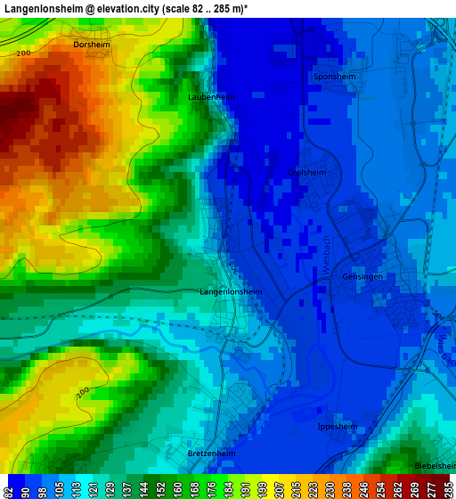
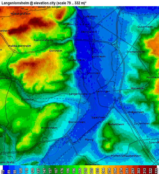
Below is the Elevation map of Langenlonsheim, which displays elevation range with different colors. Scale of the first map is from 82 to 285 m (269 to 935 ft) with average elevation of 136 meters (=446 ft) [note 1]
These maps also provides idea of topography and contour of this city, they are displayed at different zoom levels. More info about maps, scale and edge coordinates you can find below images.
| \ | Map #1 | Map #2 | Topo.Map |
| Scale [m] | 82..285 m | 79..332 m | × |
| Scale [ft] | 269..935 ft | 259..1089 ft | × |
| Average | 136 m = 446 ft | 154.2 m = 506 ft | × |
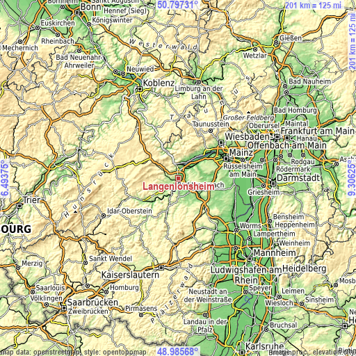
| Width | 6.29 km = 3.9 mi | 12.59 km = 7.8 mi | 201.4 km = 125.1 mi |
| Height | 6.29 km = 3.9 mi | 12.59 km = 7.8 mi | 201.4 km = 125.1 mi |
| ↑Max Latitude | 49.928298° | 49.956579° | 50.79731° |
| Latitude at center | 49.9° | 49.9° | 49.9° |
| ↓Min Latitude | 49.871685° | 49.843354° | 48.98568° |
| ← Min Longitude | 7.856055° | 7.812109° | 6.49375° |
| Longitude center | 7.9° | 7.9° | 7.9° |
| →Max Longitude | 7.943945° | 7.987891° | 9.30625° |
Nearby cities:
Cities around Langenlonsheim sort by population:
• Bad Kreuznach elevation 109 m
6.9 km,  199°
199°
• Sprendlingen 111 m
7 km,  121°
121°
• Gensingen 105 m
2.4 km,  90°
90°
• Hargesheim 192 m
6.6 km,  230°
230°
• Münster-Sarmsheim 112 m
4.8 km,  355°
355°
• Weiler 256 m
6.8 km,  338°
338°
• Bretzenheim 112 m
2.5 km,  185°
185°
• Ockenheim 117 m
7 km,  46°
46°
• Windesheim 184 m
6 km,  270°
270°
• Rümmelsheim 186 m
4.7 km,  321°
321°
• Pfaffen-Schwabenheim 114 m
6.6 km,  147°
147°
• Grolsheim 92 m
1.5 km, 50°
Multilingual:
 En español:
Langenlonsheim elevación 93 m.
 En France:
Langenlonsheim élévation 93 m.
 Auf Deutsch:
Langenlonsheim höhe über dem Meeresspiegel ist 93 m.

Sources and notes:
- [note 1] Map square and city borders are not equal. Map elevation data is calculated only from area inside that square.
- [src 1] Elevation data from geonames database provided with same terms of usage.
- [src 2] The elevation map of Langenlonsheim is generated using elevation data from NASA's 3 arcsec (90m) resolution SRTM data.
- [src 3] Base (background) map © OpenStreetMap contributors tiles are generated by Geofabrik and OpenTopoMap.
Copyright & License:
This Langenlonsheim Elevation Map is licensed under CC BY-SA. You may reuse any part from this page, if you give a proper credit by linking to this URL:
 More info on terms of use page.