Lautenbach elevation
Lautenbach (Baden-Württemberg, Freiburg Region), Germany elevation is 301 meters and Lautenbach elevation in feet is 988 ft above sea level [src 1]. Lautenbach is a populated locality (feature code) with elevation that is 43 meters (141 ft) bigger than average city elevation in Germany.
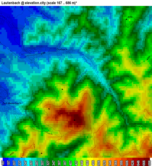
Below is the Elevation map of Lautenbach, which displays elevation range with different colors. Scale of the first map is from 167 to 686 m (548 to 2251 ft) with average elevation of 355.3 meters (=1166 ft) [note 1]
These maps also provides idea of topography and contour of this city, they are displayed at different zoom levels. More info about maps, scale and edge coordinates you can find below images.
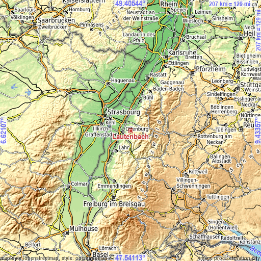
| \ | Map #1 | Topo.Map |
| Scale [m] | 167..686 m | × |
| Scale [ft] | 548..2251 ft | × |
| Average | 355.3 m = 1166 ft | × |
| Width | 6.48 km = 4 mi | 207.3 km = 128.8 mi |
| Height | 6.48 km = 4 mi | 207.3 km = 128.8 mi |
| ↑Max Latitude | 48.510971° | 49.40544° |
| Latitude at center | 48.48185° | 48.48185° |
| ↓Min Latitude | 48.452712° | 47.54113° |
| ← Min Longitude | 7.983375° | 6.62107° |
| Longitude center | 8.02732° | 8.02732° |
| →Max Longitude | 8.071265° | 9.43357° |
Nearby cities:
Cities around Lautenbach sort by population:
• Offenburg elevation 163 m
6.1 km,  261°
261°
• Oberkirch 193 m
6.8 km,  33°
33°
• Gengenbach 182 m
8.6 km,  186°
186°
• Willstätt 145 m
11.9 km,  303°
303°
• Schutterwald 150 m
11.2 km,  251°
251°
• Haslach 178 m
9.5 km,  13°
13°
• Oppenau 271 m
9.8 km,  95°
95°
• Durbach 214 m
1.5 km,  330°
330°
• Ortenberg 166 m
5.3 km,  230°
230°
• Ohlsbach 174 m
6 km,  204°
204°
• Berghaupten 176 m
8.9 km, 199°
• Nordrach 317 m
10 km,  155°
155°
Multilingual:
 En español:
Lautenbach elevación 301 m.
 En France:
Lautenbach élévation 301 m.
 Auf Deutsch:
Lautenbach höhe über dem Meeresspiegel ist 301 m.

Sources and notes:
- [note 1] Map square and city borders are not equal. Map elevation data is calculated only from area inside that square.
- [src 1] Elevation data from geonames database provided with same terms of usage.
- [src 2] The elevation map of Lautenbach is generated using elevation data from NASA's 3 arcsec (90m) resolution SRTM data.
- [src 3] Base (background) map © OpenStreetMap contributors tiles are generated by Geofabrik and OpenTopoMap.
Copyright & License:
This Lautenbach Elevation Map is licensed under CC BY-SA. You may reuse any part from this page, if you give a proper credit by linking to this URL:
 More info on terms of use page.