Lunzenau elevation
Lunzenau (Saxony), Germany elevation is 182 meters and Lunzenau elevation in feet is 597 ft above sea level [src 1]. Lunzenau is a populated place (feature code) with elevation that is 76 meters (249 ft) smaller than average city elevation in Germany.
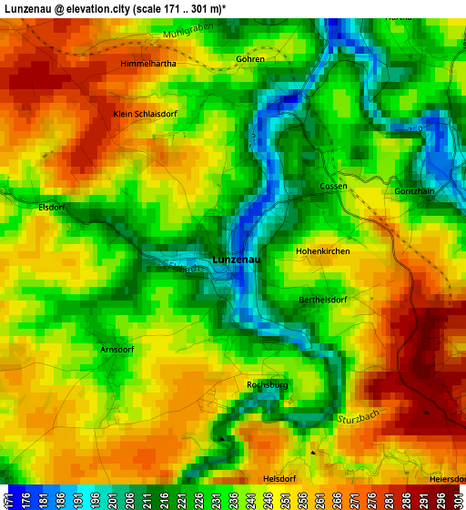
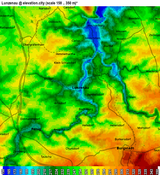
Below is the Elevation map of Lunzenau, which displays elevation range with different colors. Scale of the first map is from 171 to 301 m (561 to 988 ft) with average elevation of 241.4 meters (=792 ft) [note 1]
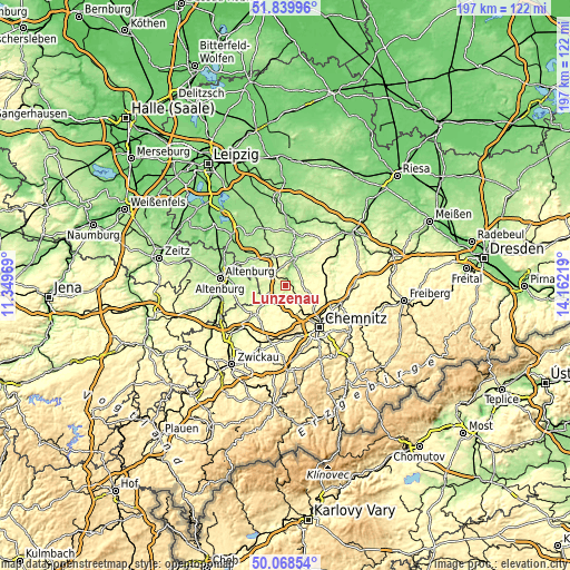
These maps also provides idea of topography and contour of this city, they are displayed at different zoom levels. More info about maps, scale and edge coordinates you can find below images.
| \ | Map #1 | Map #2 | Topo.Map |
| Scale [m] | 171..301 m | 158..350 m | × |
| Scale [ft] | 561..988 ft | 518..1148 ft | × |
| Average | 241.4 m = 792 ft | 254.6 m = 835 ft | × |
| Width | 6.15 km = 3.8 mi | 12.31 km = 7.6 mi | 197 km = 122.4 mi |
| Height | 6.16 km = 3.8 mi | 12.31 km = 7.6 mi | 196.9 km = 122.3 mi |
| ↑Max Latitude | 50.99036° | 51.018013° | 51.83996° |
| Latitude at center | 50.96269° | 50.96269° | 50.96269° |
| ↓Min Latitude | 50.935004° | 50.907301° | 50.06854° |
| ← Min Longitude | 12.711995° | 12.668049° | 11.34969° |
| Longitude center | 12.75594° | 12.75594° | 12.75594° |
| →Max Longitude | 12.799885° | 12.843831° | 14.16219° |
Nearby cities:
Cities around Lunzenau sort by population:
• Burgstädt elevation 323 m
6.5 km,  147°
147°
• Penig 207 m
4.9 km,  228°
228°
• Rochlitz 167 m
10.1 km,  16°
16°
• Geithain 229 m
11.1 km,  338°
338°
• Hartmannsdorf 304 m
7.6 km,  156°
156°
• Claußnitz 287 m
9.5 km,  110°
110°
• Taura 298 m
8.3 km,  127°
127°
• Niederfrohna 283 m
7.5 km,  201°
201°
• Mühlau 336 m
7 km,  173°
173°
• Wechselburg 184 m
4.6 km, 18°
• Seelitz 228 m
8.9 km,  28°
28°
• Narsdorf 259 m
6.6 km, 335°
Multilingual:
 En español:
Lunzenau elevación 182 m.
 En France:
Lunzenau élévation 182 m.
 Auf Deutsch:
Lunzenau höhe über dem Meeresspiegel ist 182 m.

Sources and notes:
- [note 1] Map square and city borders are not equal. Map elevation data is calculated only from area inside that square.
- [src 1] Elevation data from geonames database provided with same terms of usage.
- [src 2] The elevation map of Lunzenau is generated using elevation data from NASA's 3 arcsec (90m) resolution SRTM data.
- [src 3] Base (background) map © OpenStreetMap contributors tiles are generated by Geofabrik and OpenTopoMap.
Copyright & License:
This Lunzenau Elevation Map is licensed under CC BY-SA. You may reuse any part from this page, if you give a proper credit by linking to this URL:
 More info on terms of use page.