Mehlbach elevation
Mehlbach (Rheinland-Pfalz), Germany elevation is 290 meters and Mehlbach elevation in feet is 951 ft above sea level [src 1]. Mehlbach is a seat of a fourth-order administrative division (feature code) with elevation that is 32 meters (105 ft) bigger than average city elevation in Germany.
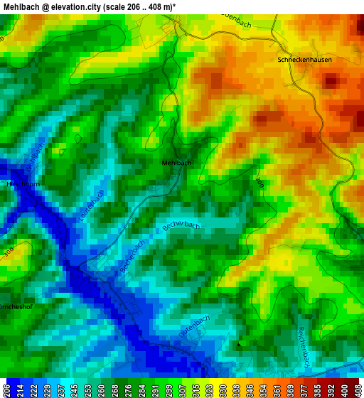
Below is the Elevation map of Mehlbach, which displays elevation range with different colors. Scale of the first map is from 206 to 408 m (676 to 1339 ft) with average elevation of 287.2 meters (=942 ft) [note 1]
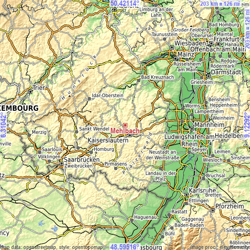
These maps also provides idea of topography and contour of this city, they are displayed at different zoom levels. More info about maps, scale and edge coordinates you can find below images.
| \ | Map #1 | Topo.Map |
| Scale [m] | 206..408 m | × |
| Scale [ft] | 676..1339 ft | × |
| Average | 287.2 m = 942 ft | × |
| Width | 6.34 km = 3.9 mi | 203 km = 126.1 mi |
| Height | 6.34 km = 3.9 mi | 203 km = 126.1 mi |
| ↑Max Latitude | 49.545192° | 50.42114° |
| Latitude at center | 49.51667° | 49.51667° |
| ↓Min Latitude | 49.488131° | 48.59516° |
| ← Min Longitude | 7.672725° | 6.31042° |
| Longitude center | 7.71667° | 7.71667° |
| →Max Longitude | 7.760615° | 9.12292° |
Nearby cities:
Cities around Mehlbach sort by population:
• Kaiserslautern elevation 240 m
9.1 km,  154°
154°
• Otterberg 263 m
4.1 km,  111°
111°
• Winnweiler 268 m
11.1 km,  59°
59°
• Weilerbach 231 m
7.1 km,  238°
238°
• Otterbach 222 m
3.7 km,  159°
159°
• Mehlingen 309 m
10.4 km, 105°
• Niederkirchen 341 m
7.5 km,  350°
350°
• Wolfstein 201 m
11 km,  312°
312°
• Katzweiler 215 m
2.2 km,  212°
212°
• Sembach 314 m
10.8 km,  92°
92°
• Olsbrücken 213 m
4.9 km,  300°
300°
• Schwedelbach 253 m
9.2 km,  255°
255°
Multilingual:
 En español:
Mehlbach elevación 290 m.
 En France:
Mehlbach élévation 290 m.
 Auf Deutsch:
Mehlbach höhe über dem Meeresspiegel ist 290 m.

Sources and notes:
- [note 1] Map square and city borders are not equal. Map elevation data is calculated only from area inside that square.
- [src 1] Elevation data from geonames database provided with same terms of usage.
- [src 2] The elevation map of Mehlbach is generated using elevation data from NASA's 3 arcsec (90m) resolution SRTM data.
- [src 3] Base (background) map © OpenStreetMap contributors tiles are generated by Geofabrik and OpenTopoMap.
Copyright & License:
This Mehlbach Elevation Map is licensed under CC BY-SA. You may reuse any part from this page, if you give a proper credit by linking to this URL:
 More info on terms of use page.