Michendorf elevation
Michendorf (Brandenburg), Germany elevation is 47 meters and Michendorf elevation in feet is 154 ft above sea level [src 1]. Michendorf is a seat of a fourth-order administrative division (feature code) with elevation that is 211 meters (692 ft) smaller than average city elevation in Germany.
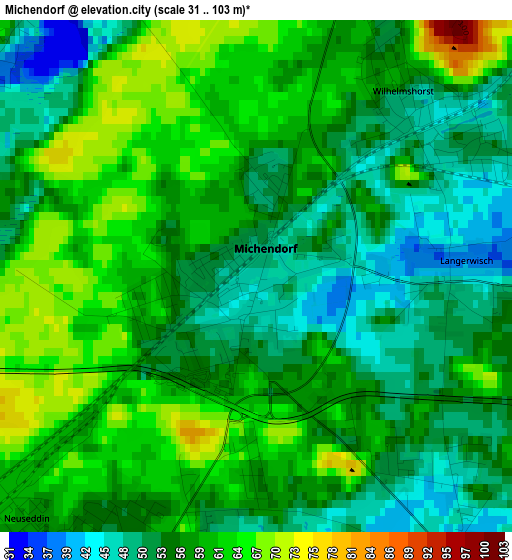
Below is the Elevation map of Michendorf, which displays elevation range with different colors. Scale of the first map is from 31 to 103 m (102 to 338 ft) with average elevation of 56.8 meters (=186 ft) [note 1]
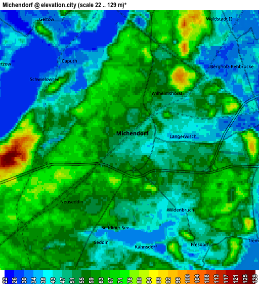
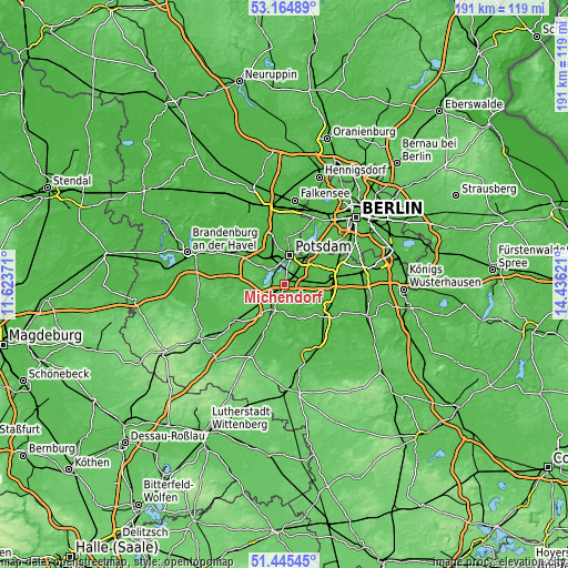
These maps also provides idea of topography and contour of this city, they are displayed at different zoom levels. More info about maps, scale and edge coordinates you can find below images.
| \ | Map #1 | Map #2 | Topo.Map |
| Scale [m] | 31..103 m | 22..129 m | × |
| Scale [ft] | 102..338 ft | 72..423 ft | × |
| Average | 56.8 m = 186 ft | 53.1 m = 174 ft | × |
| Width | 5.97 km = 3.7 mi | 11.95 km = 7.4 mi | 191.2 km = 118.8 mi |
| Height | 5.97 km = 3.7 mi | 11.95 km = 7.4 mi | 191.2 km = 118.8 mi |
| ↑Max Latitude | 52.340377° | 52.367218° | 53.16489° |
| Latitude at center | 52.31352° | 52.31352° | 52.31352° |
| ↓Min Latitude | 52.286646° | 52.259756° | 51.44545° |
| ← Min Longitude | 12.986015° | 12.942069° | 11.62371° |
| Longitude center | 13.02996° | 13.02996° | 13.02996° |
| →Max Longitude | 13.073905° | 13.117851° | 14.43621° |
Nearby cities:
Cities around Michendorf sort by population:
• Potsdam elevation 34 m
9.8 km,  14°
14°
• Ludwigsfelde 47 m
15.3 km,  94°
94°
• Werder 33 m
9.8 km,  318°
318°
• Kleinmachnow 47 m
16.9 km,  51°
51°
• Kladow 50 m
17.5 km,  26°
26°
• Stahnsdorf 43 m
14.9 km,  58°
58°
• Beelitz 40 m
9.3 km,  205°
205°
• Wannsee 40 m
14.5 km,  35°
35°
• Trebbin 41 m
17.1 km,  129°
129°
• Fichtenwalde 75 m
10.6 km,  249°
249°
• Borkheide 69 m
16.3 km,  228°
228°
• Borkwalde 67 m
15.1 km,  242°
242°
Multilingual:
 En español:
Michendorf elevación 47 m.
 En France:
Michendorf élévation 47 m.
 Auf Deutsch:
Michendorf höhe über dem Meeresspiegel ist 47 m.

Sources and notes:
- [note 1] Map square and city borders are not equal. Map elevation data is calculated only from area inside that square.
- [src 1] Elevation data from geonames database provided with same terms of usage.
- [src 2] The elevation map of Michendorf is generated using elevation data from NASA's 3 arcsec (90m) resolution SRTM data.
- [src 3] Base (background) map © OpenStreetMap contributors tiles are generated by Geofabrik and OpenTopoMap.
Copyright & License:
This Michendorf Elevation Map is licensed under CC BY-SA. You may reuse any part from this page, if you give a proper credit by linking to this URL:
 More info on terms of use page.