Nattheim elevation
Nattheim (Baden-Württemberg, Regierungsbezirk Stuttgart), Germany elevation is 561 meters and Nattheim elevation in feet is 1841 ft above sea level [src 1]. Nattheim is a seat of a fourth-order administrative division (feature code) with elevation that is 303 meters (994 ft) bigger than average city elevation in Germany.
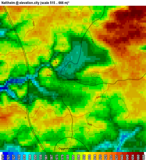
Below is the Elevation map of Nattheim, which displays elevation range with different colors. Scale of the first map is from 515 to 666 m (1690 to 2185 ft) with average elevation of 594.8 meters (=1951 ft) [note 1]
These maps also provides idea of topography and contour of this city, they are displayed at different zoom levels. More info about maps, scale and edge coordinates you can find below images.
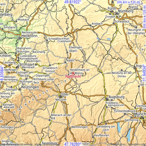
| \ | Map #1 | Map #2 | Topo.Map |
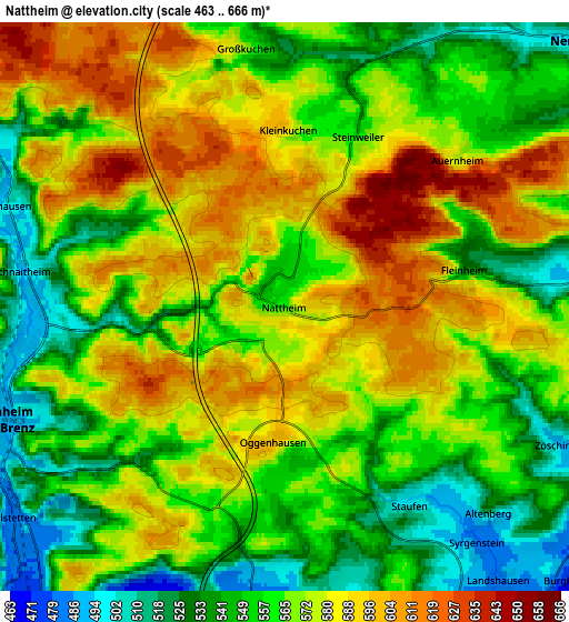
| Scale [m] | 515..666 m | 463..666 m | × |
| Scale [ft] | 1690..2185 ft | 1519..2185 ft | × |
| Average | 594.8 m = 1951 ft | 566.8 m = 1860 ft | × |
| Width | 6.45 km = 4 mi | 12.9 km = 8 mi | 206.4 km = 128.3 mi |
| Height | 6.45 km = 4 mi | 12.9 km = 8 mi | 206.4 km = 128.3 mi |
| ↑Max Latitude | 48.728626° | 48.757605° | 49.61922° |
| Latitude at center | 48.69963° | 48.69963° | 48.69963° |
| ↓Min Latitude | 48.670617° | 48.641588° | 47.76293° |
| ← Min Longitude | 10.198145° | 10.154199° | 8.83584° |
| Longitude center | 10.24209° | 10.24209° | 10.24209° |
| →Max Longitude | 10.286035° | 10.329981° | 11.64834° |
Nearby cities:
Cities around Nattheim sort by population:
• Heidenheim an der Brenz elevation 494 m
7.1 km,  250°
250°
• Giengen an der Brenz 473 m
8.6 km,  179°
179°
• Herbrechtingen 469 m
9.9 km,  209°
209°
• Steinheim am Albuch 534 m
13.1 km,  265°
265°
• Oberkochen 495 m
13.7 km,  312°
312°
• Neresheim 502 m
8.9 km,  46°
46°
• Königsbronn 503 m
10.7 km,  296°
296°
• Dischingen 469 m
9.1 km,  89°
89°
• Bolheim 483 m
10.2 km,  221°
221°
• Bachhagel 470 m
9.5 km,  142°
142°
• Hermaringen 452 m
11.7 km,  173°
173°
• Ziertheim 462 m
12.6 km,  114°
114°
Multilingual:
 En español:
Nattheim elevación 561 m.
 En France:
Nattheim élévation 561 m.
 Auf Deutsch:
Nattheim höhe über dem Meeresspiegel ist 561 m.

Sources and notes:
- [note 1] Map square and city borders are not equal. Map elevation data is calculated only from area inside that square.
- [src 1] Elevation data from geonames database provided with same terms of usage.
- [src 2] The elevation map of Nattheim is generated using elevation data from NASA's 3 arcsec (90m) resolution SRTM data.
- [src 3] Base (background) map © OpenStreetMap contributors tiles are generated by Geofabrik and OpenTopoMap.
Copyright & License:
This Nattheim Elevation Map is licensed under CC BY-SA. You may reuse any part from this page, if you give a proper credit by linking to this URL:
 More info on terms of use page.