Neubeuern elevation
Neubeuern (Bavaria, Upper Bavaria), Germany elevation is 474 meters and Neubeuern elevation in feet is 1555 ft above sea level [src 1]. Neubeuern is a populated place (feature code) with elevation that is 216 meters (709 ft) bigger than average city elevation in Germany.
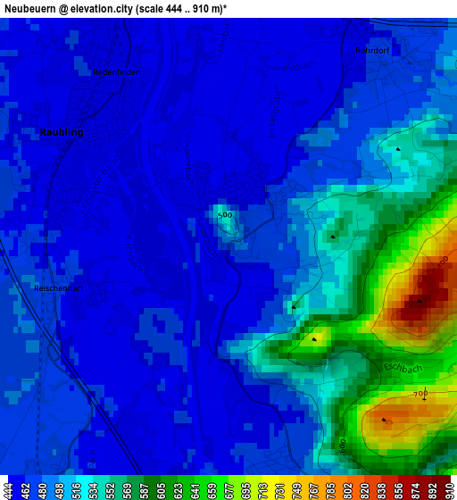
Below is the Elevation map of Neubeuern, which displays elevation range with different colors. Scale of the first map is from 444 to 910 m (1457 to 2986 ft) with average elevation of 502.1 meters (=1647 ft) [note 1]
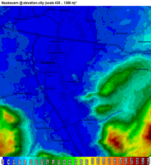
These maps also provides idea of topography and contour of this city, they are displayed at different zoom levels. More info about maps, scale and edge coordinates you can find below images.
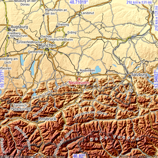
| \ | Map #1 | Map #2 | Topo.Map |
| Scale [m] | 444..910 m | 438..1386 m | × |
| Scale [ft] | 1457..2986 ft | 1437..4547 ft | × |
| Average | 502.1 m = 1647 ft | 570.4 m = 1871 ft | × |
| Width | 6.57 km = 4.1 mi | 13.14 km = 8.2 mi | 210.2 km = 130.6 mi |
| Height | 6.57 km = 4.1 mi | 13.14 km = 8.2 mi | 210.2 km = 130.6 mi |
| ↑Max Latitude | 47.803206° | 47.832714° | 48.71019° |
| Latitude at center | 47.77368° | 47.77368° | 47.77368° |
| ↓Min Latitude | 47.744138° | 47.714579° | 46.82° |
| ← Min Longitude | 12.096075° | 12.052129° | 10.73377° |
| Longitude center | 12.14002° | 12.14002° | 12.14002° |
| →Max Longitude | 12.183965° | 12.227911° | 13.54627° |
Nearby cities:
Cities around Neubeuern sort by population:
• Rosenheim elevation 448 m
9.3 km,  351°
351°
• Raubling 460 m
2.9 km,  310°
310°
• Stephanskirchen 483 m
9.5 km,  20°
20°
• Bad Feilnbach 520 m
9.7 km,  269°
269°
• Brannenburg 507 m
5.2 km,  223°
223°
• Rohrdorf 476 m
3.4 km,  40°
40°
• Riedering 489 m
8.8 km,  34°
34°
• Altenmarkt 453 m
0.7 km,  333°
333°
• Flintsbach 475 m
5.5 km,  192°
192°
• Nußdorf am Inn 482 m
3.7 km,  160°
160°
• Samerberg 779 m
3.9 km,  85°
85°
• Burg Unter-Falkenstein 1256 m
8.1 km,  198°
198°
Multilingual:
 En español:
Neubeuern elevación 474 m.
 En France:
Neubeuern élévation 474 m.
 Auf Deutsch:
Neubeuern höhe über dem Meeresspiegel ist 474 m.

Sources and notes:
- [note 1] Map square and city borders are not equal. Map elevation data is calculated only from area inside that square.
- [src 1] Elevation data from geonames database provided with same terms of usage.
- [src 2] The elevation map of Neubeuern is generated using elevation data from NASA's 3 arcsec (90m) resolution SRTM data.
- [src 3] Base (background) map © OpenStreetMap contributors tiles are generated by Geofabrik and OpenTopoMap.
Copyright & License:
This Neubeuern Elevation Map is licensed under CC BY-SA. You may reuse any part from this page, if you give a proper credit by linking to this URL:
 More info on terms of use page.