Niederaichbach elevation
Niederaichbach (Bavaria, Lower Bavaria), Germany elevation is 394 meters and Niederaichbach elevation in feet is 1293 ft above sea level [src 1]. Niederaichbach is a seat of a fourth-order administrative division (feature code) with elevation that is 136 meters (446 ft) bigger than average city elevation in Germany.
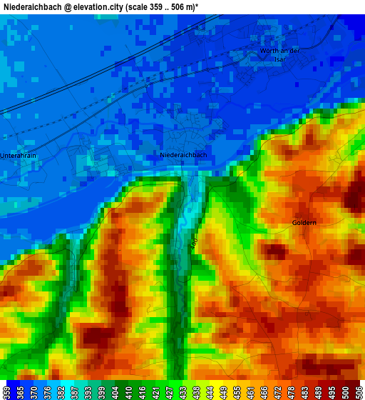
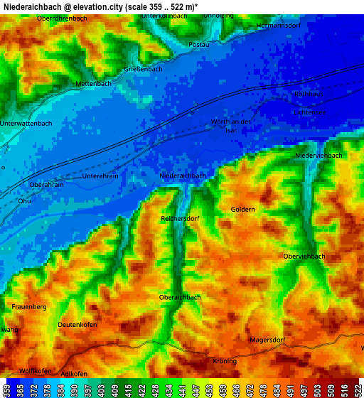
Below is the Elevation map of Niederaichbach, which displays elevation range with different colors. Scale of the first map is from 359 to 506 m (1178 to 1660 ft) with average elevation of 417.5 meters (=1370 ft) [note 1]
These maps also provides idea of topography and contour of this city, they are displayed at different zoom levels. More info about maps, scale and edge coordinates you can find below images.
| \ | Map #1 | Map #2 | Topo.Map |
| Scale [m] | 359..506 m | 359..522 m | × |
| Scale [ft] | 1178..1660 ft | 1178..1713 ft | × |
| Average | 417.5 m = 1370 ft | 426 m = 1398 ft | × |
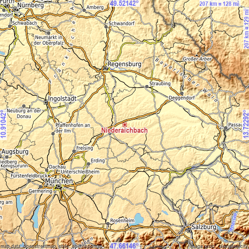
| Width | 6.46 km = 4 mi | 12.93 km = 8 mi | 206.8 km = 128.5 mi |
| Height | 6.46 km = 4 mi | 12.93 km = 8 mi | 206.8 km = 128.5 mi |
| ↑Max Latitude | 48.629053° | 48.65809° | 49.52142° |
| Latitude at center | 48.6° | 48.6° | 48.6° |
| ↓Min Latitude | 48.57093° | 48.541843° | 47.66146° |
| ← Min Longitude | 12.272725° | 12.228779° | 10.91042° |
| Longitude center | 12.31667° | 12.31667° | 12.31667° |
| →Max Longitude | 12.360615° | 12.404561° | 13.72292° |
Nearby cities:
Cities around Niederaichbach sort by population:
• Ergolding elevation 394 m
11 km,  256°
256°
• Essenbach 391 m
7.4 km,  281°
281°
• Adlkofen 498 m
6.7 km,  213°
213°
• Loiching 439 m
8.8 km,  77°
77°
• Buch 462 m
12.7 km,  297°
297°
• Niederviehbach 367 m
5.2 km,  69°
69°
• Wörth an der Isar 373 m
3.1 km,  33°
33°
• Gerzen 431 m
13.1 km,  141°
141°
• Bayerbach 414 m
11.7 km,  353°
353°
• Postau 380 m
5.7 km,  12°
12°
• Weng 383 m
7.6 km, 30°
• Stallwang 427 m
7.8 km,  233°
233°
Multilingual:
 En español:
Niederaichbach elevación 394 m.
 En France:
Niederaichbach élévation 394 m.
 Auf Deutsch:
Niederaichbach höhe über dem Meeresspiegel ist 394 m.

Sources and notes:
- [note 1] Map square and city borders are not equal. Map elevation data is calculated only from area inside that square.
- [src 1] Elevation data from geonames database provided with same terms of usage.
- [src 2] The elevation map of Niederaichbach is generated using elevation data from NASA's 3 arcsec (90m) resolution SRTM data.
- [src 3] Base (background) map © OpenStreetMap contributors tiles are generated by Geofabrik and OpenTopoMap.
Copyright & License:
This Niederaichbach Elevation Map is licensed under CC BY-SA. You may reuse any part from this page, if you give a proper credit by linking to this URL:
 More info on terms of use page.