Nienstädt elevation
Nienstädt (Lower Saxony), Germany elevation is 110 meters and Nienstädt elevation in feet is 361 ft above sea level [src 1]. Nienstädt is a seat of a fourth-order administrative division (feature code) with elevation that is 148 meters (486 ft) smaller than average city elevation in Germany.
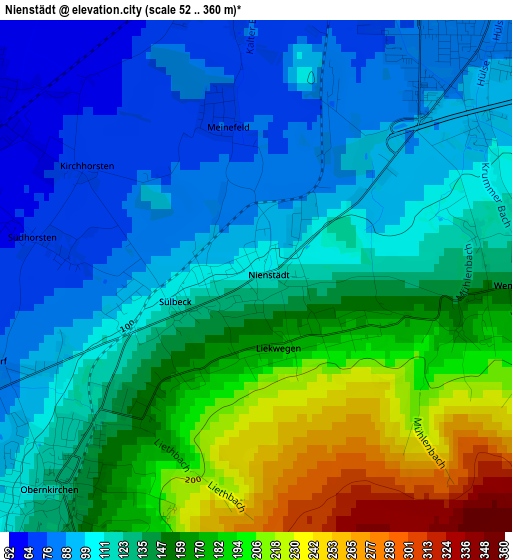
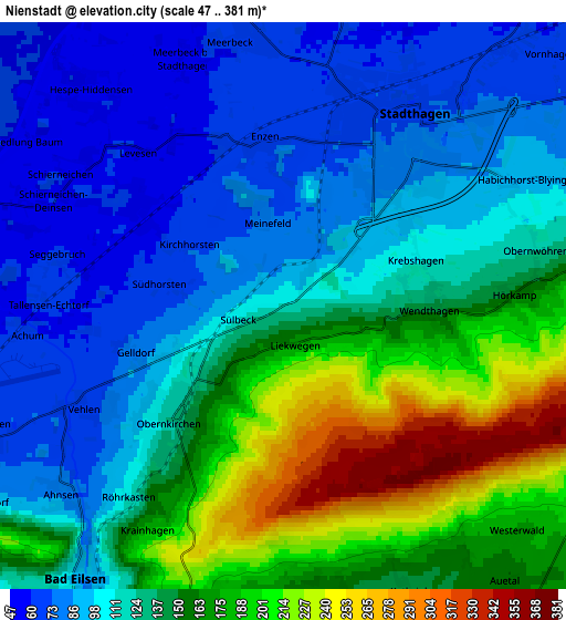
Below is the Elevation map of Nienstädt, which displays elevation range with different colors. Scale of the first map is from 52 to 360 m (171 to 1181 ft) with average elevation of 135.7 meters (=445 ft) [note 1]
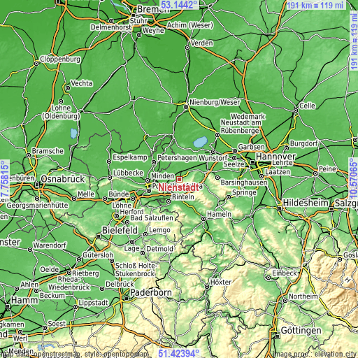
These maps also provides idea of topography and contour of this city, they are displayed at different zoom levels. More info about maps, scale and edge coordinates you can find below images.
| \ | Map #1 | Map #2 | Topo.Map |
| Scale [m] | 52..360 m | 47..381 m | × |
| Scale [ft] | 171..1181 ft | 154..1250 ft | × |
| Average | 135.7 m = 445 ft | 131.5 m = 431 ft | × |
| Width | 5.98 km = 3.7 mi | 11.95 km = 7.4 mi | 191.3 km = 118.9 mi |
| Height | 5.98 km = 3.7 mi | 11.95 km = 7.4 mi | 191.3 km = 118.9 mi |
| ↑Max Latitude | 52.31929° | 52.346144° | 53.1442° |
| Latitude at center | 52.29242° | 52.29242° | 52.29242° |
| ↓Min Latitude | 52.265533° | 52.238631° | 51.42394° |
| ← Min Longitude | 9.120455° | 9.076509° | 7.75815° |
| Longitude center | 9.1644° | 9.1644° | 9.1644° |
| →Max Longitude | 9.208345° | 9.252291° | 10.57065° |
Nearby cities:
Cities around Nienstädt sort by population:
• Stadthagen elevation 77 m
4.3 km,  37°
37°
• Bückeburg 68 m
8.6 km,  245°
245°
• Obernkirchen 121 m
3.3 km,  226°
226°
• Bad Eilsen 106 m
7.2 km,  218°
218°
• Hespe 60 m
5.7 km,  317°
317°
• Meerbeck 64 m
5.6 km,  350°
350°
• Niedernwöhren 62 m
6.7 km, 350°
• Helpsen 58 m
3.9 km,  302°
302°
• Seggebruch 63 m
4.8 km,  280°
280°
• Heeßen 99 m
8.1 km,  214°
214°
• Lauenhagen 58 m
7.6 km,  22°
22°
• Ahnsen 75 m
6 km, 225°
Multilingual:
 En español:
Nienstädt elevación 110 m.
 En France:
Nienstädt élévation 110 m.
 Auf Deutsch:
Nienstädt höhe über dem Meeresspiegel ist 110 m.

Sources and notes:
- [note 1] Map square and city borders are not equal. Map elevation data is calculated only from area inside that square.
- [src 1] Elevation data from geonames database provided with same terms of usage.
- [src 2] The elevation map of Nienstädt is generated using elevation data from NASA's 3 arcsec (90m) resolution SRTM data.
- [src 3] Base (background) map © OpenStreetMap contributors tiles are generated by Geofabrik and OpenTopoMap.
Copyright & License:
This Nienstädt Elevation Map is licensed under CC BY-SA. You may reuse any part from this page, if you give a proper credit by linking to this URL:
 More info on terms of use page.