Nordhorn elevation
Nordhorn (Lower Saxony), Germany elevation is 25 meters and Nordhorn elevation in feet is 82 ft above sea level [src 1]. Nordhorn is a seat of a third-order administrative division (feature code) with elevation that is 233 meters (764 ft) smaller than average city elevation in Germany.
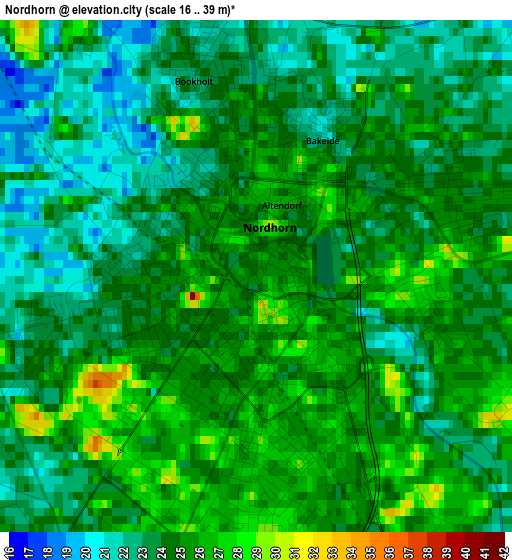
Below is the Elevation map of Nordhorn, which displays elevation range with different colors. Scale of the first map is from 16 to 39 m (52 to 128 ft) with average elevation of 24 meters (=79 ft) [note 1]
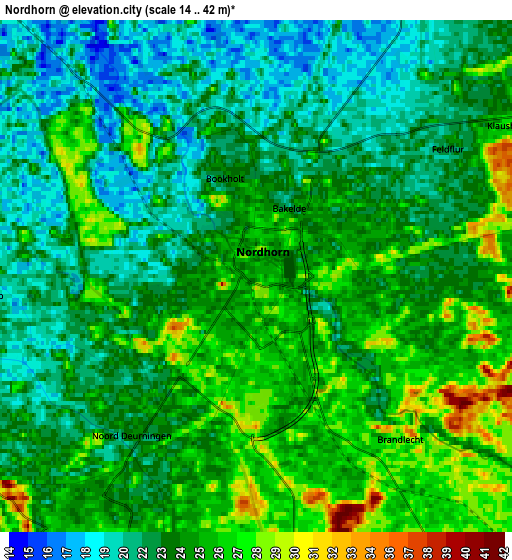
These maps also provides idea of topography and contour of this city, they are displayed at different zoom levels. More info about maps, scale and edge coordinates you can find below images.
| \ | Map #1 | Map #2 | Topo.Map |
| Scale [m] | 16..39 m | 14..42 m | × |
| Scale [ft] | 52..128 ft | 46..138 ft | × |
| Average | 24 m = 79 ft | 23.6 m = 77 ft | × |
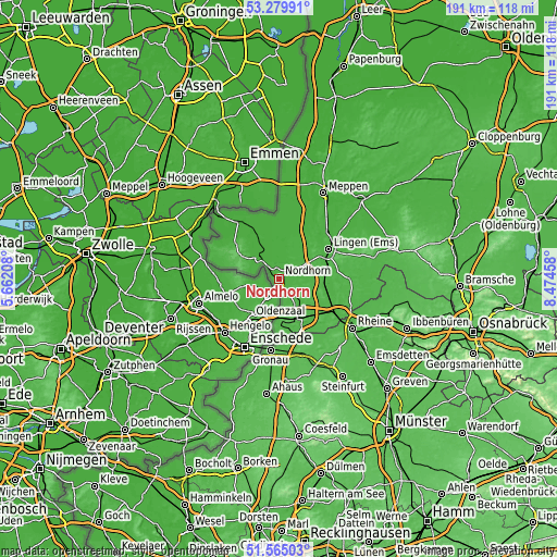
| Width | 5.96 km = 3.7 mi | 11.92 km = 7.4 mi | 190.7 km = 118.5 mi |
| Height | 5.96 km = 3.7 mi | 11.92 km = 7.4 mi | 190.7 km = 118.5 mi |
| ↑Max Latitude | 52.457596° | 52.484366° | 53.27991° |
| Latitude at center | 52.43081° | 52.43081° | 52.43081° |
| ↓Min Latitude | 52.404008° | 52.377189° | 51.56503° |
| ← Min Longitude | 7.024385° | 6.980439° | 5.66208° |
| Longitude center | 7.06833° | 7.06833° | 7.06833° |
| →Max Longitude | 7.112275° | 7.156221° | 8.47458° |
Nearby cities:
Cities around Nordhorn sort by population:
• Lingen elevation 25 m
19.7 km,  59°
59°
• Bad Bentheim 60 m
15.7 km,  157°
157°
• Schüttorf 34 m
15.9 km,  139°
139°
• Wietmarschen 23 m
10.7 km,  24°
24°
• Emsbüren 28 m
16.1 km,  102°
102°
• Lohne 29 m
13 km, 55°
• Uelsen 55 m
14.7 km,  301°
301°
• Hoogstede 14 m
18.8 km,  334°
334°
• Itterbeck 40 m
19.8 km, 295°
• Wilsum 30 m
18.7 km,  307°
307°
• Georgsdorf 16 m
15.1 km,  3°
3°
• Suddendorf 35 m
18 km, 143°
Multilingual:
 En español:
Nordhorn elevación 25 m.
 En France:
Nordhorn élévation 25 m.


Sources and notes:
- [note 1] Map square and city borders are not equal. Map elevation data is calculated only from area inside that square.
- [src 1] Elevation data from geonames database provided with same terms of usage.
- [src 2] The elevation map of Nordhorn is generated using elevation data from NASA's 3 arcsec (90m) resolution SRTM data.
- [src 3] Base (background) map © OpenStreetMap contributors tiles are generated by Geofabrik and OpenTopoMap.
Copyright & License:
This Nordhorn Elevation Map is licensed under CC BY-SA. You may reuse any part from this page, if you give a proper credit by linking to this URL:
 More info on terms of use page.