Nortorf elevation
Nortorf (Schleswig-Holstein), Germany elevation is 30 meters and Nortorf elevation in feet is 98 ft above sea level [src 1]. Nortorf is a populated place (feature code) with elevation that is 228 meters (748 ft) smaller than average city elevation in Germany.
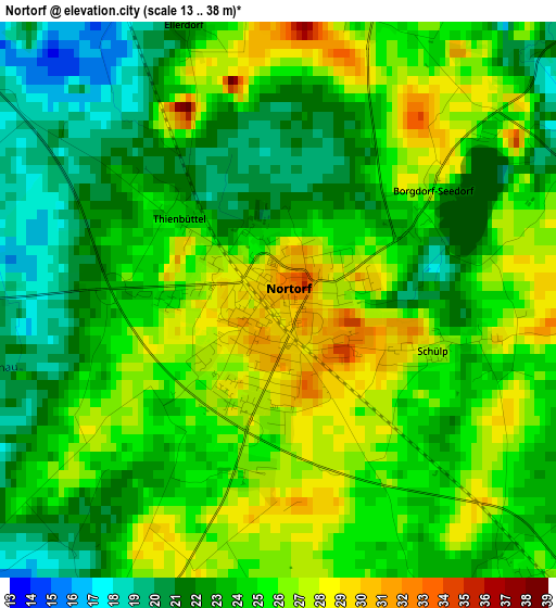
Below is the Elevation map of Nortorf, which displays elevation range with different colors. Scale of the first map is from 13 to 38 m (43 to 125 ft) with average elevation of 24 meters (=79 ft) [note 1]
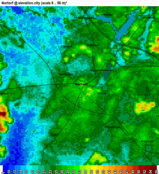
These maps also provides idea of topography and contour of this city, they are displayed at different zoom levels. More info about maps, scale and edge coordinates you can find below images.
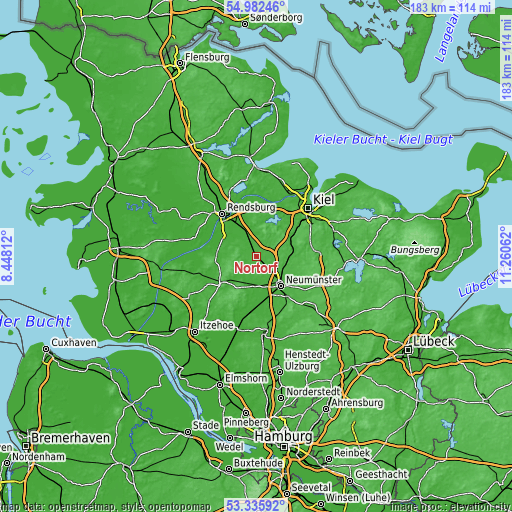
| \ | Map #1 | Map #2 | Topo.Map |
| Scale [m] | 13..38 m | 8..56 m | × |
| Scale [ft] | 43..125 ft | 26..184 ft | × |
| Average | 24 m = 79 ft | 22.2 m = 73 ft | × |
| Width | 5.72 km = 3.6 mi | 11.44 km = 7.1 mi | 183.1 km = 113.8 mi |
| Height | 5.72 km = 3.6 mi | 11.44 km = 7.1 mi | 183.1 km = 113.8 mi |
| ↑Max Latitude | 54.193098° | 54.218801° | 54.98246° |
| Latitude at center | 54.16738° | 54.16738° | 54.16738° |
| ↓Min Latitude | 54.141646° | 54.115895° | 53.33592° |
| ← Min Longitude | 9.810425° | 9.766479° | 8.44812° |
| Longitude center | 9.85437° | 9.85437° | 9.85437° |
| →Max Longitude | 9.898315° | 9.942261° | 11.26062° |
Nearby cities:
Cities around Nortorf sort by population:
• Neumünster elevation 23 m
13.2 km,  141°
141°
• Bordesholm 28 m
11.6 km,  85°
85°
• Aukrug 14 m
10.4 km,  206°
206°
• Wattenbek 23 m
12.7 km, 90°
• Wasbek 18 m
10.7 km,  164°
164°
• Westensee 16 m
12.2 km,  12°
12°
• Emkendorf 13 m
11 km,  358°
358°
• Langwedel 28 m
6.7 km,  44°
44°
• Padenstedt 13 m
13.7 km, 162°
• Gnutz 20 m
4.5 km, 212°
• Timmaspe 26 m
4 km, 139°
• Brügge 22 m
14 km, 86°
Multilingual:
 En español:
Nortorf elevación 30 m.
 En France:
Nortorf élévation 30 m.


Sources and notes:
- [note 1] Map square and city borders are not equal. Map elevation data is calculated only from area inside that square.
- [src 1] Elevation data from geonames database provided with same terms of usage.
- [src 2] The elevation map of Nortorf is generated using elevation data from NASA's 3 arcsec (90m) resolution SRTM data.
- [src 3] Base (background) map © OpenStreetMap contributors tiles are generated by Geofabrik and OpenTopoMap.
Copyright & License:
This Nortorf Elevation Map is licensed under CC BY-SA. You may reuse any part from this page, if you give a proper credit by linking to this URL:
 More info on terms of use page.