Ochtrup elevation
Ochtrup (North Rhine-Westphalia, Regierungsbezirk Münster), Germany elevation is 61 meters and Ochtrup elevation in feet is 200 ft above sea level [src 1]. Ochtrup is a populated place (feature code) with elevation that is 197 meters (646 ft) smaller than average city elevation in Germany.
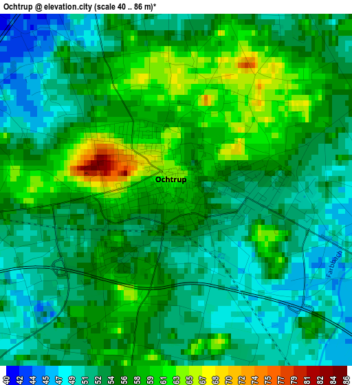
Below is the Elevation map of Ochtrup, which displays elevation range with different colors. Scale of the first map is from 40 to 86 m (131 to 282 ft) with average elevation of 54.9 meters (=180 ft) [note 1]
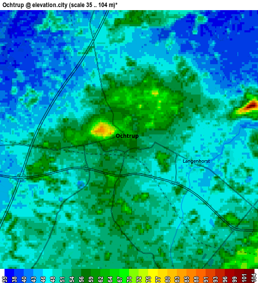
These maps also provides idea of topography and contour of this city, they are displayed at different zoom levels. More info about maps, scale and edge coordinates you can find below images.
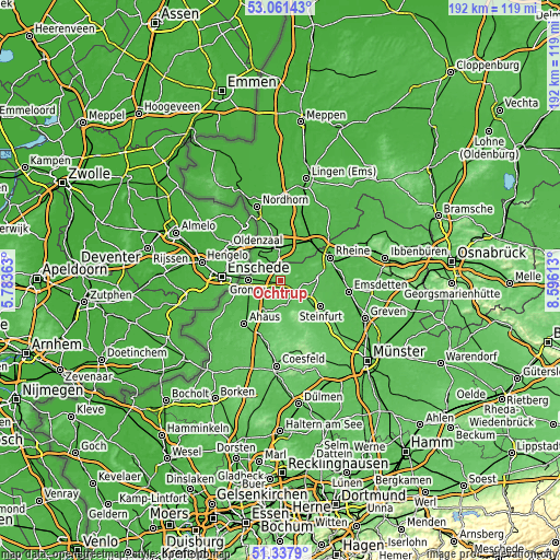
| \ | Map #1 | Map #2 | Topo.Map |
| Scale [m] | 40..86 m | 35..104 m | × |
| Scale [ft] | 131..282 ft | 115..341 ft | × |
| Average | 54.9 m = 180 ft | 49.7 m = 163 ft | × |
| Width | 5.99 km = 3.7 mi | 11.98 km = 7.4 mi | 191.6 km = 119.1 mi |
| Height | 5.99 km = 3.7 mi | 11.98 km = 7.4 mi | 191.6 km = 119.1 mi |
| ↑Max Latitude | 52.234941° | 52.261846° | 53.06143° |
| Latitude at center | 52.20802° | 52.20802° | 52.20802° |
| ↓Min Latitude | 52.181082° | 52.154128° | 51.3379° |
| ← Min Longitude | 7.145935° | 7.101989° | 5.78363° |
| Longitude center | 7.18988° | 7.18988° | 7.18988° |
| →Max Longitude | 7.233825° | 7.277771° | 8.59613° |
Nearby cities:
Cities around Ochtrup sort by population:
• Gronau elevation 42 m
11.4 km,  271°
271°
• Steinfurt 59 m
11.9 km,  122°
122°
• Bad Bentheim 60 m
10.5 km,  347°
347°
• Neuenkirchen 64 m
13 km,  71°
71°
• Schüttorf 34 m
12.9 km,  9°
9°
• Heek 52 m
11.9 km,  211°
211°
• Schöppingen 86 m
12.4 km,  166°
166°
• Wettringen 49 m
8.8 km,  89°
89°
• Salzbergen 31 m
17.7 km,  38°
38°
• Horstmar 104 m
16.2 km,  150°
150°
• Metelen 59 m
7.2 km, 167°
• Suddendorf 35 m
10.6 km, 13°
Multilingual:
 En español:
Ochtrup elevación 61 m.
 En France:
Ochtrup élévation 61 m.


Sources and notes:
- [note 1] Map square and city borders are not equal. Map elevation data is calculated only from area inside that square.
- [src 1] Elevation data from geonames database provided with same terms of usage.
- [src 2] The elevation map of Ochtrup is generated using elevation data from NASA's 3 arcsec (90m) resolution SRTM data.
- [src 3] Base (background) map © OpenStreetMap contributors tiles are generated by Geofabrik and OpenTopoMap.
Copyright & License:
This Ochtrup Elevation Map is licensed under CC BY-SA. You may reuse any part from this page, if you give a proper credit by linking to this URL:
 More info on terms of use page.