Olfen elevation
Olfen (North Rhine-Westphalia, Regierungsbezirk Münster), Germany elevation is 51 meters and Olfen elevation in feet is 167 ft above sea level [src 1]. Olfen is a populated place (feature code) with elevation that is 207 meters (679 ft) smaller than average city elevation in Germany.
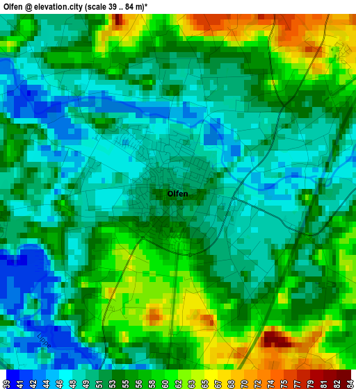
Below is the Elevation map of Olfen, which displays elevation range with different colors. Scale of the first map is from 39 to 84 m (128 to 276 ft) with average elevation of 53.7 meters (=176 ft) [note 1]
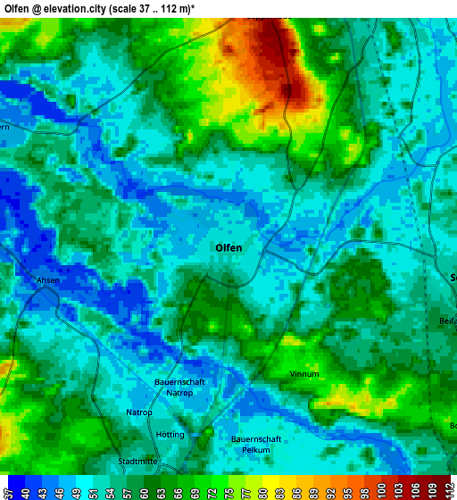
These maps also provides idea of topography and contour of this city, they are displayed at different zoom levels. More info about maps, scale and edge coordinates you can find below images.
| \ | Map #1 | Map #2 | Topo.Map |
| Scale [m] | 39..84 m | 37..112 m | × |
| Scale [ft] | 128..276 ft | 121..367 ft | × |
| Average | 53.7 m = 176 ft | 57.4 m = 188 ft | × |
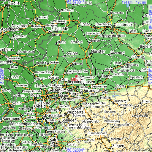
| Width | 6.06 km = 3.8 mi | 12.11 km = 7.5 mi | 193.8 km = 120.4 mi |
| Height | 6.06 km = 3.8 mi | 12.11 km = 7.5 mi | 193.8 km = 120.4 mi |
| ↑Max Latitude | 51.735093° | 51.762301° | 52.57091° |
| Latitude at center | 51.70787° | 51.70787° | 51.70787° |
| ↓Min Latitude | 51.68063° | 51.653374° | 50.82804° |
| ← Min Longitude | 7.334985° | 7.291039° | 5.97268° |
| Longitude center | 7.37893° | 7.37893° | 7.37893° |
| →Max Longitude | 7.422875° | 7.466821° | 8.78518° |
Nearby cities:
Cities around Olfen sort by population:
• Recklinghausen elevation 80 m
16.3 km,  230°
230°
• Lünen 57 m
14.5 km,  134°
134°
• Castrop-Rauxel 83 m
17.5 km,  195°
195°
• Dülmen 72 m
15.3 km,  333°
333°
• Haltern am See 45 m
14.1 km,  286°
286°
• Datteln 54 m
6.2 km, 201°
• Oer-Erkenschwick 76 m
10.8 km, 227°
• Waltrop 71 m
9.8 km,  170°
170°
• Selm 57 m
6.3 km,  101°
101°
• Lüdinghausen 52 m
8.1 km,  33°
33°
• Senden 60 m
18 km,  23°
23°
• Nordkirchen 63 m
10.4 km,  71°
71°
Multilingual:
 En español:
Olfen elevación 51 m.
 En France:
Olfen élévation 51 m.


Sources and notes:
- [note 1] Map square and city borders are not equal. Map elevation data is calculated only from area inside that square.
- [src 1] Elevation data from geonames database provided with same terms of usage.
- [src 2] The elevation map of Olfen is generated using elevation data from NASA's 3 arcsec (90m) resolution SRTM data.
- [src 3] Base (background) map © OpenStreetMap contributors tiles are generated by Geofabrik and OpenTopoMap.
Copyright & License:
This Olfen Elevation Map is licensed under CC BY-SA. You may reuse any part from this page, if you give a proper credit by linking to this URL:
 More info on terms of use page.