Putbus elevation
Putbus (Mecklenburg-Vorpommern), Germany elevation is 45 meters and Putbus elevation in feet is 148 ft above sea level [src 1]. Putbus is a populated place (feature code) with elevation that is 213 meters (699 ft) smaller than average city elevation in Germany.
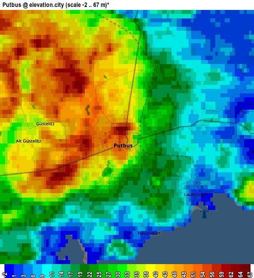
Below is the Elevation map of Putbus, which displays elevation range with different colors. Scale of the first map is from -2 to 67 m (-7 to 220 ft) with average elevation of 26.3 meters (=86 ft) [note 1]
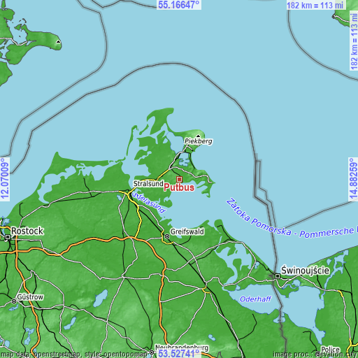
These maps also provides idea of topography and contour of this city, they are displayed at different zoom levels. More info about maps, scale and edge coordinates you can find below images.
| \ | Map #1 | Map #2 | Topo.Map |
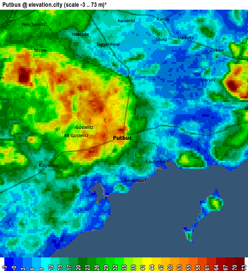
| Scale [m] | -2..67 m | -3..73 m | × |
| Scale [ft] | -7..220 ft | -10..240 ft | × |
| Average | 26.3 m = 86 ft | 20.5 m = 67 ft | × |
| Width | 5.69 km = 3.5 mi | 11.39 km = 7.1 mi | 182.2 km = 113.2 mi |
| Height | 5.7 km = 3.5 mi | 11.39 km = 7.1 mi | 182.2 km = 113.2 mi |
| ↑Max Latitude | 54.380712° | 54.406297° | 55.16647° |
| Latitude at center | 54.35511° | 54.35511° | 54.35511° |
| ↓Min Latitude | 54.329492° | 54.303859° | 53.52741° |
| ← Min Longitude | 13.432395° | 13.388449° | 12.07009° |
| Longitude center | 13.47634° | 13.47634° | 13.47634° |
| →Max Longitude | 13.520285° | 13.564231° | 14.88259° |
Nearby cities:
Cities around Putbus sort by population:
• Bergen auf Rügen elevation 73 m
7.5 km,  338°
338°
• Saßnitz 32 m
20.9 km,  31°
31°
• Ostseebad Binz 5 m
10 km,  60°
60°
• Sagard 26 m
19.6 km,  14°
14°
• Ostseebad Sellin 14 m
14.3 km,  79°
79°
• Samtens 5 m
11.9 km,  269°
269°
• Garz 14 m
9.1 km,  243°
243°
• Gingst 9 m
18.1 km,  308°
308°
• Ostseebad Göhren 36 m
17 km,  95°
95°
• Poseritz 19 m
14.5 km, 244°
• Rambin 7 m
17.6 km, 270°
• Sehlen 31 m
6.3 km,  295°
295°
Multilingual:
 En español:
Putbus elevación 45 m.
 En France:
Putbus élévation 45 m.


Sources and notes:
- [note 1] Map square and city borders are not equal. Map elevation data is calculated only from area inside that square.
- [src 1] Elevation data from geonames database provided with same terms of usage.
- [src 2] The elevation map of Putbus is generated using elevation data from NASA's 3 arcsec (90m) resolution SRTM data.
- [src 3] Base (background) map © OpenStreetMap contributors tiles are generated by Geofabrik and OpenTopoMap.
Copyright & License:
This Putbus Elevation Map is licensed under CC BY-SA. You may reuse any part from this page, if you give a proper credit by linking to this URL:
 More info on terms of use page.