Remagen elevation
Remagen (Rheinland-Pfalz), Germany elevation is 65 meters and Remagen elevation in feet is 213 ft above sea level [src 1]. Remagen is a populated place (feature code) with elevation that is 193 meters (633 ft) smaller than average city elevation in Germany.
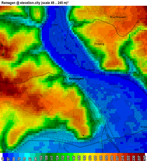
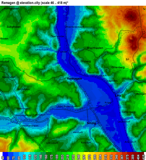
Below is the Elevation map of Remagen, which displays elevation range with different colors. Scale of the first map is from 49 to 245 m (161 to 804 ft) with average elevation of 126.5 meters (=415 ft) [note 1]
These maps also provides idea of topography and contour of this city, they are displayed at different zoom levels. More info about maps, scale and edge coordinates you can find below images.
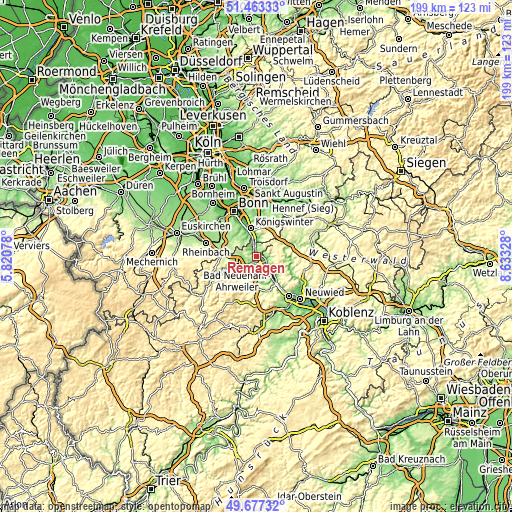
| \ | Map #1 | Map #2 | Topo.Map |
| Scale [m] | 49..245 m | 46..418 m | × |
| Scale [ft] | 161..804 ft | 151..1371 ft | × |
| Average | 126.5 m = 415 ft | 167.1 m = 548 ft | × |
| Width | 6.21 km = 3.9 mi | 12.41 km = 7.7 mi | 198.6 km = 123.4 mi |
| Height | 6.21 km = 3.9 mi | 12.41 km = 7.7 mi | 198.6 km = 123.4 mi |
| ↑Max Latitude | 50.606688° | 50.634569° | 51.46333° |
| Latitude at center | 50.57879° | 50.57879° | 50.57879° |
| ↓Min Latitude | 50.550876° | 50.522945° | 49.67732° |
| ← Min Longitude | 7.183085° | 7.139139° | 5.82078° |
| Longitude center | 7.22703° | 7.22703° | 7.22703° |
| →Max Longitude | 7.270975° | 7.314921° | 8.63328° |
Nearby cities:
Cities around Remagen sort by population:
• Bad Neuenahr-Ahrweiler elevation 101 m
9.1 km,  244°
244°
• Bad Honnef 73 m
7.2 km,  0°
0°
• Sinzig 78 m
4.1 km,  160°
160°
• Linz am Rhein 75 m
4.2 km,  105°
105°
• Bad Hönningen 69 m
9.1 km,  138°
138°
• Unkel 57 m
2.1 km,  343°
343°
• Rheinbreitbach 94 m
4.2 km,  6°
6°
• Erpel 61 m
0.7 km,  41°
41°
• Leubsdorf 133 m
6.1 km,  121°
121°
• Dattenberg 182 m
5.5 km, 120°
• Kasbach-Ohlenberg 168 m
2.8 km,  79°
79°
• Ockenfels 124 m
3.4 km,  95°
95°
Multilingual:
 En español:
Remagen elevación 65 m.
 En France:
Remagen élévation 65 m.


Sources and notes:
- [note 1] Map square and city borders are not equal. Map elevation data is calculated only from area inside that square.
- [src 1] Elevation data from geonames database provided with same terms of usage.
- [src 2] The elevation map of Remagen is generated using elevation data from NASA's 3 arcsec (90m) resolution SRTM data.
- [src 3] Base (background) map © OpenStreetMap contributors tiles are generated by Geofabrik and OpenTopoMap.
Copyright & License:
This Remagen Elevation Map is licensed under CC BY-SA. You may reuse any part from this page, if you give a proper credit by linking to this URL:
 More info on terms of use page.