Rottenburg elevation
Rottenburg (Baden-Württemberg, Tübingen Region), Germany elevation is 349 meters and Rottenburg elevation in feet is 1145 ft above sea level [src 1]. Rottenburg is a populated place (feature code) with elevation that is 91 meters (299 ft) bigger than average city elevation in Germany.
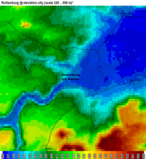
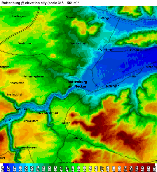
Below is the Elevation map of Rottenburg, which displays elevation range with different colors. Scale of the first map is from 328 to 559 m (1076 to 1834 ft) with average elevation of 401.7 meters (=1318 ft) [note 1]
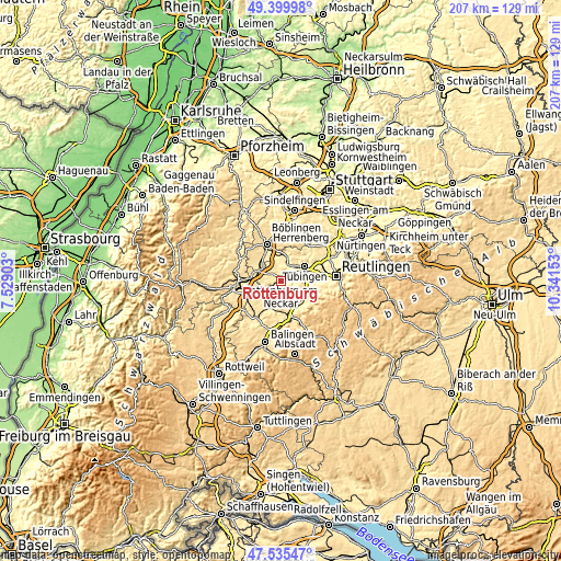
These maps also provides idea of topography and contour of this city, they are displayed at different zoom levels. More info about maps, scale and edge coordinates you can find below images.
| \ | Map #1 | Map #2 | Topo.Map |
| Scale [m] | 328..559 m | 318..561 m | × |
| Scale [ft] | 1076..1834 ft | 1043..1841 ft | × |
| Average | 401.7 m = 1318 ft | 424.1 m = 1391 ft | × |
| Width | 6.48 km = 4 mi | 12.96 km = 8.1 mi | 207.3 km = 128.8 mi |
| Height | 6.48 km = 4 mi | 12.96 km = 8.1 mi | 207.3 km = 128.8 mi |
| ↑Max Latitude | 48.505414° | 48.534522° | 49.39998° |
| Latitude at center | 48.47629° | 48.47629° | 48.47629° |
| ↓Min Latitude | 48.447149° | 48.417991° | 47.53547° |
| ← Min Longitude | 8.891335° | 8.847389° | 7.52903° |
| Longitude center | 8.93528° | 8.93528° | 8.93528° |
| →Max Longitude | 8.979225° | 9.023171° | 10.34153° |
Nearby cities:
Cities around Rottenburg sort by population:
• Tübingen elevation 333 m
10 km,  59°
59°
• Mössingen 464 m
11.8 km,  131°
131°
• Hechingen 531 m
14 km,  171°
171°
• Gomaringen 430 m
12.1 km,  102°
102°
• Bodelshausen 495 m
10.2 km,  162°
162°
• Bondorf 464 m
8.8 km,  304°
304°
• Dußlingen 379 m
9.2 km,  105°
105°
• Rangendingen 418 m
11.1 km,  197°
197°
• Ofterdingen 429 m
9.8 km, 132°
• Nehren 424 m
11.1 km,  116°
116°
• Mötzingen 531 m
13.4 km, 298°
• Hirrlingen 429 m
7.9 km,  206°
206°
Multilingual:
 En español:
Rottenburg elevación 349 m.
 En France:
Rottenburg élévation 349 m.
 Auf Deutsch:
Rottenburg höhe über dem Meeresspiegel ist 349 m.

Sources and notes:
- [note 1] Map square and city borders are not equal. Map elevation data is calculated only from area inside that square.
- [src 1] Elevation data from geonames database provided with same terms of usage.
- [src 2] The elevation map of Rottenburg is generated using elevation data from NASA's 3 arcsec (90m) resolution SRTM data.
- [src 3] Base (background) map © OpenStreetMap contributors tiles are generated by Geofabrik and OpenTopoMap.
Copyright & License:
This Rottenburg Elevation Map is licensed under CC BY-SA. You may reuse any part from this page, if you give a proper credit by linking to this URL:
 More info on terms of use page.