Rückersdorf elevation
Rückersdorf (Bavaria, Regierungsbezirk Mittelfranken), Germany elevation is 330 meters and Rückersdorf elevation in feet is 1083 ft above sea level [src 1]. Rückersdorf is a seat of a fourth-order administrative division (feature code) with elevation that is 72 meters (236 ft) bigger than average city elevation in Germany.
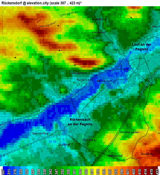
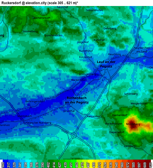
Below is the Elevation map of Rückersdorf, which displays elevation range with different colors. Scale of the first map is from 307 to 423 m (1007 to 1388 ft) with average elevation of 350.5 meters (=1150 ft) [note 1]
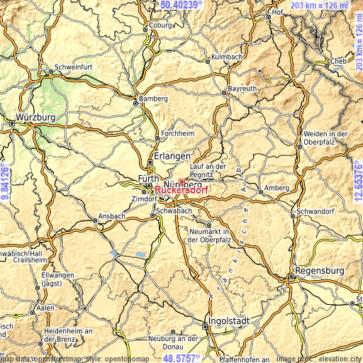
These maps also provides idea of topography and contour of this city, they are displayed at different zoom levels. More info about maps, scale and edge coordinates you can find below images.
| \ | Map #1 | Map #2 | Topo.Map |
| Scale [m] | 307..423 m | 305..621 m | × |
| Scale [ft] | 1007..1388 ft | 1001..2037 ft | × |
| Average | 350.5 m = 1150 ft | 368.2 m = 1208 ft | × |
| Width | 6.35 km = 3.9 mi | 12.69 km = 7.9 mi | 203.1 km = 126.2 mi |
| Height | 6.35 km = 3.9 mi | 12.69 km = 7.9 mi | 203.1 km = 126.2 mi |
| ↑Max Latitude | 49.526103° | 49.55462° | 50.40239° |
| Latitude at center | 49.49757° | 49.49757° | 49.49757° |
| ↓Min Latitude | 49.46902° | 49.440453° | 48.5757° |
| ← Min Longitude | 11.203565° | 11.159619° | 9.84126° |
| Longitude center | 11.24751° | 11.24751° | 11.24751° |
| →Max Longitude | 11.291455° | 11.335401° | 12.65376° |
Nearby cities:
Cities around Rückersdorf sort by population:
• Lauf an der Pegnitz elevation 334 m
3.1 km,  54°
54°
• Röthenbach an der Pegnitz 331 m
1.7 km,  195°
195°
• Schwaig 324 m
4.6 km,  227°
227°
• Schnaittach 349 m
9.8 km, 45°
• Heroldsberg 369 m
7.7 km,  300°
300°
• Leinburg 397 m
6.8 km,  138°
138°
• Neunkirchen am Sand 332 m
6 km,  59°
59°
• Kalchreuth 414 m
10.6 km,  309°
309°
• Reichenschwand 342 m
9.2 km,  78°
78°
• Ottensoos 336 m
6.9 km, 78°
• Henfenfeld 341 m
10.3 km,  89°
89°
• Engelthal 373 m
11.3 km,  104°
104°
Multilingual:
 En español:
Rückersdorf elevación 330 m.
 En France:
Rückersdorf élévation 330 m.
 Auf Deutsch:
Rückersdorf höhe über dem Meeresspiegel ist 330 m.

Sources and notes:
- [note 1] Map square and city borders are not equal. Map elevation data is calculated only from area inside that square.
- [src 1] Elevation data from geonames database provided with same terms of usage.
- [src 2] The elevation map of Rückersdorf is generated using elevation data from NASA's 3 arcsec (90m) resolution SRTM data.
- [src 3] Base (background) map © OpenStreetMap contributors tiles are generated by Geofabrik and OpenTopoMap.
Copyright & License:
This Rückersdorf Elevation Map is licensed under CC BY-SA. You may reuse any part from this page, if you give a proper credit by linking to this URL:
 More info on terms of use page.