Schkeuditz elevation
Schkeuditz (Saxony), Germany elevation is 110 meters and Schkeuditz elevation in feet is 361 ft above sea level [src 1]. Schkeuditz is a populated place (feature code) with elevation that is 148 meters (486 ft) smaller than average city elevation in Germany.
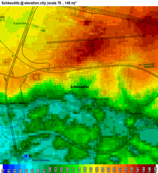
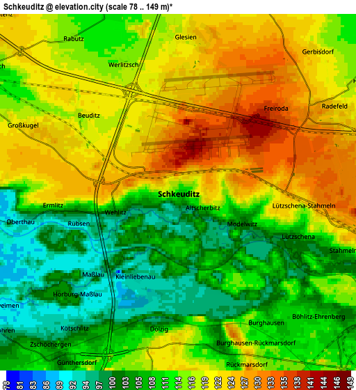
Below is the Elevation map of Schkeuditz, which displays elevation range with different colors. Scale of the first map is from 78 to 149 m (256 to 489 ft) with average elevation of 115.7 meters (=380 ft) [note 1]
These maps also provides idea of topography and contour of this city, they are displayed at different zoom levels. More info about maps, scale and edge coordinates you can find below images.
| \ | Map #1 | Map #2 | Topo.Map |
| Scale [m] | 78..149 m | 78..149 m | × |
| Scale [ft] | 256..489 ft | 256..489 ft | × |
| Average | 115.7 m = 380 ft | 114.5 m = 376 ft | × |
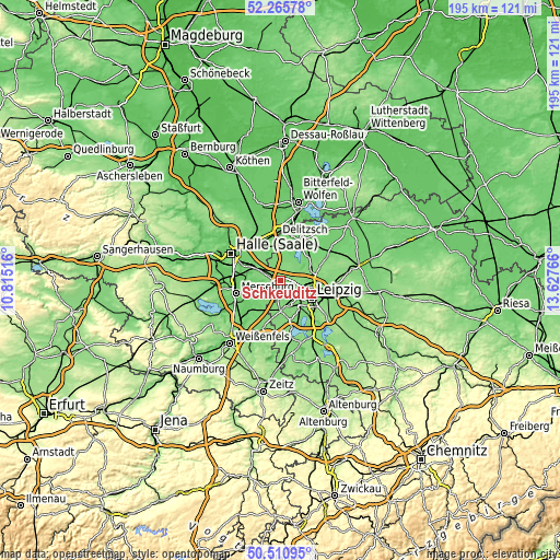
| Width | 6.1 km = 3.8 mi | 12.19 km = 7.6 mi | 195.1 km = 121.2 mi |
| Height | 6.1 km = 3.8 mi | 12.19 km = 7.6 mi | 195.1 km = 121.2 mi |
| ↑Max Latitude | 51.42419° | 51.451584° | 52.26578° |
| Latitude at center | 51.39678° | 51.39678° | 51.39678° |
| ↓Min Latitude | 51.369353° | 51.34191° | 50.51095° |
| ← Min Longitude | 12.177465° | 12.133519° | 10.81516° |
| Longitude center | 12.22141° | 12.22141° | 12.22141° |
| →Max Longitude | 12.265355° | 12.309301° | 13.62766° |
Nearby cities:
Cities around Schkeuditz sort by population:
• Markranstädt elevation 126 m
10.6 km,  180°
180°
• Großlehna 116 m
10.6 km,  198°
198°
• Gröbers 110 m
8.2 km,  297°
297°
• Wiedemar 109 m
7.9 km,  349°
349°
• Großkugel 121 m
5.7 km,  293°
293°
• Queis 113 m
10.7 km,  325°
325°
• Ermlitz 112 m
4.3 km,  262°
262°
• Günthersdorf 113 m
6.6 km,  211°
211°
• Zwochau 112 m
8.2 km,  23°
23°
• Raßnitz 94 m
8.9 km,  265°
265°
• Zöschen 90 m
8.5 km,  239°
239°
• Wallendorf 88 m
10.9 km,  247°
247°
Multilingual:
 En español:
Schkeuditz elevación 110 m.
 En France:
Schkeuditz élévation 110 m.
 Auf Deutsch:
Schkeuditz höhe über dem Meeresspiegel ist 110 m.

Sources and notes:
- [note 1] Map square and city borders are not equal. Map elevation data is calculated only from area inside that square.
- [src 1] Elevation data from geonames database provided with same terms of usage.
- [src 2] The elevation map of Schkeuditz is generated using elevation data from NASA's 3 arcsec (90m) resolution SRTM data.
- [src 3] Base (background) map © OpenStreetMap contributors tiles are generated by Geofabrik and OpenTopoMap.
Copyright & License:
This Schkeuditz Elevation Map is licensed under CC BY-SA. You may reuse any part from this page, if you give a proper credit by linking to this URL:
 More info on terms of use page.