Schliengen elevation
Schliengen (Baden-Württemberg, Freiburg Region), Germany elevation is 243 meters and Schliengen elevation in feet is 797 ft above sea level [src 1]. Schliengen is a seat of a fourth-order administrative division (feature code) with elevation that is 15 meters (49 ft) smaller than average city elevation in Germany.
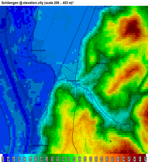
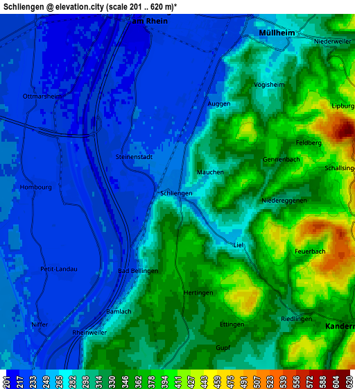
Below is the Elevation map of Schliengen, which displays elevation range with different colors. Scale of the first map is from 209 to 453 m (686 to 1486 ft) with average elevation of 280.9 meters (=922 ft) [note 1]
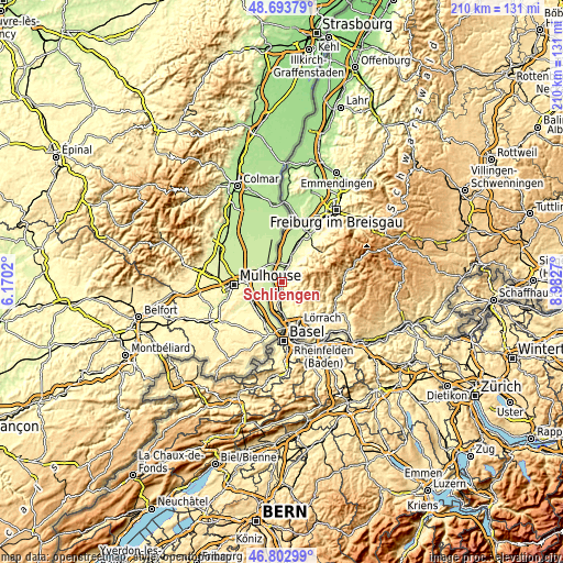
These maps also provides idea of topography and contour of this city, they are displayed at different zoom levels. More info about maps, scale and edge coordinates you can find below images.
| \ | Map #1 | Map #2 | Topo.Map |
| Scale [m] | 209..453 m | 201..620 m | × |
| Scale [ft] | 686..1486 ft | 659..2034 ft | × |
| Average | 280.9 m = 922 ft | 294.1 m = 965 ft | × |
| Width | 6.57 km = 4.1 mi | 13.14 km = 8.2 mi | 210.2 km = 130.6 mi |
| Height | 6.57 km = 4.1 mi | 13.14 km = 8.2 mi | 210.2 km = 130.6 mi |
| ↑Max Latitude | 47.786515° | 47.816033° | 48.69379° |
| Latitude at center | 47.75698° | 47.75698° | 47.75698° |
| ↓Min Latitude | 47.727428° | 47.69786° | 46.80299° |
| ← Min Longitude | 7.532505° | 7.488559° | 6.1702° |
| Longitude center | 7.57645° | 7.57645° | 7.57645° |
| →Max Longitude | 7.620395° | 7.664341° | 8.9827° |
Nearby cities:
Cities around Schliengen sort by population:
• Müllheim elevation 268 m
7 km,  35°
35°
• Neuenburg am Rhein 228 m
6.5 km,  349°
349°
• Efringen-Kirchen 248 m
11.9 km,  183°
183°
• Kandern 348 m
8 km,  126°
126°
• Badenweiler 415 m
8.8 km,  54°
54°
• Buggingen 225 m
11.1 km,  24°
24°
• Bad Bellingen 250 m
3.2 km,  206°
206°
• Sulzburg 338 m
13.6 km, 46°
• Auggen 283 m
3.4 km,  30°
30°
• Eimeldingen 264 m
13.9 km,  172°
172°
• Feldberg 381 m
5.2 km,  68°
68°
• Rümmingen 296 m
13.8 km,  159°
159°
Multilingual:
 En español:
Schliengen elevación 243 m.
 En France:
Schliengen élévation 243 m.
 Auf Deutsch:
Schliengen höhe über dem Meeresspiegel ist 243 m.

Sources and notes:
- [note 1] Map square and city borders are not equal. Map elevation data is calculated only from area inside that square.
- [src 1] Elevation data from geonames database provided with same terms of usage.
- [src 2] The elevation map of Schliengen is generated using elevation data from NASA's 3 arcsec (90m) resolution SRTM data.
- [src 3] Base (background) map © OpenStreetMap contributors tiles are generated by Geofabrik and OpenTopoMap.
Copyright & License:
This Schliengen Elevation Map is licensed under CC BY-SA. You may reuse any part from this page, if you give a proper credit by linking to this URL:
 More info on terms of use page.