Schmallenberg elevation
Schmallenberg (North Rhine-Westphalia, Regierungsbezirk Arnsberg), Germany elevation is 411 meters and Schmallenberg elevation in feet is 1348 ft above sea level [src 1]. Schmallenberg is a populated place (feature code) with elevation that is 153 meters (502 ft) bigger than average city elevation in Germany.
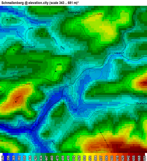
Below is the Elevation map of Schmallenberg, which displays elevation range with different colors. Scale of the first map is from 343 to 681 m (1125 to 2234 ft) with average elevation of 453.1 meters (=1487 ft) [note 1]
These maps also provides idea of topography and contour of this city, they are displayed at different zoom levels. More info about maps, scale and edge coordinates you can find below images.
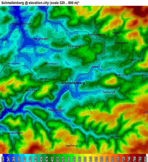
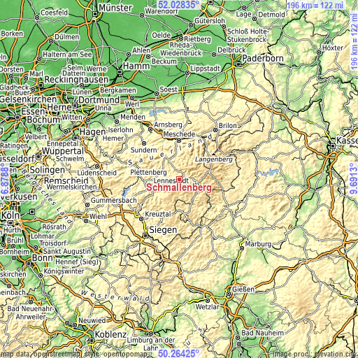
| \ | Map #1 | Map #2 | Topo.Map |
| Scale [m] | 343..681 m | 329..800 m | × |
| Scale [ft] | 1125..2234 ft | 1079..2625 ft | × |
| Average | 453.1 m = 1487 ft | 502.2 m = 1648 ft | × |
| Width | 6.13 km = 3.8 mi | 12.26 km = 7.6 mi | 196.1 km = 121.9 mi |
| Height | 6.13 km = 3.8 mi | 12.26 km = 7.6 mi | 196.1 km = 121.9 mi |
| ↑Max Latitude | 51.182285° | 51.209824° | 52.02835° |
| Latitude at center | 51.15473° | 51.15473° | 51.15473° |
| ↓Min Latitude | 51.127158° | 51.09957° | 50.26425° |
| ← Min Longitude | 8.241105° | 8.197159° | 6.8788° |
| Longitude center | 8.28505° | 8.28505° | 8.28505° |
| →Max Longitude | 8.328995° | 8.372941° | 9.6913° |
Nearby cities:
Cities around Schmallenberg sort by population:
• Meschede elevation 272 m
21.7 km,  359°
359°
• Lennestadt 271 m
15.8 km,  254°
254°
• Bad Berleburg 420 m
13.6 km,  146°
146°
• Finnentrop 251 m
21.8 km,  273°
273°
• Hilchenbach 357 m
21.4 km,  214°
214°
• Winterberg 679 m
17.9 km,  76°
76°
• Kirchhundem 308 m
15.7 km,  240°
240°
• Eslohe 313 m
13.6 km,  323°
323°
• Erndtebrück 490 m
18.5 km,  186°
186°
• Hallenberg 425 m
23.9 km,  101°
101°
• Bad Fredeburg 460 m
4.2 km,  24°
24°
• Bamenohl 241 m
21 km, 273°
Multilingual:
 En español:
Schmallenberg elevación 411 m.
 En France:
Schmallenberg élévation 411 m.
 Auf Deutsch:
Schmallenberg höhe über dem Meeresspiegel ist 411 m.

Sources and notes:
- [note 1] Map square and city borders are not equal. Map elevation data is calculated only from area inside that square.
- [src 1] Elevation data from geonames database provided with same terms of usage.
- [src 2] The elevation map of Schmallenberg is generated using elevation data from NASA's 3 arcsec (90m) resolution SRTM data.
- [src 3] Base (background) map © OpenStreetMap contributors tiles are generated by Geofabrik and OpenTopoMap.
Copyright & License:
This Schmallenberg Elevation Map is licensed under CC BY-SA. You may reuse any part from this page, if you give a proper credit by linking to this URL:
 More info on terms of use page.