Schneverdingen elevation
Schneverdingen (Lower Saxony), Germany elevation is 97 meters and Schneverdingen elevation in feet is 318 ft above sea level [src 1]. Schneverdingen is a populated place (feature code) with elevation that is 161 meters (528 ft) smaller than average city elevation in Germany.
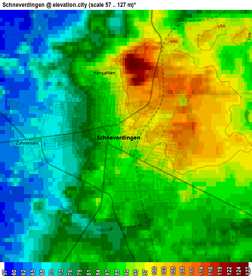
Below is the Elevation map of Schneverdingen, which displays elevation range with different colors. Scale of the first map is from 57 to 127 m (187 to 417 ft) with average elevation of 85.3 meters (=280 ft) [note 1]
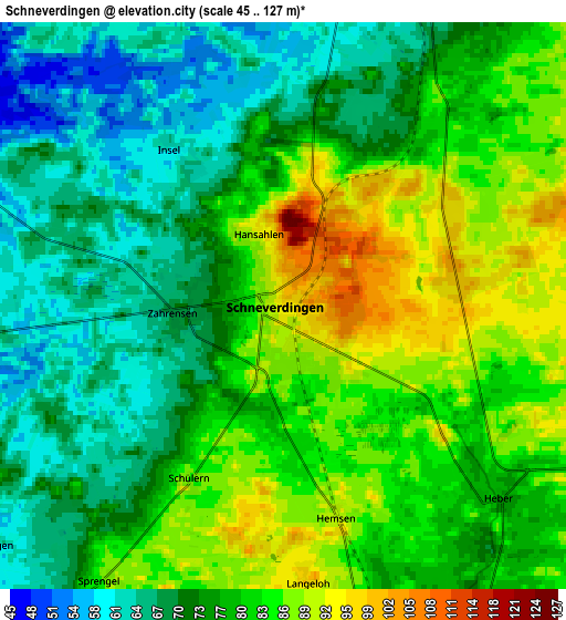
These maps also provides idea of topography and contour of this city, they are displayed at different zoom levels. More info about maps, scale and edge coordinates you can find below images.
| \ | Map #1 | Map #2 | Topo.Map |
| Scale [m] | 57..127 m | 45..127 m | × |
| Scale [ft] | 187..417 ft | 148..417 ft | × |
| Average | 85.3 m = 280 ft | 77.1 m = 253 ft | × |
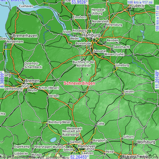
| Width | 5.87 km = 3.6 mi | 11.73 km = 7.3 mi | 187.7 km = 116.6 mi |
| Height | 5.87 km = 3.6 mi | 11.73 km = 7.3 mi | 187.7 km = 116.6 mi |
| ↑Max Latitude | 53.143217° | 53.169568° | 53.9526° |
| Latitude at center | 53.11685° | 53.11685° | 53.11685° |
| ↓Min Latitude | 53.090467° | 53.064067° | 52.26453° |
| ← Min Longitude | 9.751295° | 9.707349° | 8.38899° |
| Longitude center | 9.79524° | 9.79524° | 9.79524° |
| →Max Longitude | 9.839185° | 9.883131° | 11.20149° |
Nearby cities:
Cities around Schneverdingen sort by population:
• Soltau elevation 62 m
14.9 km,  167°
167°
• Tostedt 62 m
19.2 km,  344°
344°
• Bispingen 78 m
14 km,  105°
105°
• Neuenkirchen 68 m
11.1 km,  212°
212°
• Fintel 45 m
10.4 km,  306°
306°
• Handeloh 56 m
14.6 km,  11°
11°
• Lauenbrück 32 m
17.8 km,  301°
301°
• Wistedt 47 m
18.3 km, 335°
• Hemslingen 38 m
13.6 km,  254°
254°
• Otter 56 m
14.2 km,  345°
345°
• Brockel 34 m
18.7 km,  264°
264°
• Welle 52 m
13.7 km,  1°
1°
Multilingual:
 En español:
Schneverdingen elevación 97 m.
 En France:
Schneverdingen élévation 97 m.
 Auf Deutsch:
Schneverdingen höhe über dem Meeresspiegel ist 97 m.

Sources and notes:
- [note 1] Map square and city borders are not equal. Map elevation data is calculated only from area inside that square.
- [src 1] Elevation data from geonames database provided with same terms of usage.
- [src 2] The elevation map of Schneverdingen is generated using elevation data from NASA's 3 arcsec (90m) resolution SRTM data.
- [src 3] Base (background) map © OpenStreetMap contributors tiles are generated by Geofabrik and OpenTopoMap.
Copyright & License:
This Schneverdingen Elevation Map is licensed under CC BY-SA. You may reuse any part from this page, if you give a proper credit by linking to this URL:
 More info on terms of use page.