Bad Schussenried elevation
Bad Schussenried (Baden-Württemberg, Tübingen Region), Germany elevation is 569 meters and Bad Schussenried elevation in feet is 1867 ft above sea level [src 1]. Bad Schussenried is a populated place (feature code) with elevation that is 311 meters (1020 ft) bigger than average city elevation in Germany.
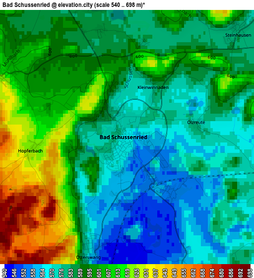
Below is the Elevation map of Bad Schussenried, which displays elevation range with different colors. Scale of the first map is from 540 to 698 m (1772 to 2290 ft) with average elevation of 590.8 meters (=1938 ft) [note 1]
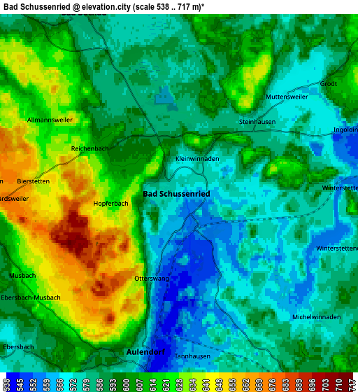
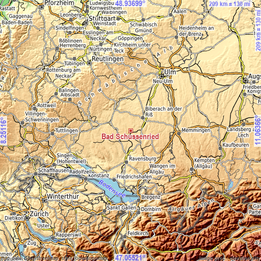
These maps also provides idea of topography and contour of this city, they are displayed at different zoom levels. More info about maps, scale and edge coordinates you can find below images.
| \ | Map #1 | Map #2 | Topo.Map |
| Scale [m] | 540..698 m | 538..717 m | × |
| Scale [ft] | 1772..2290 ft | 1765..2352 ft | × |
| Average | 590.8 m = 1938 ft | 597.3 m = 1960 ft | × |
| Width | 6.54 km = 4.1 mi | 13.08 km = 8.1 mi | 209.2 km = 130 mi |
| Height | 6.54 km = 4.1 mi | 13.08 km = 8.1 mi | 209.2 km = 130 mi |
| ↑Max Latitude | 48.034074° | 48.063451° | 48.93699° |
| Latitude at center | 48.00468° | 48.00468° | 48.00468° |
| ↓Min Latitude | 47.975269° | 47.945842° | 47.05521° |
| ← Min Longitude | 9.613465° | 9.569519° | 8.25116° |
| Longitude center | 9.65741° | 9.65741° | 9.65741° |
| →Max Longitude | 9.701355° | 9.745301° | 11.06366° |
Nearby cities:
Cities around Bad Schussenried sort by population:
• Biberach an der Riß elevation 535 m
14 km,  45°
45°
• Bad Waldsee 590 m
11.9 km,  142°
142°
• Saulgau 590 m
11.7 km,  276°
276°
• Aulendorf 571 m
6.2 km,  193°
193°
• Altshausen 586 m
12.2 km,  229°
229°
• Wolpertswende 574 m
12.7 km,  195°
195°
• Bad Buchau 589 m
7.2 km,  332°
332°
• Eberhardzell 635 m
11.9 km,  92°
92°
• Mittelbiberach 577 m
11.1 km,  38°
38°
• Ingoldingen 560 m
6.7 km,  69°
69°
• Hochdorf 557 m
10 km,  76°
76°
• Ebersbach-Musbach 599 m
6.9 km, 232°
Multilingual:
 En español:
Bad Schussenried elevación 569 m.
 En France:
Bad Schussenried élévation 569 m.
 Auf Deutsch:
Bad Schussenried höhe über dem Meeresspiegel ist 569 m.

Sources and notes:
- [note 1] Map square and city borders are not equal. Map elevation data is calculated only from area inside that square.
- [src 1] Elevation data from geonames database provided with same terms of usage.
- [src 2] The elevation map of Bad Schussenried is generated using elevation data from NASA's 3 arcsec (90m) resolution SRTM data.
- [src 3] Base (background) map © OpenStreetMap contributors tiles are generated by Geofabrik and OpenTopoMap.
Copyright & License:
This Bad Schussenried Elevation Map is licensed under CC BY-SA. You may reuse any part from this page, if you give a proper credit by linking to this URL:
 More info on terms of use page.