Schwarzenbek elevation
Schwarzenbek (Schleswig-Holstein), Germany elevation is 42 meters and Schwarzenbek elevation in feet is 138 ft above sea level [src 1]. Schwarzenbek is a populated place (feature code) with elevation that is 216 meters (709 ft) smaller than average city elevation in Germany.
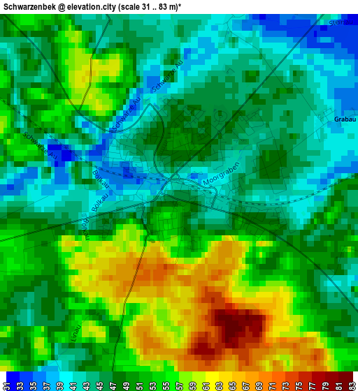
Below is the Elevation map of Schwarzenbek, which displays elevation range with different colors. Scale of the first map is from 31 to 83 m (102 to 272 ft) with average elevation of 49.3 meters (=162 ft) [note 1]
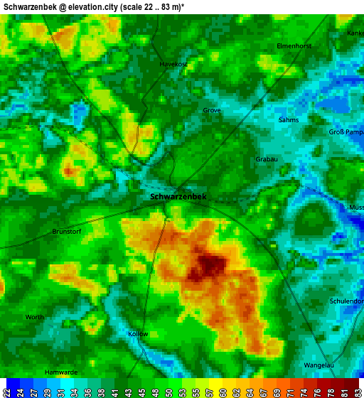
These maps also provides idea of topography and contour of this city, they are displayed at different zoom levels. More info about maps, scale and edge coordinates you can find below images.
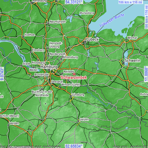
| \ | Map #1 | Map #2 | Topo.Map |
| Scale [m] | 31..83 m | 22..83 m | × |
| Scale [ft] | 102..272 ft | 72..272 ft | × |
| Average | 49.3 m = 162 ft | 45.2 m = 148 ft | × |
| Width | 5.81 km = 3.6 mi | 11.63 km = 7.2 mi | 186 km = 115.6 mi |
| Height | 5.81 km = 3.6 mi | 11.62 km = 7.2 mi | 186 km = 115.6 mi |
| ↑Max Latitude | 53.52916° | 53.555273° | 54.33121° |
| Latitude at center | 53.50303° | 53.50303° | 53.50303° |
| ↓Min Latitude | 53.476884° | 53.450722° | 52.65834° |
| ← Min Longitude | 10.436605° | 10.392659° | 9.0743° |
| Longitude center | 10.48055° | 10.48055° | 10.48055° |
| →Max Longitude | 10.524495° | 10.568441° | 11.8868° |
Nearby cities:
Cities around Schwarzenbek sort by population:
• Geesthacht elevation 26 m
10.1 km,  222°
222°
• Büchen 17 m
9.4 km,  105°
105°
• Tespe 5 m
12.7 km,  201°
201°
• Marschacht 4 m
12 km, 215°
• Dassendorf 58 m
8 km,  263°
263°
• Escheburg 48 m
11.6 km,  249°
249°
• Wohltorf 29 m
13.1 km,  276°
276°
• Witzhave 26 m
12 km,  306°
306°
• Kuddewörde 32 m
10.4 km,  329°
329°
• Gülzow 42 m
6 km,  167°
167°
• Güster 18 m
13.5 km,  73°
73°
• Kröppelshagen-Fahrendorf 58 m
10.9 km, 262°
Multilingual:
 En español:
Schwarzenbek elevación 42 m.
 En France:
Schwarzenbek élévation 42 m.
 Auf Deutsch:
Schwarzenbek höhe über dem Meeresspiegel ist 42 m.

Sources and notes:
- [note 1] Map square and city borders are not equal. Map elevation data is calculated only from area inside that square.
- [src 1] Elevation data from geonames database provided with same terms of usage.
- [src 2] The elevation map of Schwarzenbek is generated using elevation data from NASA's 3 arcsec (90m) resolution SRTM data.
- [src 3] Base (background) map © OpenStreetMap contributors tiles are generated by Geofabrik and OpenTopoMap.
Copyright & License:
This Schwarzenbek Elevation Map is licensed under CC BY-SA. You may reuse any part from this page, if you give a proper credit by linking to this URL:
 More info on terms of use page.