Schweinfurt elevation
Schweinfurt (Bavaria, Regierungsbezirk Unterfranken), Germany elevation is 230 meters and Schweinfurt elevation in feet is 755 ft above sea level [src 1]. Schweinfurt is a seat of a third-order administrative division (feature code) with elevation that is 28 meters (92 ft) smaller than average city elevation in Germany.
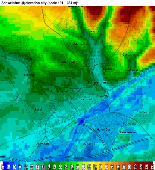
Below is the Elevation map of Schweinfurt, which displays elevation range with different colors. Scale of the first map is from 191 to 331 m (627 to 1086 ft) with average elevation of 237.3 meters (=779 ft) [note 1]
These maps also provides idea of topography and contour of this city, they are displayed at different zoom levels. More info about maps, scale and edge coordinates you can find below images.
| \ | Map #1 | Map #2 | Topo.Map |
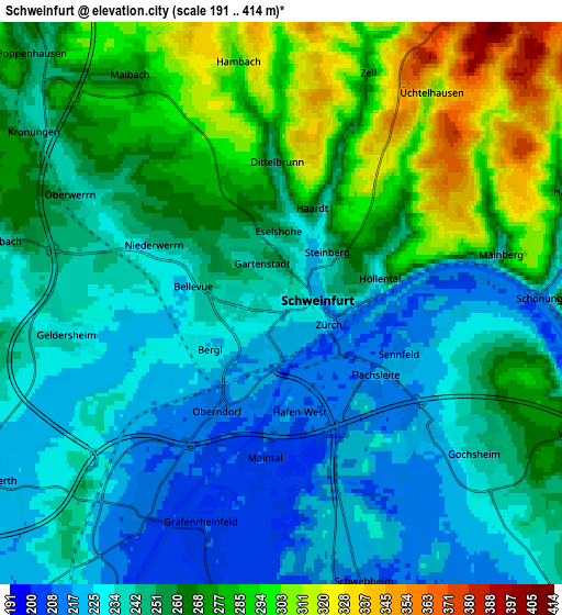
| Scale [m] | 191..331 m | 191..414 m | × |
| Scale [ft] | 627..1086 ft | 627..1358 ft | × |
| Average | 237.3 m = 779 ft | 254.5 m = 835 ft | × |
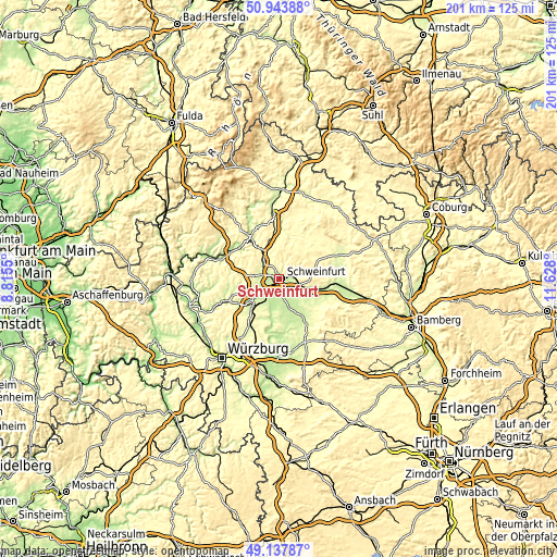
| Width | 6.28 km = 3.9 mi | 12.55 km = 7.8 mi | 200.8 km = 124.8 mi |
| Height | 6.28 km = 3.9 mi | 12.55 km = 7.8 mi | 200.8 km = 124.8 mi |
| ↑Max Latitude | 50.07758° | 50.105774° | 50.94388° |
| Latitude at center | 50.04937° | 50.04937° | 50.04937° |
| ↓Min Latitude | 50.021143° | 49.9929° | 49.13787° |
| ← Min Longitude | 10.177805° | 10.133859° | 8.8155° |
| Longitude center | 10.22175° | 10.22175° | 10.22175° |
| →Max Longitude | 10.265695° | 10.309641° | 11.628° |
Nearby cities:
Cities around Schweinfurt sort by population:
• Schonungen elevation 262 m
6.2 km,  89°
89°
• Niederwerrn 246 m
3.1 km,  295°
295°
• Dittelbrunn 252 m
2.5 km,  356°
356°
• Gochsheim 236 m
5.7 km,  129°
129°
• Bergrheinfeld 213 m
5.2 km,  213°
213°
• Röthlein 205 m
7.4 km,  182°
182°
• Üchtelhausen 306 m
5.8 km,  35°
35°
• Sennfeld 216 m
3 km,  113°
113°
• Schwebheim 215 m
6.8 km,  164°
164°
• Grafenrheinfeld 208 m
5.7 km,  195°
195°
• Euerbach 241 m
6.2 km,  283°
283°
• Geldersheim 233 m
4.7 km,  261°
261°
Multilingual:
 En español:
Schweinfurt elevación 230 m.
 En France:
Schweinfurt élévation 230 m.
 Auf Deutsch:
Schweinfurt höhe über dem Meeresspiegel ist 230 m.

Sources and notes:
- [note 1] Map square and city borders are not equal. Map elevation data is calculated only from area inside that square.
- [src 1] Elevation data from geonames database provided with same terms of usage.
- [src 2] The elevation map of Schweinfurt is generated using elevation data from NASA's 3 arcsec (90m) resolution SRTM data.
- [src 3] Base (background) map © OpenStreetMap contributors tiles are generated by Geofabrik and OpenTopoMap.
Copyright & License:
This Schweinfurt Elevation Map is licensed under CC BY-SA. You may reuse any part from this page, if you give a proper credit by linking to this URL:
 More info on terms of use page.