Seelow elevation
Seelow (Brandenburg), Germany elevation is 51 meters and Seelow elevation in feet is 167 ft above sea level [src 1]. Seelow is a seat of a third-order administrative division (feature code) with elevation that is 207 meters (679 ft) smaller than average city elevation in Germany.
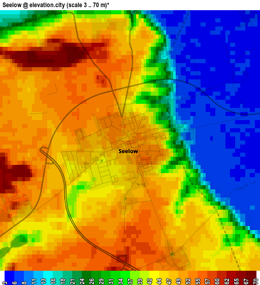
Below is the Elevation map of Seelow, which displays elevation range with different colors. Scale of the first map is from 3 to 70 m (10 to 230 ft) with average elevation of 37.7 meters (=124 ft) [note 1]
These maps also provides idea of topography and contour of this city, they are displayed at different zoom levels. More info about maps, scale and edge coordinates you can find below images.
| \ | Map #1 | Map #2 | Topo.Map |
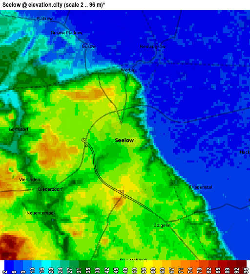
| Scale [m] | 3..70 m | 2..96 m | × |
| Scale [ft] | 10..230 ft | 7..315 ft | × |
| Average | 37.7 m = 124 ft | 29.1 m = 95 ft | × |
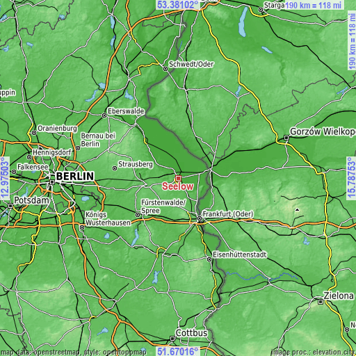
| Width | 5.94 km = 3.7 mi | 11.89 km = 7.4 mi | 190.2 km = 118.2 mi |
| Height | 5.94 km = 3.7 mi | 11.89 km = 7.4 mi | 190.2 km = 118.2 mi |
| ↑Max Latitude | 52.560643° | 52.587351° | 53.38102° |
| Latitude at center | 52.53392° | 52.53392° | 52.53392° |
| ↓Min Latitude | 52.50718° | 52.480424° | 51.67016° |
| ← Min Longitude | 14.337335° | 14.293389° | 12.97503° |
| Longitude center | 14.38128° | 14.38128° | 14.38128° |
| →Max Longitude | 14.425225° | 14.469171° | 15.78753° |
Nearby cities:
Cities around Seelow sort by population:
• Müncheberg elevation 60 m
16.8 km,  259°
259°
• Letschin 9 m
12.3 km,  353°
353°
• Steinhöfel 51 m
20.8 km,  224°
224°
• Lebus 52 m
15.7 km,  139°
139°
• Neuhardenberg 13 m
11.9 km,  305°
305°
• Briesen 42 m
22.3 km,  198°
198°
• Buckow 34 m
21.1 km,  279°
279°
• Neutrebbin 2 m
17.9 km,  324°
324°
• Waldsieversdorf 56 m
21.1 km,  272°
272°
• Manschnow 12 m
11.8 km,  81°
81°
• Alt Tucheband 11 m
8.9 km,  87°
87°
• Podelzig 49 m
12.5 km,  123°
123°
Multilingual:
 En español:
Seelow elevación 51 m.
 En France:
Seelow élévation 51 m.


Sources and notes:
- [note 1] Map square and city borders are not equal. Map elevation data is calculated only from area inside that square.
- [src 1] Elevation data from geonames database provided with same terms of usage.
- [src 2] The elevation map of Seelow is generated using elevation data from NASA's 3 arcsec (90m) resolution SRTM data.
- [src 3] Base (background) map © OpenStreetMap contributors tiles are generated by Geofabrik and OpenTopoMap.
Copyright & License:
This Seelow Elevation Map is licensed under CC BY-SA. You may reuse any part from this page, if you give a proper credit by linking to this URL:
 More info on terms of use page.