Spalt elevation
Spalt (Bavaria, Regierungsbezirk Mittelfranken), Germany elevation is 368 meters and Spalt elevation in feet is 1207 ft above sea level [src 1]. Spalt is a populated place (feature code) with elevation that is 110 meters (361 ft) bigger than average city elevation in Germany.
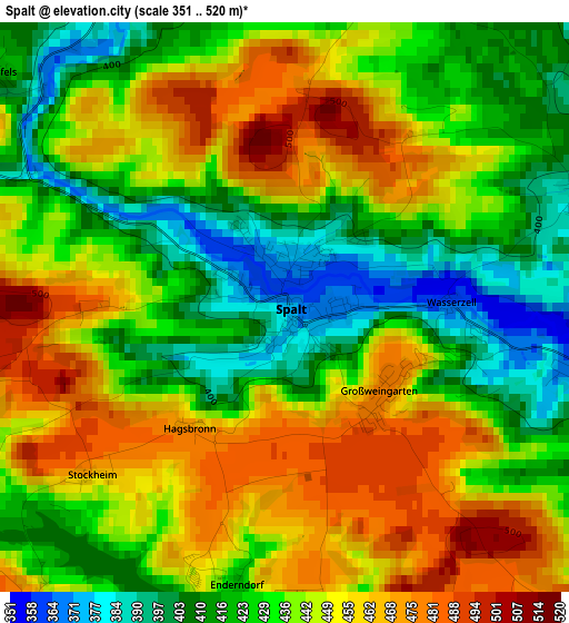
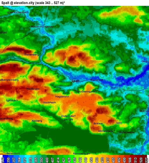
Below is the Elevation map of Spalt, which displays elevation range with different colors. Scale of the first map is from 351 to 520 m (1152 to 1706 ft) with average elevation of 437.6 meters (=1436 ft) [note 1]
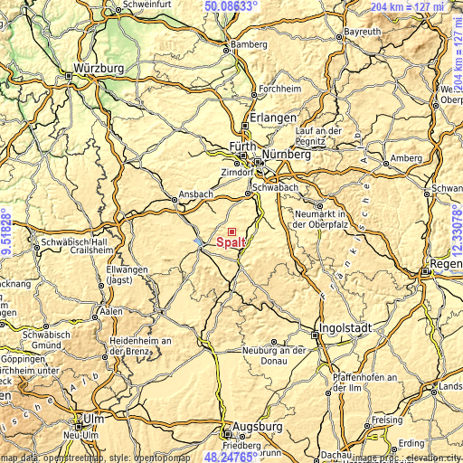
These maps also provides idea of topography and contour of this city, they are displayed at different zoom levels. More info about maps, scale and edge coordinates you can find below images.
| \ | Map #1 | Map #2 | Topo.Map |
| Scale [m] | 351..520 m | 343..527 m | × |
| Scale [ft] | 1152..1706 ft | 1125..1729 ft | × |
| Average | 437.6 m = 1436 ft | 422.6 m = 1386 ft | × |
| Width | 6.39 km = 4 mi | 12.78 km = 7.9 mi | 204.4 km = 127 mi |
| Height | 6.39 km = 4 mi | 12.78 km = 7.9 mi | 204.4 km = 127 mi |
| ↑Max Latitude | 49.204251° | 49.232955° | 50.08633° |
| Latitude at center | 49.17553° | 49.17553° | 49.17553° |
| ↓Min Latitude | 49.146793° | 49.118039° | 48.24765° |
| ← Min Longitude | 10.880585° | 10.836639° | 9.51828° |
| Longitude center | 10.92453° | 10.92453° | 10.92453° |
| →Max Longitude | 10.968475° | 11.012421° | 12.33078° |
Nearby cities:
Cities around Spalt sort by population:
• Gunzenhausen elevation 430 m
13.7 km,  241°
241°
• Pleinfeld 385 m
8.9 km,  152°
152°
• Georgensgmünd 359 m
6.9 km,  76°
76°
• Windsbach 389 m
10.7 km,  318°
318°
• Abenberg 416 m
8 km,  20°
20°
• Ellingen 397 m
13.1 km,  166°
166°
• Röttenbach 373 m
8.4 km,  109°
109°
• Haundorf 444 m
11.1 km,  270°
270°
• Kammerstein 422 m
13.5 km,  14°
14°
• Mitteleschenbach 410 m
10.1 km,  293°
293°
• Pfofeld 451 m
10 km,  219°
219°
• Absberg 467 m
4.7 km, 222°
Multilingual:
 En español:
Spalt elevación 368 m.
 En France:
Spalt élévation 368 m.


Sources and notes:
- [note 1] Map square and city borders are not equal. Map elevation data is calculated only from area inside that square.
- [src 1] Elevation data from geonames database provided with same terms of usage.
- [src 2] The elevation map of Spalt is generated using elevation data from NASA's 3 arcsec (90m) resolution SRTM data.
- [src 3] Base (background) map © OpenStreetMap contributors tiles are generated by Geofabrik and OpenTopoMap.
Copyright & License:
This Spalt Elevation Map is licensed under CC BY-SA. You may reuse any part from this page, if you give a proper credit by linking to this URL:
 More info on terms of use page.