Stadtlengsfeld elevation
Stadtlengsfeld (Thuringia), Germany elevation is 278 meters and Stadtlengsfeld elevation in feet is 912 ft above sea level [src 1]. Stadtlengsfeld is a populated place (feature code) with elevation that is 20 meters (66 ft) bigger than average city elevation in Germany.
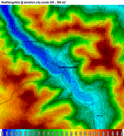
Below is the Elevation map of Stadtlengsfeld, which displays elevation range with different colors. Scale of the first map is from 245 to 504 m (804 to 1654 ft) with average elevation of 377.4 meters (=1238 ft) [note 1]
These maps also provides idea of topography and contour of this city, they are displayed at different zoom levels. More info about maps, scale and edge coordinates you can find below images.
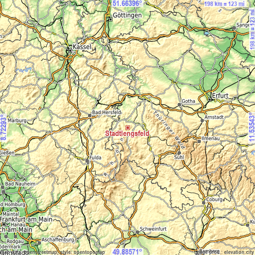
| \ | Map #1 | Topo.Map |
| Scale [m] | 245..504 m | × |
| Scale [ft] | 804..1654 ft | × |
| Average | 377.4 m = 1238 ft | × |
| Width | 6.18 km = 3.8 mi | 197.7 km = 122.8 mi |
| Height | 6.18 km = 3.8 mi | 197.7 km = 122.8 mi |
| ↑Max Latitude | 50.811066° | 51.66396° |
| Latitude at center | 50.78329° | 50.78329° |
| ↓Min Latitude | 50.755497° | 49.88571° |
| ← Min Longitude | 10.085235° | 8.72293° |
| Longitude center | 10.12918° | 10.12918° |
| →Max Longitude | 10.173125° | 11.53543° |
Nearby cities:
Cities around Stadtlengsfeld sort by population:
• Bad Salzungen elevation 250 m
8.2 km,  65°
65°
• Breitungen 252 m
14.1 km,  98°
98°
• Philippsthal 234 m
10.5 km,  306°
306°
• Tiefenort 238 m
6.8 km,  22°
22°
• Unterbreizbach 236 m
10.9 km,  289°
289°
• Vacha 237 m
9 km,  303°
303°
• Dermbach 370 m
7.8 km,  185°
185°
• Dorndorf 250 m
6.4 km,  333°
333°
• Leimbach 238 m
6.2 km,  53°
53°
• Immelborn 252 m
10.5 km,  84°
84°
• Buttlar 260 m
12.7 km,  257°
257°
• Völkershausen 304 m
5.9 km, 288°
Multilingual:
 En español:
Stadtlengsfeld elevación 278 m.
 En France:
Stadtlengsfeld élévation 278 m.
 Auf Deutsch:
Stadtlengsfeld höhe über dem Meeresspiegel ist 278 m.

Sources and notes:
- [note 1] Map square and city borders are not equal. Map elevation data is calculated only from area inside that square.
- [src 1] Elevation data from geonames database provided with same terms of usage.
- [src 2] The elevation map of Stadtlengsfeld is generated using elevation data from NASA's 3 arcsec (90m) resolution SRTM data.
- [src 3] Base (background) map © OpenStreetMap contributors tiles are generated by Geofabrik and OpenTopoMap.
Copyright & License:
This Stadtlengsfeld Elevation Map is licensed under CC BY-SA. You may reuse any part from this page, if you give a proper credit by linking to this URL:
 More info on terms of use page.