Stein elevation
Stein (Bavaria, Regierungsbezirk Mittelfranken), Germany elevation is 308 meters and Stein elevation in feet is 1010 ft above sea level [src 1]. Stein is a populated place (feature code) with elevation that is 50 meters (164 ft) bigger than average city elevation in Germany.
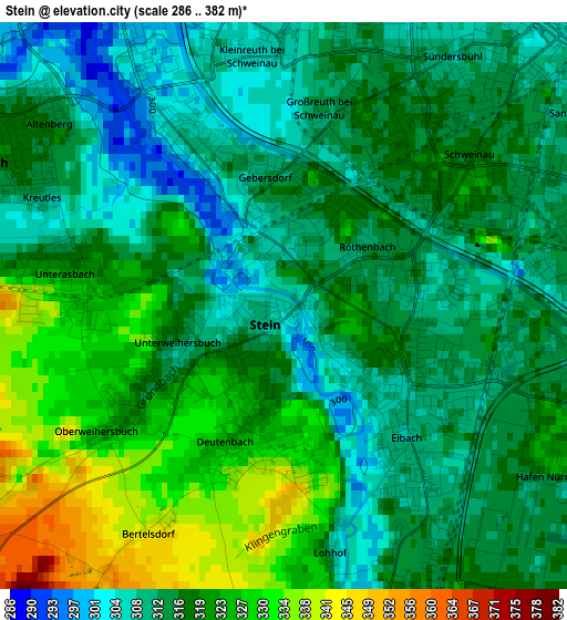
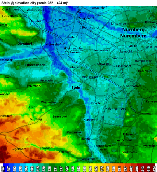
Below is the Elevation map of Stein, which displays elevation range with different colors. Scale of the first map is from 286 to 382 m (938 to 1253 ft) with average elevation of 317.2 meters (=1041 ft) [note 1]
These maps also provides idea of topography and contour of this city, they are displayed at different zoom levels. More info about maps, scale and edge coordinates you can find below images.
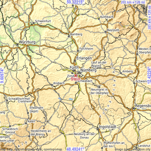
| \ | Map #1 | Map #2 | Topo.Map |
| Scale [m] | 286..382 m | 282..424 m | × |
| Scale [ft] | 938..1253 ft | 925..1391 ft | × |
| Average | 317.2 m = 1041 ft | 328.5 m = 1078 ft | × |
| Width | 6.36 km = 4 mi | 12.72 km = 7.9 mi | 203.4 km = 126.4 mi |
| Height | 6.36 km = 4 mi | 12.72 km = 7.9 mi | 203.4 km = 126.4 mi |
| ↑Max Latitude | 49.444391° | 49.472955° | 50.32215° |
| Latitude at center | 49.41581° | 49.41581° | 49.41581° |
| ↓Min Latitude | 49.387212° | 49.358598° | 48.49241° |
| ← Min Longitude | 10.972045° | 10.928099° | 9.60974° |
| Longitude center | 11.01599° | 11.01599° | 11.01599° |
| →Max Longitude | 11.059935° | 11.103881° | 12.42224° |
Nearby cities:
Cities around Stein sort by population:
• Nürnberg elevation 300 m
6.2 km,  46°
46°
• Fürth 302 m
7 km,  343°
343°
• Schwabach 328 m
9.5 km,  176°
176°
• Zirndorf 309 m
5.4 km,  303°
303°
• Oberasbach 316 m
4.3 km,  280°
280°
• Wendelstein 342 m
12 km,  125°
125°
• Cadolzburg 381 m
12.6 km,  291°
291°
• Roßtal 367 m
9.5 km,  256°
256°
• Wetzendorf 304 m
6.4 km,  16°
16°
• Großreuth bei Schweinau 311 m
2.1 km,  13°
13°
• Rohr 350 m
12.3 km,  227°
227°
• Ammerndorf 317 m
12 km,  273°
273°
Multilingual:
 En español:
Stein elevación 308 m.
 En France:
Stein élévation 308 m.


Sources and notes:
- [note 1] Map square and city borders are not equal. Map elevation data is calculated only from area inside that square.
- [src 1] Elevation data from geonames database provided with same terms of usage.
- [src 2] The elevation map of Stein is generated using elevation data from NASA's 3 arcsec (90m) resolution SRTM data.
- [src 3] Base (background) map © OpenStreetMap contributors tiles are generated by Geofabrik and OpenTopoMap.
Copyright & License:
This Stein Elevation Map is licensed under CC BY-SA. You may reuse any part from this page, if you give a proper credit by linking to this URL:
 More info on terms of use page.